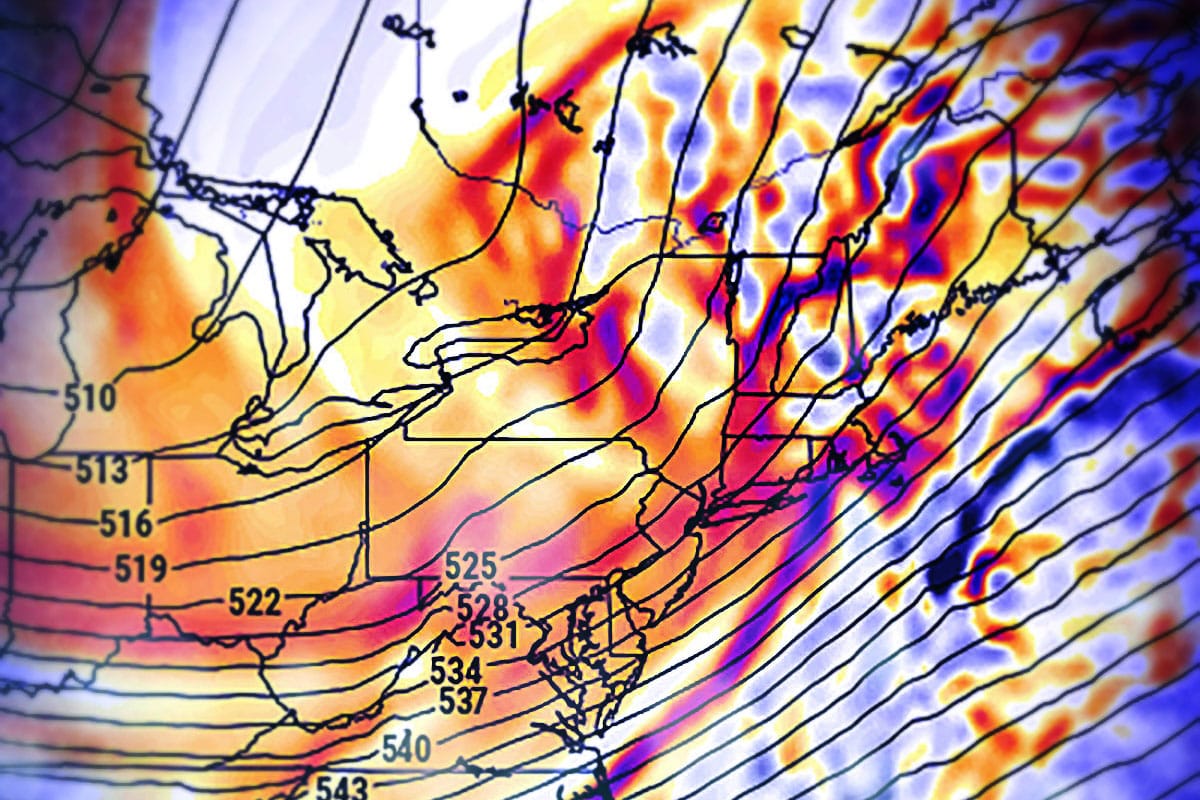
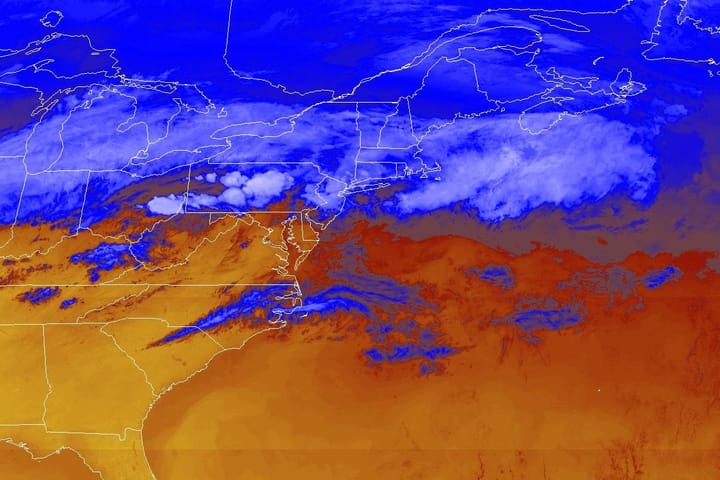
We're issuing a Storm watch for the holiday weekend. Currently the timing of this system is not set in stone, but a large trough will dig into the central regions of the US starting sometime around Friday that will likely trigger the development of two different shortwaves of energy.
At this time the leading solutions from major models is for a weak first wave impacting the Northeast around Saturday in marginal temperatures followed by a second wave late Sunday that has a wide range of possibilities though this second wave would be timed better for phasing energy more deeply with the trough and setting off a stronger storm.
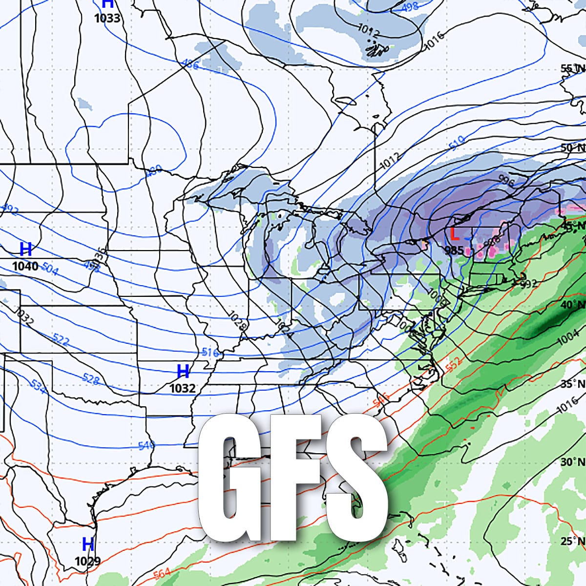
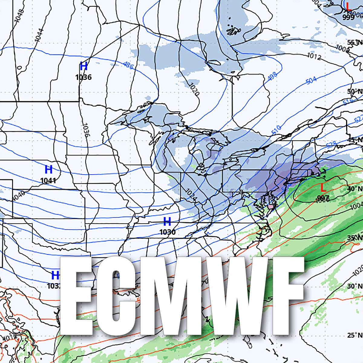
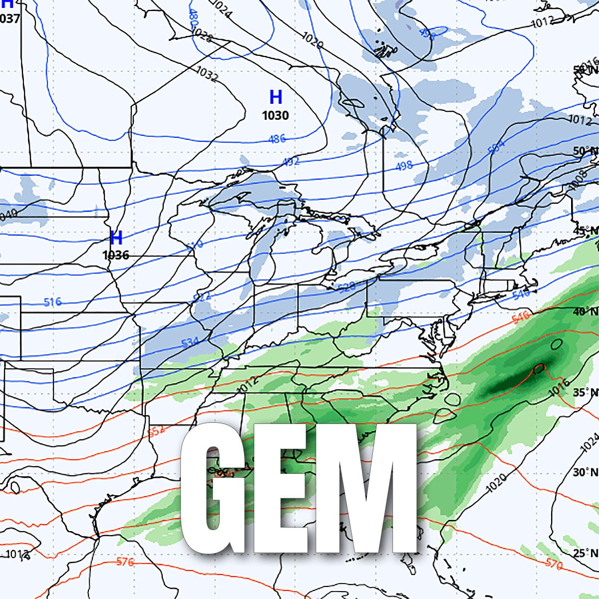
Early Sunday morning views from the deterministic versions of the medium-range models.
In the ensemble versions of the three major medium range models we don't presently see a strong possibility of a major coastal storm, however a moderate intensity storm capable of dropping over a foot of snow on a good number of ski areas within the range of possibilities we currently see. It could also be a cutter with an interior track near the Great Lakes, and it could also come through on the weak side without phasing with the trough and bringing widespread light precipitation. The deterministic versions of the three models show this range of possibilities quite well at this time, though the ensembles for both models each show support for all three scenarios. We currently favor a second wave similar to the ECMWF's deterministic modeling, but not strongly.
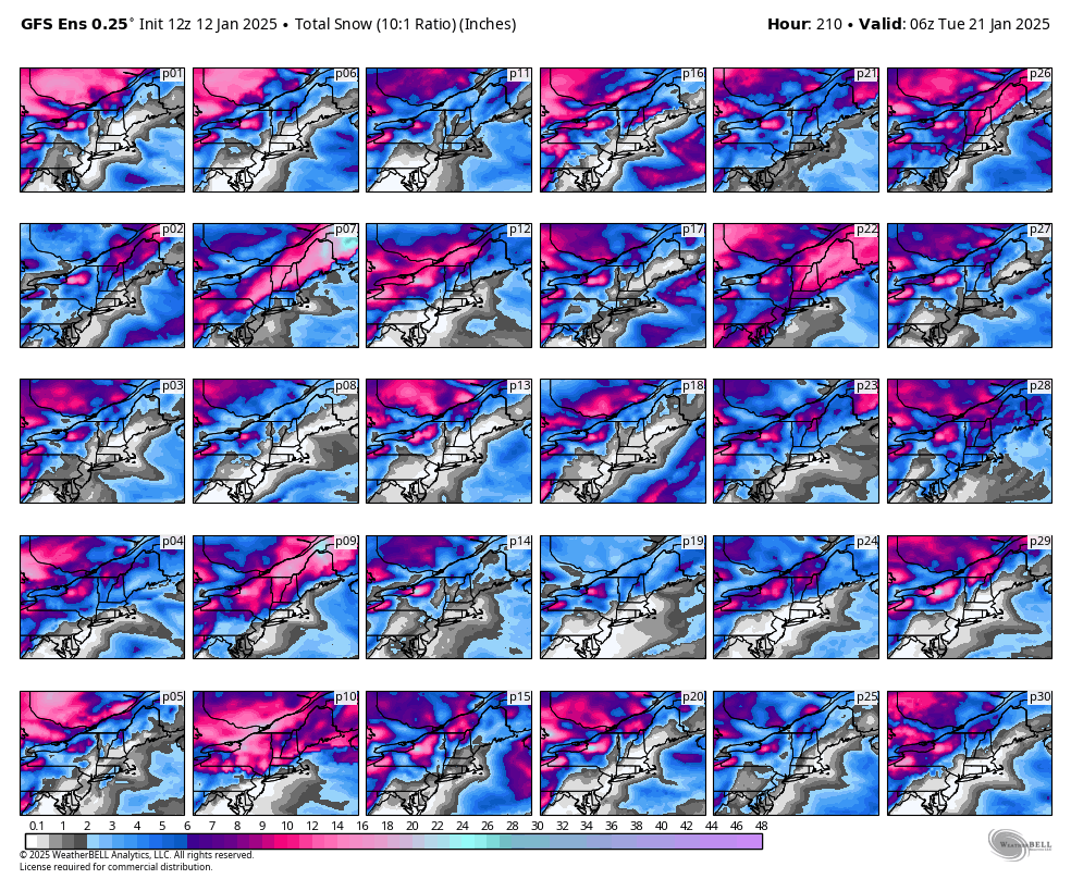
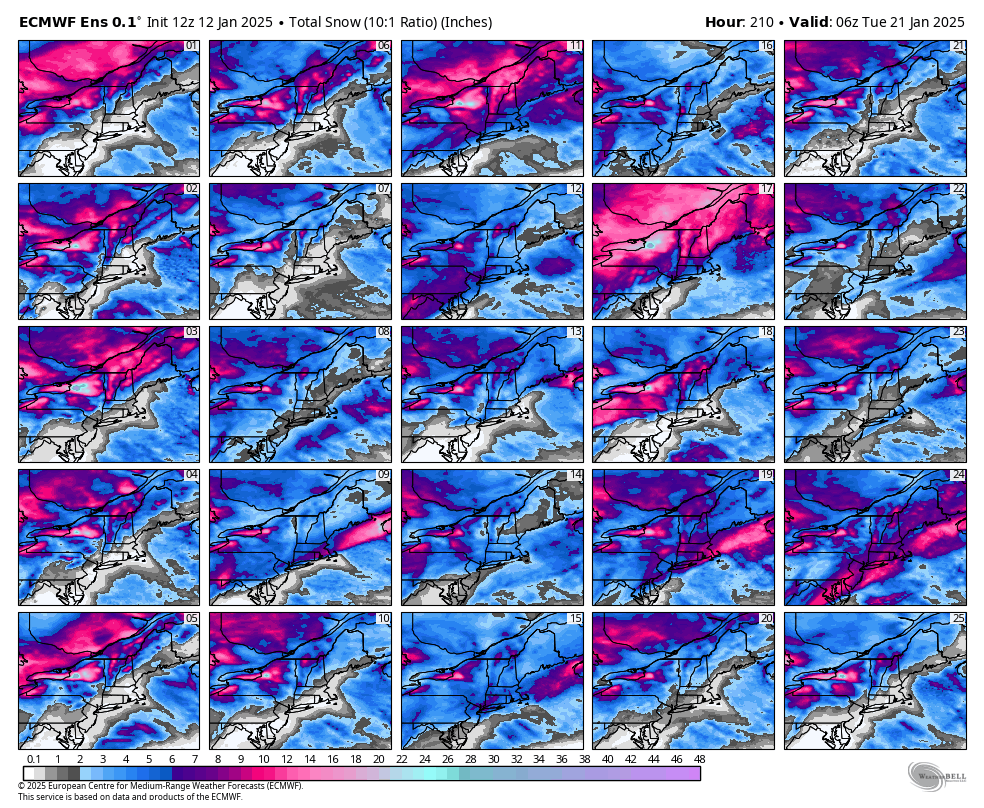
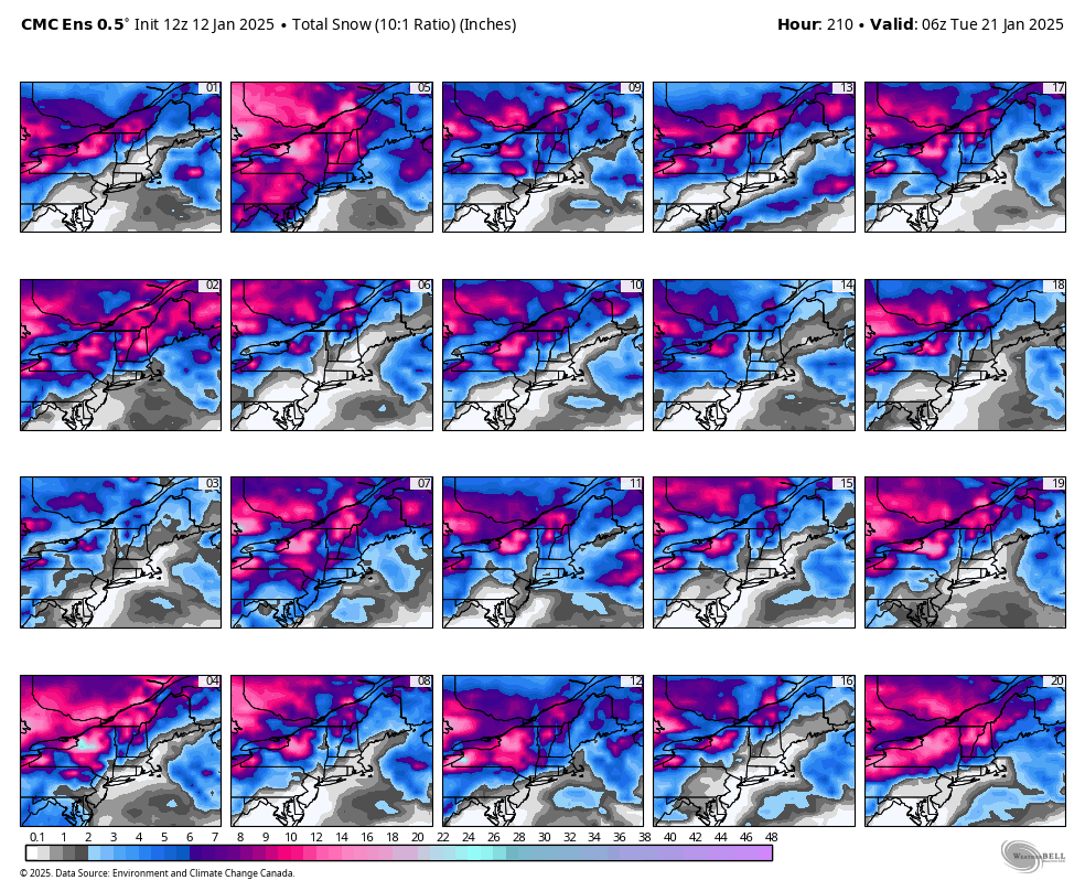
GFS, ECMWF, and GEM ensemble member snowfall through Monday, January 20th.
We will cover this more fully for our subscribers in The Week Ahead that will be published Monday morning, and we will start Storm Updates if and when there is a strong indication of 6" or more of snow across a portion of the Northeast. We do feel that it is highly likely that some sort of precipitation will occur during this time frame.
POWDER TO THE PEOPLE!

Comments ()