Here's the Snowology primer for The Week Ahead where we cover in brief the weather across Northeast ski areas through the next weekend in order to help prepare you for what is to come.
I will first cover the Synoptic Overview of the full week, then the Daily Outlooks with finer detail, and lastly I'll take a peek into the Extended Range Outlook from 1 to 2 weeks out. There's a lot here including some snowfall and wind hold forecasts for Tuesday and Wednesday, but the dailies are quick reads.
Synoptic Overview
The only notable change in the general weather pattern for this week is the absence of Greenland Block (NAO- pattern) where high pressure near Greenland last week was slowing down storms and causing their moisture to retrograde back into the Northeast on the back side. Here's what the 7 day 500 mb pressure anomalies look like for this week from the ECMWF Ensembles.
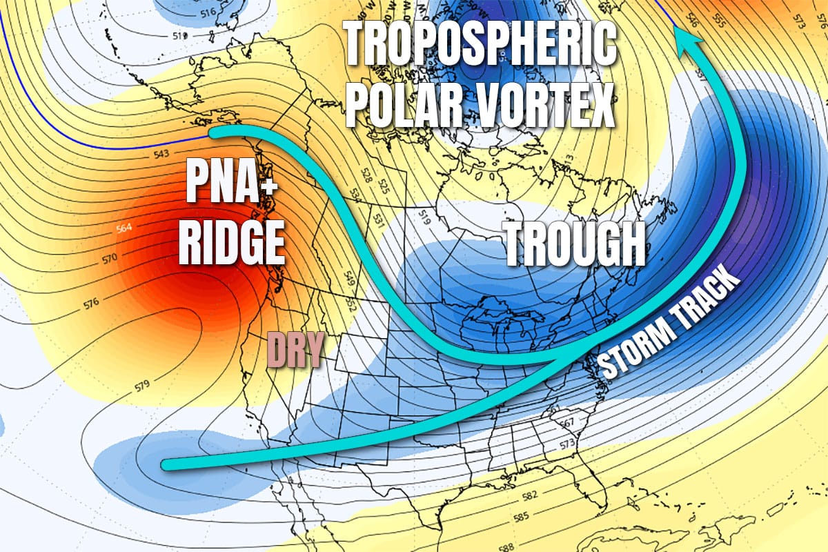
The Storm Track is an average based on flows at the 500 mb level about 20,000' up in the atmosphere which is where the main steering currents are. This will both feed us clippers, but when the trough dips a bit further south it will also pick up moisture and energy from the Subtropical Jet Stream that can produce storms, and we are likely to see one at the end of the week. Here's what the ECMWF is currently modeling through Sunday.
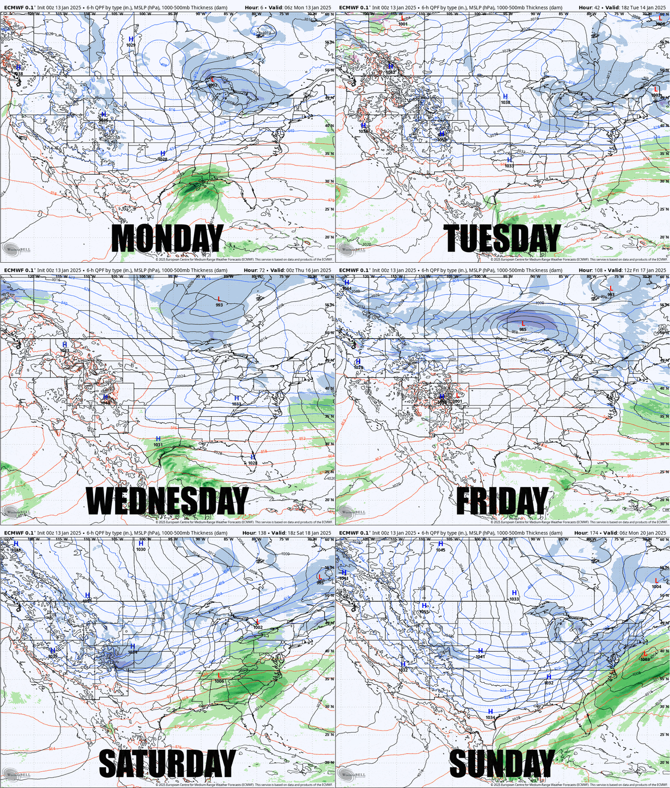
We have a clipper starting on Monday that will have both upslope enhancement through Tuesday and some lake effect that will taper off by Wednesday morning. The next small event will be another clipper starting Thursday afternoon and lasting through Friday morning. Saturday morning the first of the energy associated with the weekend storm is likely to begin to pass through the Northeast and that same trough will likely eventually pick up another shortwave and may develop a storm that could impact the Northeast starting Sunday. That was covered in yesterday's Storm Watch and presently the solution that I preferred seems to be winning with a moderate intensity storm passing somewhere off the coast bringing moderate snowfall. We do have some isolated wind concerns on Tuesday and Wednesday, and possibly on Sunday depending on what happens with that system.
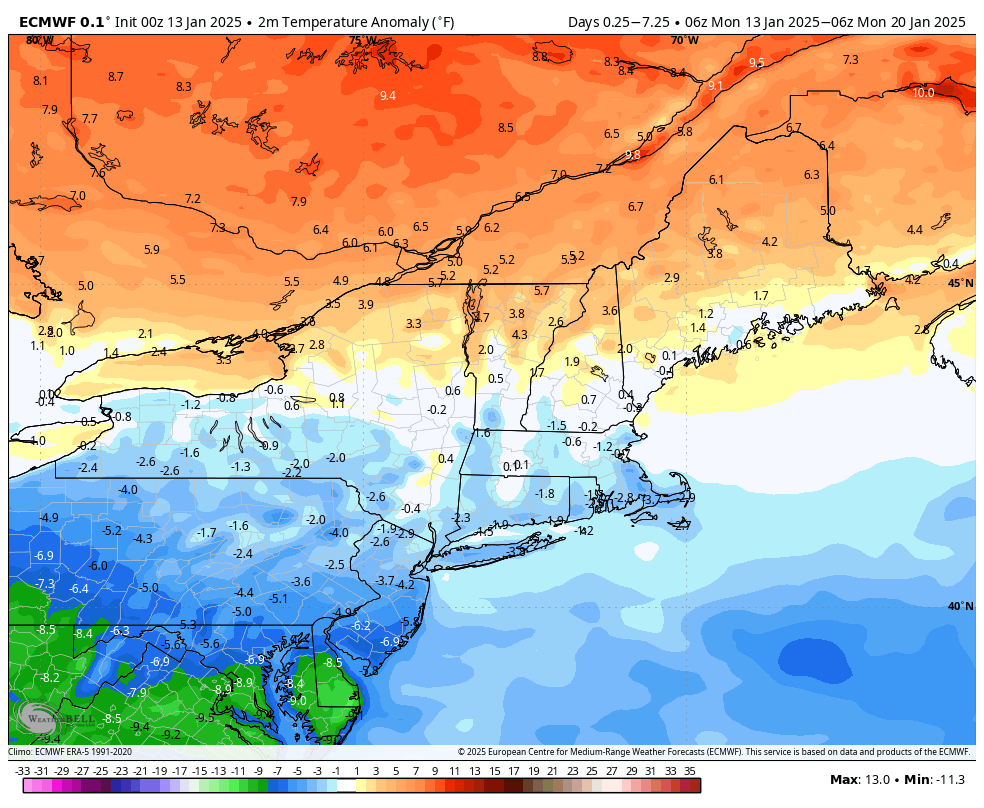
As far as temperatures go for the week, while we will have some ups and downs, over the 7 days we will see temperatures slightly warmer than average in northern areas where that's still plenty cold, and colder than average temperatures in the southern areas where even in January that helps maintain mid-winter conditions at elevation.
Monday Outlook
A weak clipper begins to brush us on Monday, though accumulations will be minimal by 4PM and the snow will mostly in the ADKs and Northern Greens. It will continue through Wednesday morning with some more intense back-end type snow on Tuesday that should benefit parts of the Whites and even Longfellows a little where they have been getting some small back end accumulations for the past two weeks. Here's my forecast for snowfall through Noon on Wednesday.

