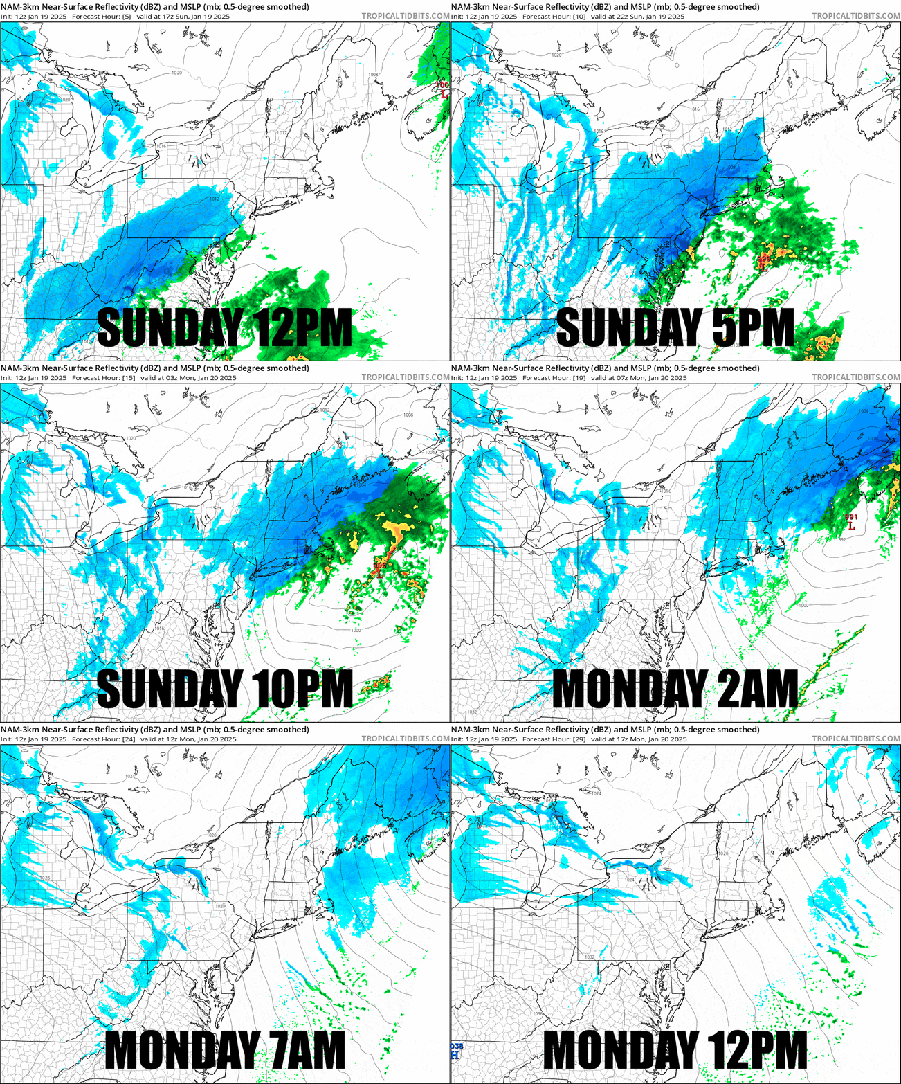
It's already snowing all the way to the Berkshires so naturally this will be the last update for the storm. We finally have pretty strong model agreement, however the storm is now modeled to track further off the coast and the low is about 5 mb weaker than it was thought about 2 days ago and I've trimmed a bit, but no more than 2" in any location. Let's start this off with a timestamped simulated radar covering the 24 hours between noon today and noon on Monday.

I'm going to speed through the forecast details here as we're pretty much locked in and nuance has been discussed in previous updates. I'll first cover the Snowfall Forecast, then the Wind Hold Forecast, and finally the Travel Forecast for this evening.


