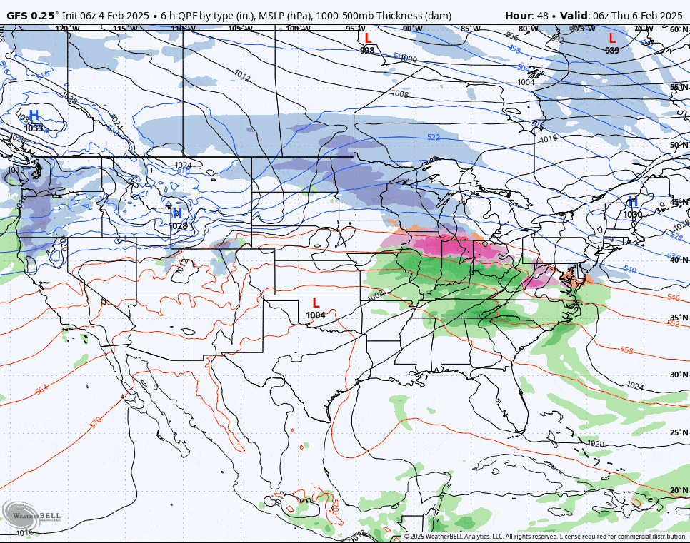
This isn't a big storm as far as moisture goes, but it does come in with a frozen mix in the southern half of the Northeast though quite a few are going to be saved from the frozen mix. There is also some back end snow that should occur off of both Lake Erie and on the upslope into the ADKs, Northern Greens, likely also Southern Greens and the NW side of the Whites. The snow is really starting to stack up nicely and that snowpack is now building in NH and ME as well, though corn season has set back in parts of PA, NJ, CT, and RI. Let's take a look at the broad view from the GFS covering all of Thursday and Friday.
I'll first cover the Snowfall Forecast along with other types of precip. With this storm we do also have wind hold concerns with just a handful on Thursday but Friday looks widely problematic and I'll have Wind Hold Forecasts for both.
This update is shorter than many due to me leaving some nuance out though some do appreciate those details. Let me know in the comments on our site if you feel this update has the right mix for you or not.


