It's time to get excited! We have a weekend storm that should drop widespread 6"-12" amounts of snow across much of the Northeast, though there will be some mixed precipitation in PA and NJ again that will cause some operational and travel issues Saturday night and Sunday morning.
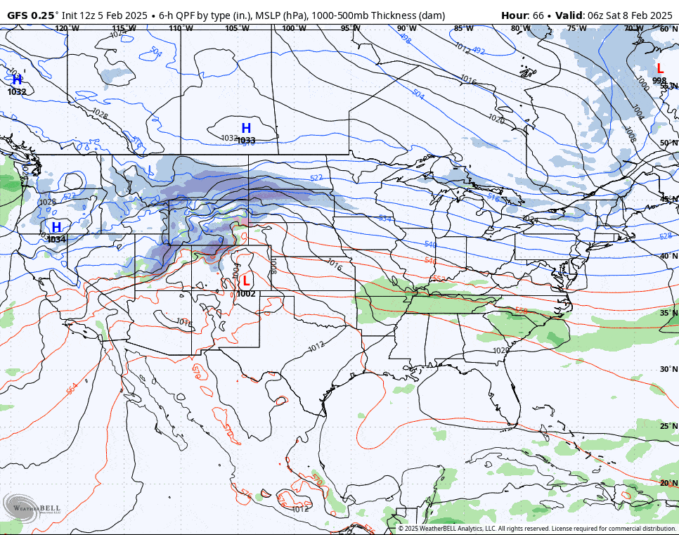
The storm will form from energy related to a remnant low that traverses the Rockies and then turns north into the jet stream. Modeling is already in good agreement on the general intensity and track of this storm with only finer details to work out such as where the changeover line will be and of course how much snow will fall where. Let's jump into the broad view from the GFS showing all day Saturday and Sunday.
I will be providing coverage in a Storm Overview at this time and on Thursday in the next update I will put out the first snowfall and precipitation type forecast which will figuratively put numbers to paper. At this time I do not have wind hold concerns related to this storm on either the front end or the back end, though that could change. I will also visit the Extended Range Storm Pattern as there is a series of similar storms being modeled over the next two weeks which will likely impact the Northeast and/or the Mid Atlantic.