This storm isn't a prolific snow maker, but it will bring a large swath of mixed precipitation that will cause issues from Wednesday night through Thursday afternoon along with some wind challenges to lifts on Thursday and widely on Friday behind the storm. Let's jump right into the simulated radar covering from 7PM on Wednesday through 7PM on Friday. Note that the purples are sleet on this map, and maroon/pinks are freezing r@!n.
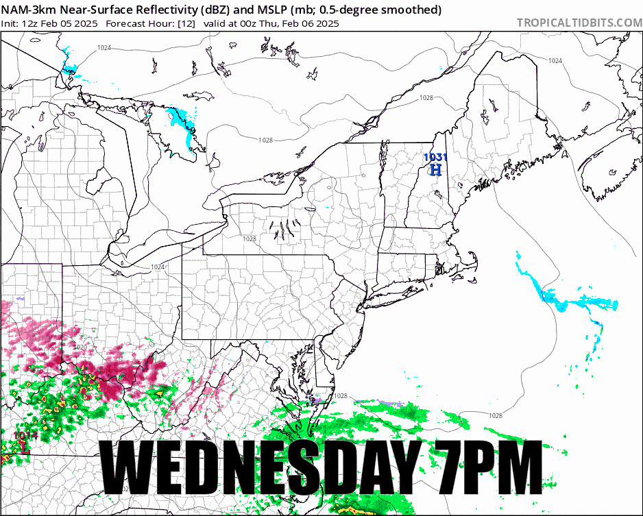
There is not as productive of a back end as I had thought and I have also trimmed our forecast on the southern edge of the all snow line that I will detail in the Snowfall Forecast, and I will then detail the Wind Hold Forecast for both days.
I will be covering the Sunday storm this evening for the first time in detail. That storm is looking very good and modeling is favoring the best case scenario that existed earlier in the week. We're going to have a widespread pow day on Sunday, but we will also see a mixed bag for some.