I was thinking that this update would be just a final small adjustment before the fireworks start but we're getting a bump! I'm now expecting over a foot of snow in a bonus zone. This is also now going to impact travel on Sunday morning more notably.
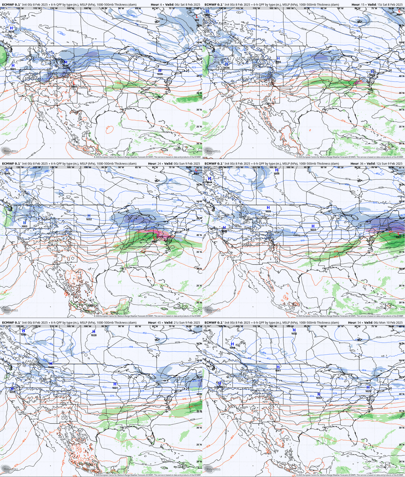
Let's start as (almost) always with the broad view, this time from the ECMWF showing all of Saturday and Sunday as the remnant low starts to pick up moisture in the Ohio Valley and runs head on into the jet stream causing convergence and amplification of the surface low. This isn't a strong storm, but it has plenty of moisture.

I'm going to focus on 3 things in this update, first the updated Snowfall Forecast, then an updated Travel Forecast covering both Saturday evening and Sunday morning, and lastly How to Hunt this Storm, which may seem obvious to many but that's exactly what you want to avoid as pow days with 100,000 of your closest friends and being parked 1/2 mile down the access road isn't how you score the best days, though I'm sure many will find that enjoyable anyway.


