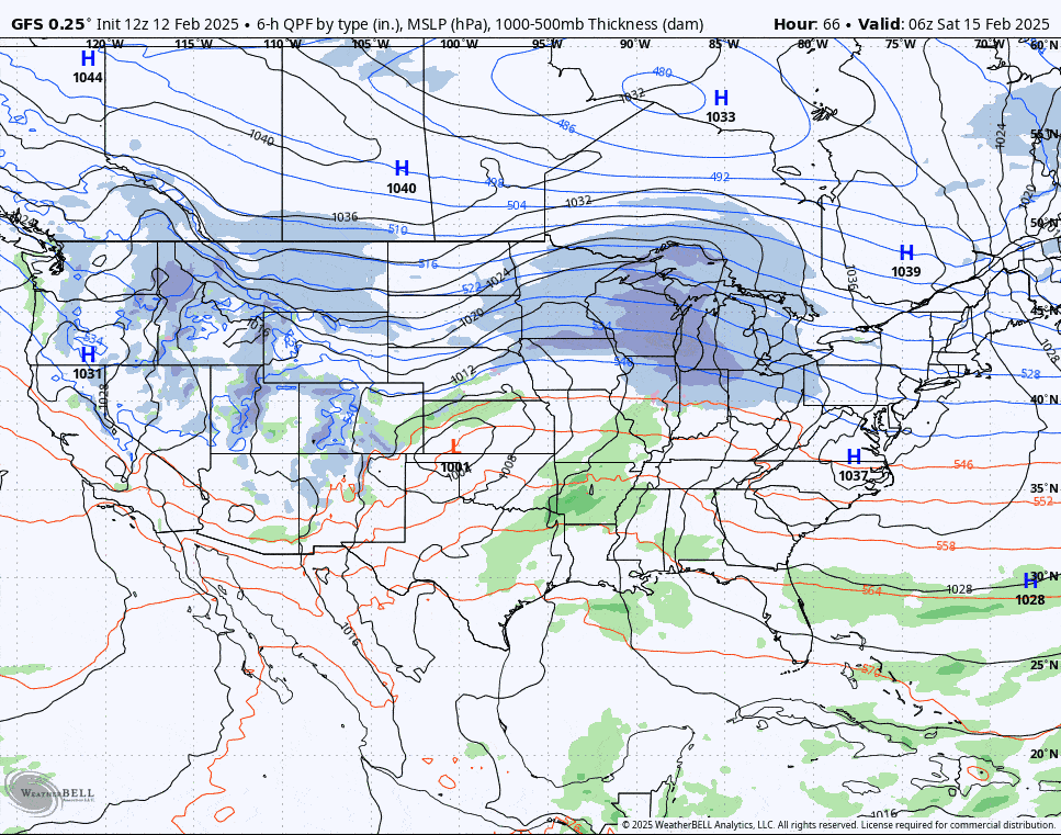
Well folks, we've got a big storm with big impacts from both precipitation and wind over a 4 day period on top of the start of a holiday week. To say that this will be impactful is an understatement. Travel, conditions, and lift operations are all at play with this system starting Saturday afternoon and lasting through early Monday morning with back end lake effect and upsloping snow looking likely through at least Tuesday. Let's look at the broad view from the GFS covering all day Saturday and Sunday.
I'm going to cover the Precipitation Overview for this storm, then the Wind Hold Overview, and lastly the Travel Overview. We're still too far away to give a deterministic type of forecast although I'm sure everyone wants to know how much snow falls at X by 5:38AM on Monday. Apps will tell you that but they are going to generally change significantly every 6 hours at this range and the best approach is to look at this a bit less precisely in order to start narrowing down the possibilities. In the Northeast you can only forecast snow from 2-4 days out with an acceptable degree of accuracy, and trying to pinpoint changeover lines and precipitation types is often a moving target.


