
I called this storm not really "huntable" yesterday and of course some people rose from the bed of nails spit out their mouthful of glass, and proclaimed "hold my beer". There's always someone of course, but don't let me hold any of you back. Sleet does ski just fine, but it might be flying in your faces at up to 70 mph in some cases. It will be an interesting day with plenty of challenges.
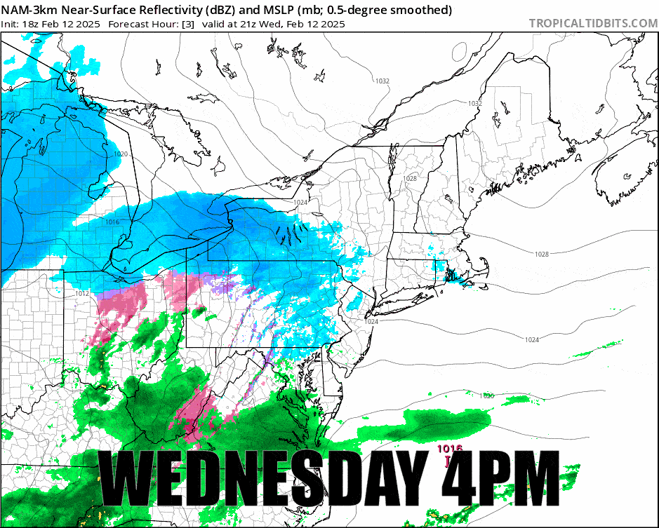
The storm is actually looking better in the modeling since yesterday though I had speculated that the NAM3K was running a bit warm and that seems to have been the case, and I think it has found the sweet spot in this last run. Here's the 24 hour simulated radar covering the heart of this event from 4PM Wednesday through 4PM Thursday.
I'm going to go over the Precipitation Forecast and then the Wind Hold Forecast in much greater detail than yesterday. I will update the Friday wind hold forecast again in an update on Thursday.


