Well, that was a doozy of a start of the holiday week to say the least, but things have gotten back to normal again mostly but I do want to start off by giving some detail about the lifts that are still under repair and how they may impact terrain availability and also crowding.
Attitash Flying Bear: A grip failure and detachment along with inspections and investigations by the NH Passenger Tramway Safety Board are keeping this lift off line with no estimate for its return and it will not be operational this weekend. This brings a loss of the upper mountain terrain at Bear Peak and is likely to cause extra traffic at Attitash Peak.
Stratton Gondola: 100 mph wind blew the roof off the top terminal of the gondola and they are working on repairing the roof and cleaning up the debris. They are hoping to have it ready for operation Saturday but that is not guaranteed. This will not cause any loss of terrain but if it persists on Saturday it could cause longer lines for other main base lifts. I always suggest starting in the Sun Bowl on busy days regardless.
Gunstock Panorama: The gearbox on the bottom terminal failed earlier this week and while they initially expected it to be back in action on Saturday it is no longer likely to happen this weekend due to parts availability. This is Gunstock's main lift and there is no summit access as a result and this also impacts their capacity.
Belleayre Express: Strong wind blew a tree over that impacted this lift while the ski area was shut down. They have been working on it but their snow report gives no immediate expectation of when it might be operational again. This lift serves the looker's left side of the mountain and it will be difficult to get back to the Overlook Quad from some of those trails and it also reduces their non-beginner terrain capacity by about 1/3.
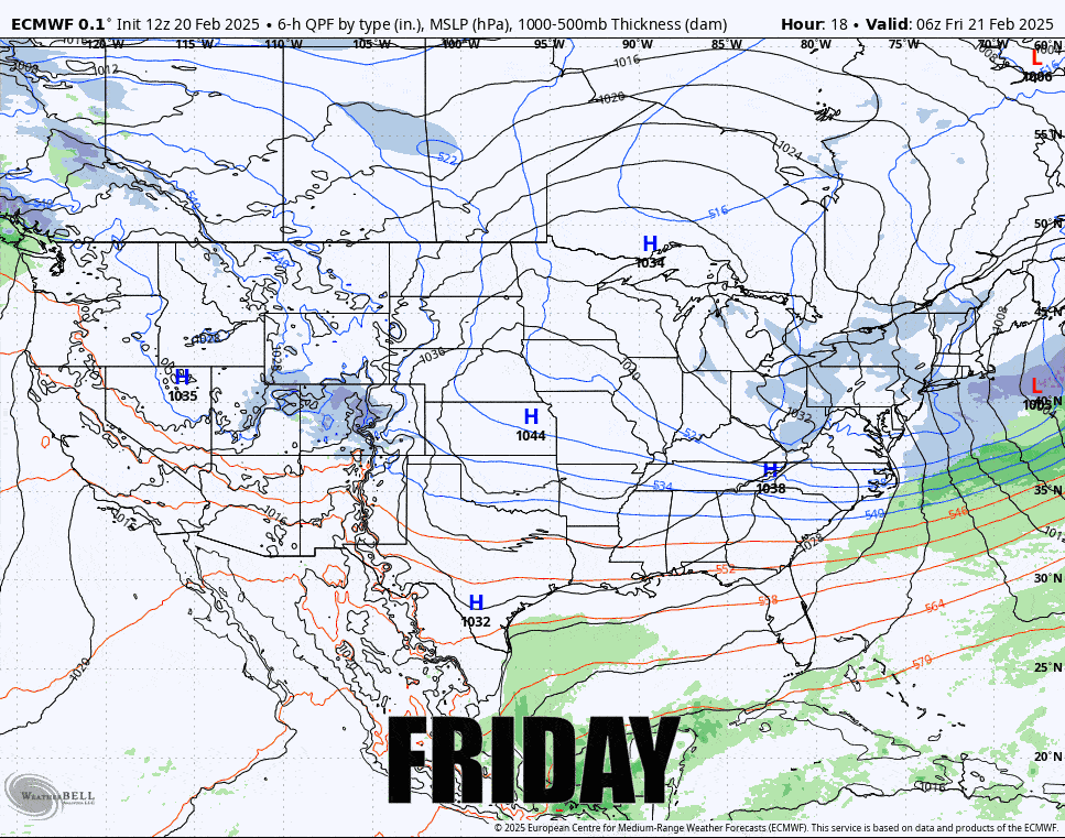
As far as the weather goes, it's going to be a beautiful weekend with some isolated snow tonight through Friday and then another batch of light snow will brush the more northern areas during Sunday, and then on Monday a loosely organized clipper will start come through but most impacts won't be felt until Tuesday and Wednesday. Here's the ECMWF 6-hour precipitation intensity look covering all 4 days.
I'll start off with an update for the Friday Wind Hold Forecast as we will see some isolated issues, then I'll cover the Temperature Outlook, and then the Snowfall Outlook. It's not a lot of activity, though that's not a bad thing because I can tell you that beyond the isolated wind issues on Friday things look spectacular this weekend and I do expect it to be busy.