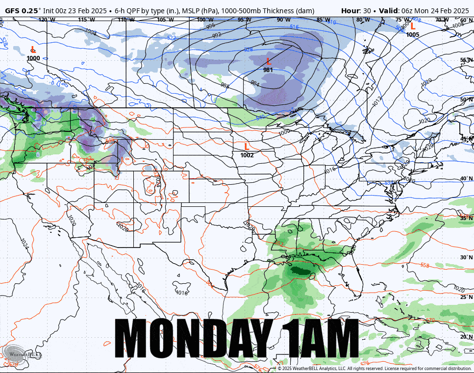
I have to say, the start of last week was a doozey with cold and wind, but the week is finishing off strong with pleasant wintry temps and some light snow. Next week we'll be in more of a zonal flow and the Northeast will be riding the wave of the Polar Jet Stream bringing us some warmer daytimes during before some colder weather returns in time for the weekend. We also have a series of 3 different systems that will bring snow primarily to the northern latitudes. Here's what the GFS is presently showing for the next 7 days.
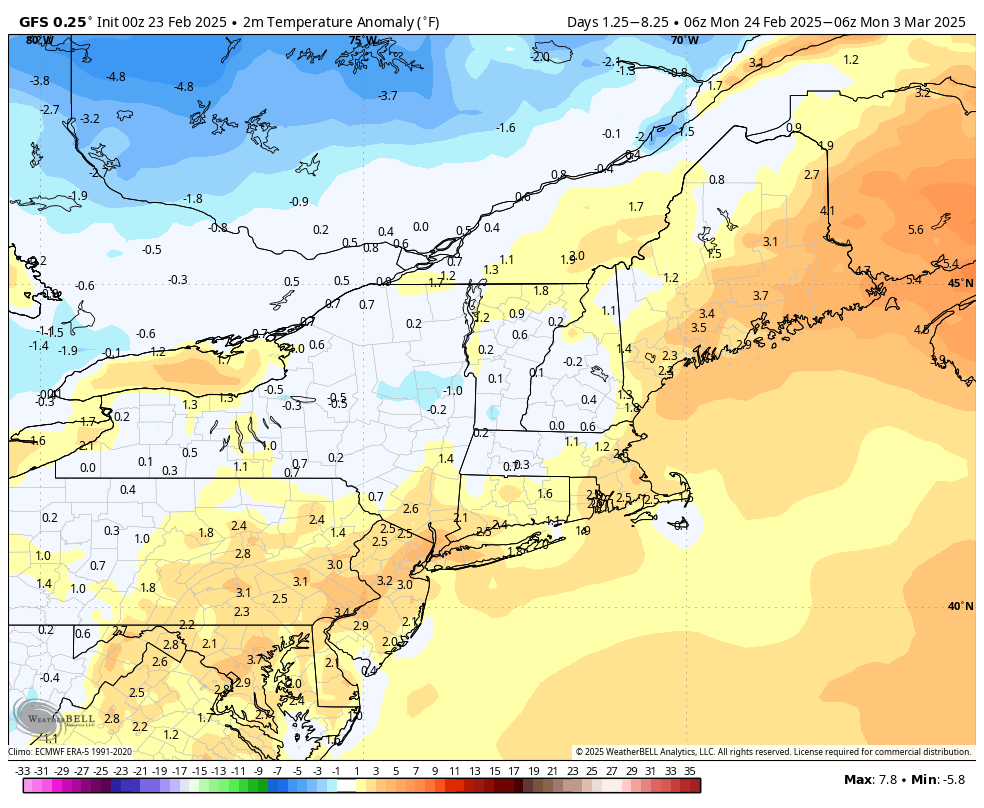
Many will focus on the temperatures this week, but they really aren't going to be that warm overall though Monday through Thursday will be warmer than average and Friday through Sunday will generally be cooler than average, but this isn't going to be a big melt for anyone, not will it be a washout.
February 28th is generally the last day for snowmaking in the Northeast except for a handful of ski areas who tend to aim for late April and beyond. The reason why everyone tends to shut down all at the same time is because of demand-based pricing for power. The rate for power that most ski areas pay is based on their peak sustained usage during a monthly billing period, and running a snowmaking system for just one day in a month can add greatly to the overall bill, potentially over $100,000 for a larger resort. Unfortunately the windows are going to be marginal this week as they finish their topping off, but on the flipside, snowpack should widely be running very strong on snowmaking terrain given the solid two months of colder than average weather we have seen and hardly any r@!n.
I do like to change up the format to better fit the weather and focus on what is more impactful to skiing and riding in these outlooks. I'm going to start off with a a Weekly Synopsis to help the powder hunters among us because there will be opportunity with the near endless snow even if there isn't going to be a huge dump. I will then do Daily Outlooks focusing on precipitation, temperatures, and wind.
Please keep in mind that the further you go out the more changes there will likely be from what is shown now, and most notably the track of the Sunday storm.