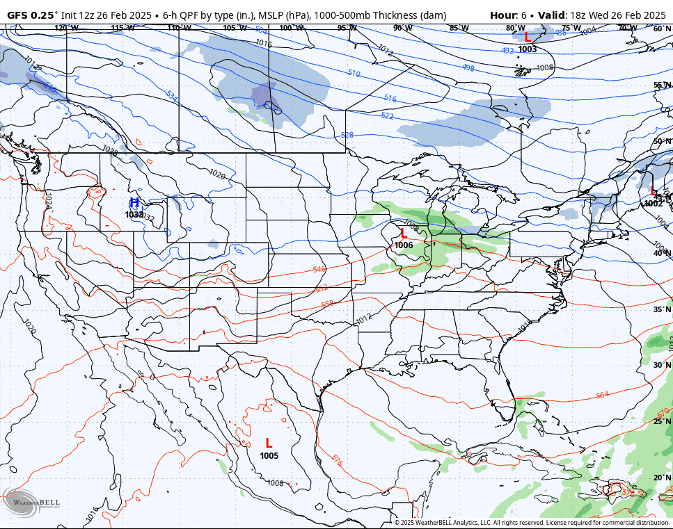
Winter is going to start clawing its way back on Thursday with a fairly weak system and a pretty decent back end along with some wind and some cooler temperatures. In combination with the warm up that we just experienced we are definitely going to see some hardpack develop where packed powder has been the rule of thumb for about 2 months with probably only a handful recovering decently by Saturday when the next storm comes in. Let's start off with the wide view as always, this time from the GFS covering 1PM Wednesday through 1PM on Friday.
I'll cover the Precipitation Forecast first and then the Wind Hold Forecast for both Thursday and Friday where we have some isolated threats that likely won't be severe. I will also share a Saturday Storm Preview to help people better plan their weekend and full coverage of that storm will start on Thursday.


