Spring must be around the corner because suddenly it feels more like a crappy El Nino or La Nina weather with mixed precipitation and hardpack is starting to spread north as things refreeze. There's no reason to complain though because meteorological spring starts on Saturday and we are getting another storm that will be 95% snow to freshen the slopes and it will be widely a fantastic day.
On the flipside while some ski areas stay frozen on Saturday and build some packed powder, others will soften to hero snow during the day and then everyone refreezes on Sunday meaning some hard and fast conditions to finish off the weekend where the pow doesn't deliver in the current storm and the next.
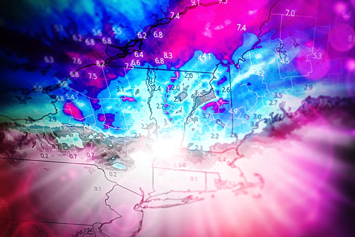
One quick note before we jump into the Saturday storm. The back end on the Thursday storm that lasts through Friday morning is going to underdeliver on my forecast by about 2"-3", mainly on the upslope into the ADKs and Northern Greens. It won't be quite enough to cushion the gnar and that means loud pow, but nothing that a good Ice Coast skier or rider can't still appreciate though we've been spoiled for a while. It will be 'loud pow'.
So let's jump into this storm with a loop from the ECMWF covering 7AM Friday through 7AM on Sunday. It's a clipper, but it's not a direct hit on the Northeast.
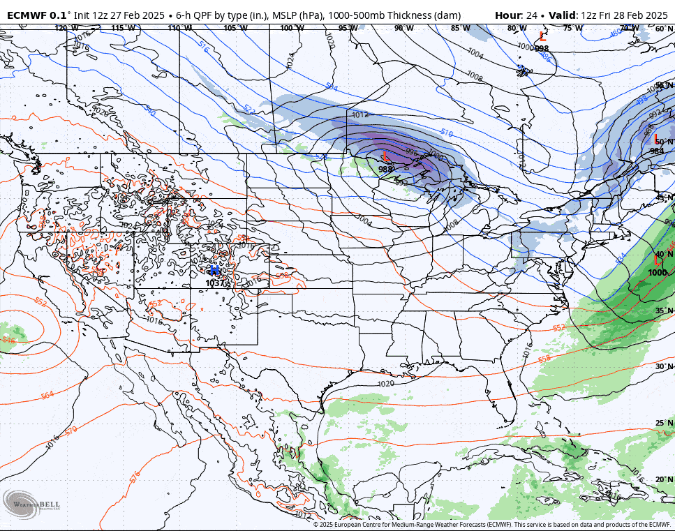
I'll cover the Snowfall Forecast first, and then the Wind Hold Forecast where I have isolated concerns about marginally threatening winds on Friday, Saturday, and Sunday.
Let me remind everyone also that if you want to hunt the snow or better conditions we have discount partners in the Snowology Club offering up to 50% off the window ticket price with all of them offering Sundays and the majority offering Saturdays as well. If you are not familiar with this perk of our subscriptions, check it out!