I choose to not provide any updates on Friday in order to bring awareness to plight of NOAA, including the NWS and their employees, and also potentially effects on our ability to accurately forecast the weather for skiing and riding. A small handful of people protested this, but the vast majority of our subscribers supported it. The fact is that 83% of Americans in a recent YouGov poll have a favorable opinion of the NWS and among our subscribers that number is likely over 95%. We do not consider this to be a political; some things transcend politics, and we all need to fight to preserve NOAA. THIS IS A BIG DEAL!
While I do not regularly consult the NWS for short-range forecasting, I do have specific concerns about how this could impact our ability to provide accurate wind hold forecasting, snowfall forecasting, and precipitation type forecasting, and even precipitation types in composite radar; all of which are critical to skiers and riders in the Northeast as our winter weather is as complicated as it gets. I will have more to say about these specific concerns in the future, but the loss of refinement in waiting 12 extra hours to update the forecast is of little consequence in comparison to what we could see over the longer-term if this proceeds.
If I upset you with this 12 hour delay, just consider the implications of the NWS no longer providing any forecasting at all. That is in fact their long-stated goal and it will be very disruptive if and when that happens and we all need to stop that from happening. They are the only organization providing manual forecasting for our entire nation, and they have the brightest and most experienced forecasters around.
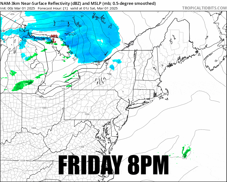
As far as this storm goes there are two changes of note; first, the storm has tracked further north which means less snow, and second the trailing cold front is advancing faster which will cause earlier refreezes and somewhat more widespread wind threats on Saturday. We'll jump right into the simulated radar since half the storm will be over by the time lifts start to spin today. Based on live radar the simulated radar this time is too sparse on on how far south the snow is reaching overnight. Lake effect off of both lakes will also affect WNY and CNY into Monday morning with moderate accumulations (24 hours beyond where this loop ends).
I'll cover the update Snowfall Forecast, then a Refreeze Forecast for Saturday, then detailed Wind Hold Forecasts for Saturday and Sunday for subscribers. Let me also state clearly, Sunday will be cold and windy with every ski area below freezing for the day, and some might only barely break 0F at their bases! It will be a good time to mabe hunt those less prone mountains closer to the coasts or further south and you might need sharp edges for the first time in months in the more northern areas.