Meteorological spring started on Saturday as we are now past the 3 coldest calendar months of the year, though looking outside you wouldn't know that today. March can be the snowiest month at times; nearer the coast when there are nor'easters, and further north on the mountains where the temperatures tend to keep precipitation as snow. March though also is famous for cycling between cold and warm spells and our more persistent PNA+ pattern with ridging near the Pacific Coast and troughing in the Northeast that brought storms from the Northwest and cooler weather that has kept our snowpack building widely for the last two months seems to have given way to a more cyclical pattern that is likely to last through the first half of the month.
This week we have four primary weather events starting with a warm up on Tuesday and Wednesday, a massive cutter on Wednesday and Thursday with a back end along with wind that could last into Saturday, and a potential nor'easter on Sunday that I'm definitely NOT hanging my hat on at this moment, but that the following loop shows in dramatic fashion.
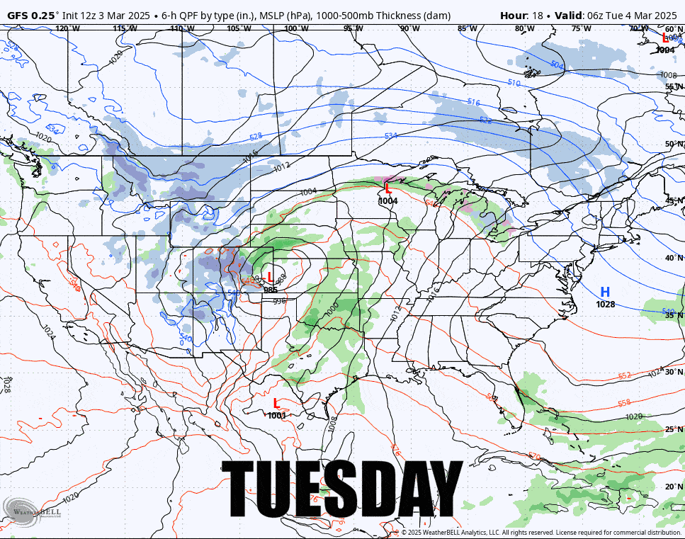
I do change formats to best fit the outlook and this week I'm going to break things down into 4 parts starting with the Tuesday-Wednesday Warm Up, then the Wednesday-Thursday Cutter, the Thursday-Saturday Back End, and then the Possible Sunday Storm.