The mountains are currently crying some runoff as winter let loose its grip on their terrain, though that's all starting to freeze back up right now as the howl of the cold wind passes over my house. Our mountains were in great shape to start and there is plenty of natural snow left on most mountains north of the Albany, NY latitude, and the snowmaking terrain is quite robust across the area as well. The Mt. Mansfield snow stake lost just 9" of loft and the snowpack ate up the 1" or so of r@!n that they saw which will end up frozen into the pack and increase its thermal mass providing for more tolerance to future melting.
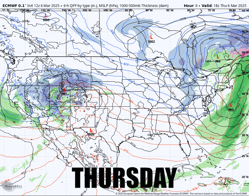
I have a little bit of good news, the storm is transfering energy to the coast further south and earlier than was modeled yesterday and that will cut down on the degree of severity of the wind on Saturday and Sunday, but Saturday is still going to be widely problematic in parts of NY and New England. Let's take a look at the ECMWF covering Thursday PM through the end of Sunday.
The first full updates tend to be pretty complete and today is really just an update to the forecasts. I am going to start with the Snowfall Forecast and extend it through Saturday at 4PM which is almost all of the snow on the back end of this system. I will then walk through the dailies for each day covering temperature and wind.


