Welp, the trend is not your friend. All modeling has become worse for snow potential with a weaker and later forming low, though there is still disagreement on the track and intensity. Advanced timing and less snow will also likely cause notable issues with a flash freeze on Friday as well, and we have some back end wind also to deal with.
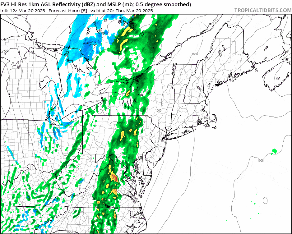
I'm going to use the FV3 model, a newer mesoscale model still in development (the last I heard at least), to display the simulated radar this time. It does tend to run a little warm and strong on precipitation but it misses lighter snow especially on the upslope behind storms. In this case it better matches the expected track and intensity of the medium-range models that are better at cyclogenesis (the NAM3K seems still out to lunch and doesn't handle lows forming on low level jets well unless they are fairly strong). This loop covers from 4PM Thursday through 4PM Friday. By 9AM on Friday snow will be tapering off in the Northern Greens and Whites, and should end before noon in the Longfellows.
I will say that the GFS still shows upside from the other models but I will not be forecasting that potential. Call it a bonus if it confirms. I will revisit the Precipitation & Conditions Forecast and the Wind Hold Forecast for Friday to dial things in for subscribers. Early this evening expect to see a Weekend Outlook that covers through Monday.
There are lots of reasons not to try to hunt what snow does fall with this system, and aiming for lower elevation ski areas that stay unfrozen and will be less windy is the best call for Friday.