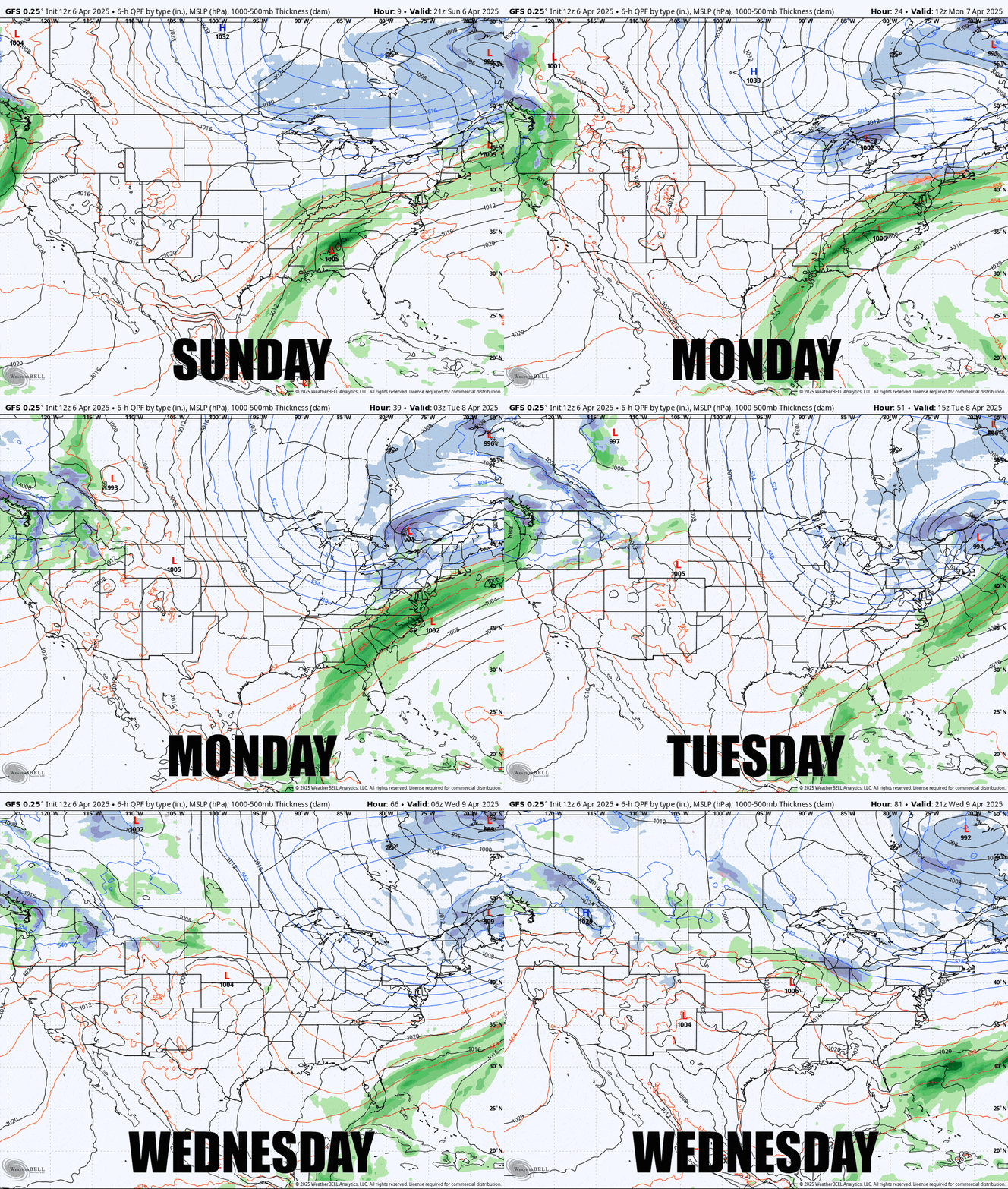
It ain't over 'till it's over. I believe 8"-12" of snow is likely to fall by Wednesday morning in some spots, though the pickin's are getting slim of course, especially on weekdays. This is actually two systems with mainly different focuses, on Monday the focus is more south, and then on Tuesday the focus is more north, and by Wednesday the loud pow may disappear for a short time before temps move back up before the weekend when some stuff is coming at us. Here's the wide view from the GFS covering 5PM Sunday through 5PM Wednesday to get things going.
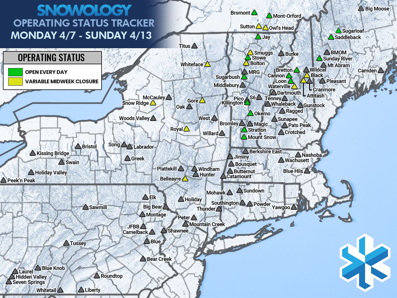
I'm going to call this a "storm" despite being fairly limited in scope for where the +6" will fall, but it will hit quite a few of the ski areas that are currently operating during the week. Here's a map that shows who is open every day and who is closed for at least 2 of the next 7 days. Make sure to check those snow reports because operations have of course been limited even when operating daily.
I'll go over the Snowfall Forecast below for subscribers and break things down day by day for the opportunities that exist. This update is being sent Sunday evening to subscribers and will be posted to social media channels on Monday morning.

