The season is winding down but you know what, we're still skiing, corn has made a strong return, tailgate weather is currently prime, and there are at least 3 more weekends left! Our line up for the weekend across the East looks like this with the projected operating schedules through the end of the season:
Killington: Open daily through Sunday, 5/11, then Fri-Sun until TBD.
Sugarbush: Open Saturday and Sunday (free tickets), closing weekend.
Jay Peak: Open daily through 5/4, then Fri-Sun until TBD.
Black Mountain: Open Saturday for closing day, $9 lift tickets.
Sommet Saint-Sauveur: Open daily through Sunday, 5/4 then Fri-Sun until 5/19.
Snowology is now just focusing on weekend weather through the end of the ski season. Wind is less of an issue now, and the difficulty of determining precipitation types and amounts in marginal temperatures that automated weather apps struggle with is likely over until October comes around. We will also be providing non-paywalled weather updates through the end of the ski season in the East. It does seem likely that Sommet Saint-Sauveur could claim the crown for last to close in the East since they will be open on Monday the 19th to celebrate Victoria Day and it is probably going to be a stretch for Killington to make the following weekend in this one-off season. One thing I have learned though from watching Killington's operations is that if it is remotely possible, they will pull it off.
And now for the forecast.
Weekend Forecast
We're looking at yet another system with r@!n this weekend, and while it might look bad on the 3-hour precipitation intensity maps (which I'm not showing for a reason), there are very likely going to be good opportunities to ski and ride between Friday and Sunday.
The best day overall will likely be Saturday, but it probably won't be t-shirt and tutu weather outside of Black Mountain.
FRIDAY
Here's the latest simulated radar from the NAM3K, and keep in mind that only Killington, Jay Peak, and Sommet Saint-Sauveur will be open. There will be light morning r@!n in Vermont that probably lasts until 11AM to Noon with later clearing likely in the north. On Friday afternoon scattered thundershowers in Vermont are possible though the NAM3K isn't great at picking up on. They'll likely be brief if they appear. Temperatures on Friday should reach the low 60's a mountain bases.
SATURDAY
Saturday will be a lot cooler in general across open ski country with a stationary front draped over the Northeast. Temperatures will peak in the low to mid 50's at bases from Killington to Sugarbush, to Jay, and Sommet Saint-Sauveur, but upper 60's are possible around Black Mountain. Killington is a bit borderline with the front and could come in for a warmer surprise.
As far as precipitation goes modeling has some disagreement about whether or not the afternoon will be dry in Vermont with the NAM3K showing a weak piece of energy holding on enough to create some light to moderate r@!n, but this could end up better or worse than the NAM3K shows with the GFS seeing a bit more and the ECMWF showing dry weather. I would call this a 30% chance between 2PM and 5PM at this point because I trust the ECMWF the most at this range for this type of weather.
SUNDAY
On Sunday there's a lot of uncertainty with the potential of r@!n. The boundary will still be draped over the Northeast and there will be r@!n south of that boundary, but where it lies is an open question and will make or break the Sunday ski and ride day. The ECMWF has been nudging that boundary more and more south by run with it currently in the vicinity of Killington leaving those further north dry, but the GFS shows the r@!n moving north through the day before stalling over Northern Vermont. I can't say which model is more likely to be correct but I can say that Sommet Saint-Sauveur has the best chance of staying dry for the day.
Here are the 2PM captures from the current ECMWF and then GFS models.
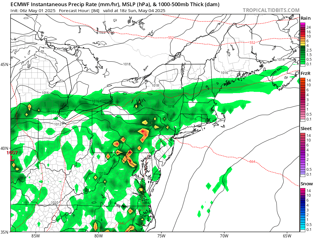
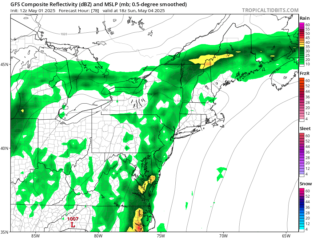
Temperatures will be dependent on how far north that boundary moves, and under the r@!n we're probably talking about mid to upper 40's, but north and south of the precipitation we're probably talking somewhere in the 60's. I'll send out an quick alert when we get stronger agreement for Sunday.
-- Matthew Scott


Comments ()