
Well this happens in both good and bad ways, and even this storm is both good and bad so lightening it up isn't completely a bad thing.
The bottom line is that modeling for this storm has both drifted south and weakened considerably. We're expecting no more than 3" at any ski area based on modeling trends over the last 18 hours. Keep in mind that the storm itself didn't move, it was always going to do just this, but modeling was just simply off. The first signs of this were right around noon yesterday and while modeling is still catching up right now, the trend is very clear.
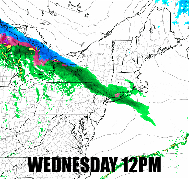
Here's the latest simulated radar from the NAM3K and this is about as far north and as strong as modeling is currently.
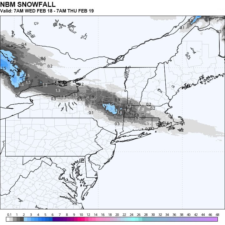
And here's the latest National Blend of Models snowfall map, and this could be on the high side still and almost certainly too broad. S-VT for instance may get nothing from this but flurries for instance.
The storm hitting Friday afternoon should make up for this at least, though this morning models are converging on primarily just light snow from the monster nor'easter that will form on Sunday but all hope is not yet lost (there wasn't a ton to start).
-- Matthew Scott


Comments ()