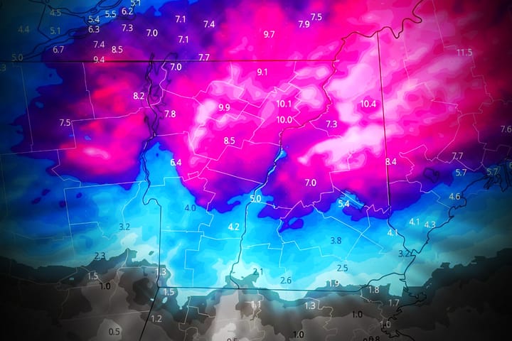
I just wanted to send out an update about the storm thus far. We did see r@!n push a bit further than our forecast though probably only into the red zone that we identified. That push of warm dry air also cause snowfall totals just north of the red zone to come in a little low though the Powculator I think has been keeping up with those changes. The Powculator did though count some r@!n as snow in the red zone from our final forecast map yesterday. We just need to integrate more data so that we can improve this even more because I think we could have detected this automatically.
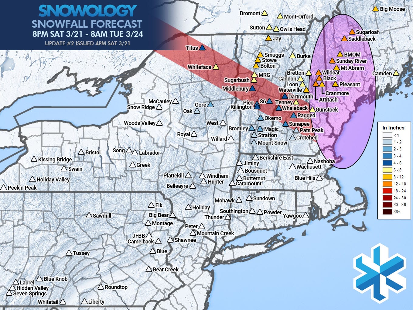
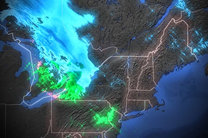
Keep in mind that this map covers through 8AM on Tuesday and after a lull of about 18 hours with only very light snow in the northern reaches we'll see a deformation band develop in Northern New England that we expect will drop up to 4" in isolated areas starting around noon on Monday and tapering off in the early morning hours of Tuesday which will provide a nice refresh.
I have an updated simulated radar to share with subscribers and also I want to point out some opportunities for hunting some untouched pow on Monday. Note, Black Mountain NH is also offering discounted tickets, food and beverages on Monday in what they are calling a "Powder Party".