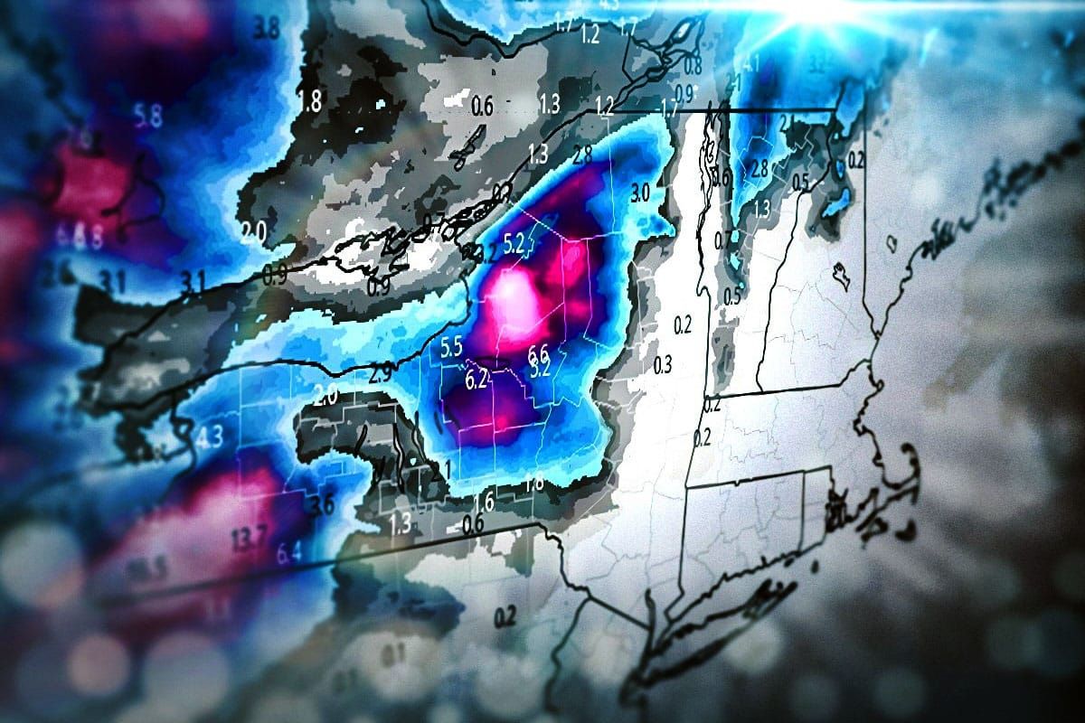
As is often the case with November r@!n we have a consolation prize behind the storm that will start kicking in with snow around midnight tonight and should last through Saturday morning with copious amounts of lake effect and some upslope as well. We could see over 18" at some ski areas off the lakes and over 8" is also possible on the upslope. We do also have a flash freeze coming in early Thursday morning and some lift holds are possible on Thursday, Friday, and Saturday. I have a lot of maps to share so let's jump right into the bird's eye view through the end of the weekend.
You may have noticed that storm coming in on Sunday which looks somewhat borderline on the precipitation types but right now it looks like we'll see all snow at open ski areas in the ADKs and Northern New England and wind holds are also an issue on Sunday and Monday. That storm is too early to pinpoint however so we'll cover it separately in a future update.
As far as ski area operations go I have a map showing everyone who will be open as of Friday. Note that Stratton opens for the season today, and Black Mountain will open on Thanksgiving for 4 hours to work your stuffing off. Jay Peak on Friday is only open for passholders and recipients of free tickets, but they open to everyone on Saturday. Please make sure you always verify operations with the ski area in question before taking a trip. It's hard to track operations at 103 different ski areas and things do change.
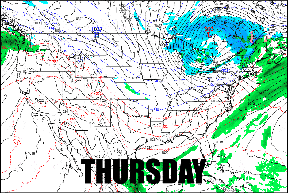
I'm going to go over the Flash Freeze and temps through Saturday, the Wind Hold forecast for Thursday, Friday, and Saturday, and I'll start off with the Snowfall Forecast.


