I hope you all are having a wonderful Thanksgiving. I have an update to the forecast through Saturday for both the snow and the wind holds along with a preview of the Sunday storm that I will cover tomorrow as a light event and there will probably be a few wind holds also.
We'll start out with an update to the Operating Status Tracker where we have added Powder Ridge in CT, and not shown on our map is Ski Ward in MA. Both of these are operating off of a beginner carpet. It's not clear what Ski Ward's public operating schedule is at this moment but Powder Ridge posted their schedule on their Facebook Page.
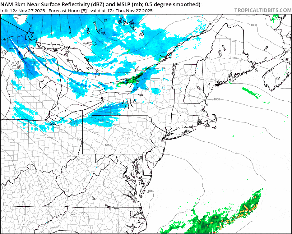
Now let's jump into the weather with a 48-hour simulated radar loop from Noon Thursday through Noon Saturday. Snow has already been stacking up from lake effect bands since Wednesday evening but the upslope in the northern areas will start early Friday morning and it all tapers off by about Noon Saturday.
I'm going to go over the Snowfall Forecast, and then the Wind Hold Forecast, and finally a Sunday System Preview. I won't be covering temps however this was covered in the previous update and I expect everyone who is open to stay below freezing during the day through Saturday with the exception of the ones open in Southern New England, but not too cold. Due to the warm up and r@!n preceding the back end you should expect that surfaces are hardpack except for some in the far north where there will be some pow, but that will be on top of hardpack. Sharpen your edges, it can make such a huge difference to your enjoyment allowing you to ski or ride more confidently due to having better edge hold.


