With this winter once again getting off to a slow start I might as well blow out some mice from the pipes and give the Snowology machine a test fire. There is some tantalizing more wintery weather though behind this system that I'll discuss, but we'll start off by focusing on what to expect from this storm on Halloween.
We do have a pretty large storm that is going to form in the south and then charge through the Northeast. Deterministic models (each model's single best solution) are favoring a cutter that passes entirely over land however ensemble models (multiple slightly different versions of the same model) universally show the storm closer to the coast and possibly cutting through New England. At this stage that doesn't matter much because this storm is highly likely to be all r@!n on the front end but right now it looks like many might be able to sneak in a dry early evening for many on Halloween. Keep in mind as always that we're 4 days out and something always changes in that time frame, but I think models at this stage have a decent idea of where this storm is going and approximately when.
This is going to make Halloween a bit tricky. Sorry, I had to say it, but it's true. Let's start off with the broad view to set this up.
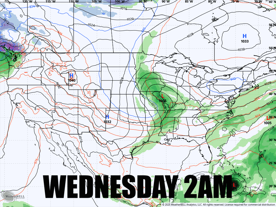
There's no reason to get any deeper in the synoptics (large scale patterns) for Halloween. There might be some snow on the higher elevations of WV, PA, and the northern parts of NY, VT, NH, and ME, but that's not prime trick or treating territory of course and it won't be enough to ski just yet (unless you are hardcore AF). If it does track closer to the coast we may see snow further south in the Catskills and Southern Greens as well though.
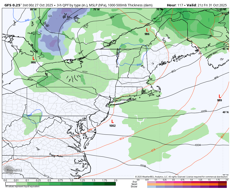
We'll jump next to the 3-hour precipitation intensity map for 5PM on Halloween. This isn't the same as radar, rather it shows the intensity of precipitation over a 3 hour period. Lighter shades are pretty light and scattered if they confirm, and the western half is back end precip that will upslope mainly into the mountains and also extend off the Great Lakes.
This storm is going to pull cold air behind it, so after the r@!n here's what the temps look like at 5PM on Halloween:
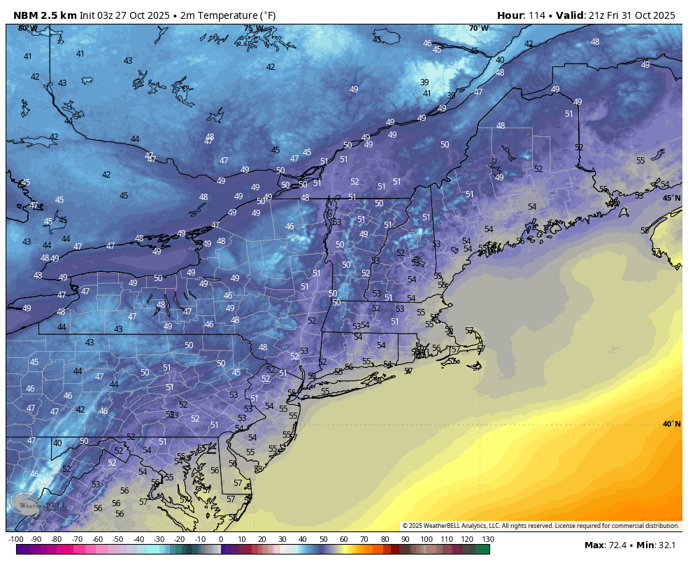
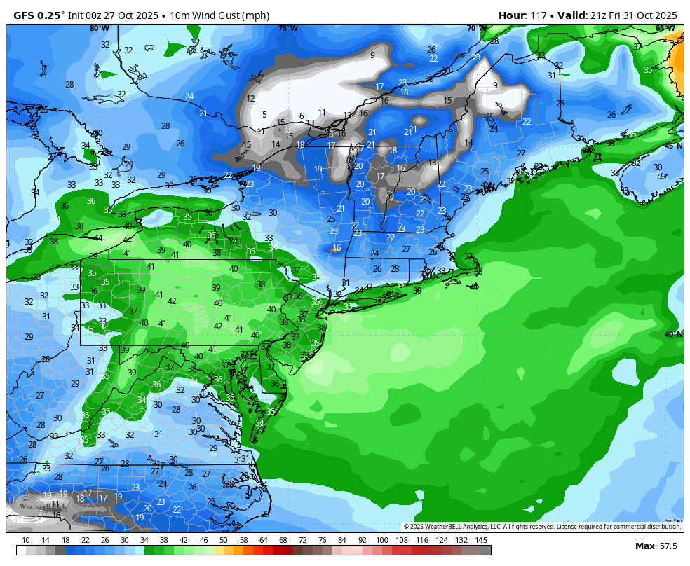
So far this looks mainly tolerable, though damp following r@!n earlier in the day, but as that low tracks northeast wind will switch to coming from the west to northwest and it looks quite brisk. Here are the modeled wind gusts at 5PM again on Halloween:
Snowology isn't just some weather app that pumps out numbers, so let's tie the weather to our operational concerns.
First off, costumes featuring tights are probably going to be a bit too chilly except near the coast. If the timing is right (it can easily shift by 6 hours or more at this rage) then you'll probably want to avoid costumes that catch wind in the green areas.
And most importantly, how much candy should you get so that you don't run out or get left with enough to make your ski pants a bit too tight? Weather is by far of course the #1 factor in determining door traffic from year to year. When things get windy and below 50F traffic starts to drop off notably. The big coastal cities probably won't see a lot of candy determent, but once you get inland a bit you'll have to deal with temps and/or wind holding back the trick or treaters.
This is an early call so we'll have to watch for adjustments to timing over the next 4 days to dial this in, but the Snowology Candy-o-meter right now is suggesting average demand along the coast and less than average demand inland with well below average demand in areas of PA and possibly NY depending on timing and track, and more steady r@!n may be seen in W-NY from lake effect/enhancement.
Now for the skier and rider stuff.
Snowmaking Weather Might Not Be Far Behind!
Storms tend to pull in cold air behind them, and they can change the general flows also since where a storm recently tracked typically isn't within a ridge or resistant high pressure. We've needed a fairly strong storm to track up the coast to help change the pattern and put us into some deeper cold so that snowmaking can finally kick off.
I'm going to start with a 500mb map of "geopotential heights". Yes, that sounds like weather jargon which is why I almost always call it "500mb pressures" but you can google the term if you wish. At this level of the atmosphere half the atmospheric mass is below it, and half the mass is above it, though it is only about 18,000' up. This level is critical because it is where the main steering currents for storms and other weather are located, but that's not all. There's a 540mb pressure level (geopotential height) that is a very good rule of thumb for when snow is possible near sea level, though at higher elevations slightly higher pressures can support snow. That of course also means possibly snowmaking temps. Keep your eyes on anything from green to blue in this loop coving Sunday through Wednesday of the following week.
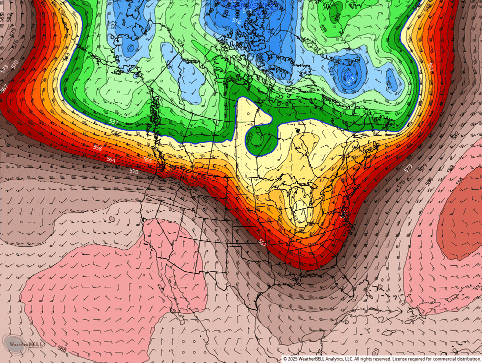
That spot of green that appears over Ohio early on is another potential storm, though likely a smaller one, but it is going to also tug on the cold air and form a trough, and in this run at least a late forming surface storm near the Maritimes that would pull in even more.
I ain't going to lie, I would like to see something dig deeper and form a storm further south for more cold, but this might just be enough to get the snowmakers out of bed for the first time this season. Here are the low temperatures for Wednesday the 5th and Thursday the 6th according to the National Blend of Models:
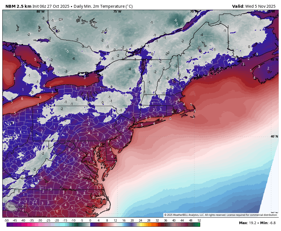
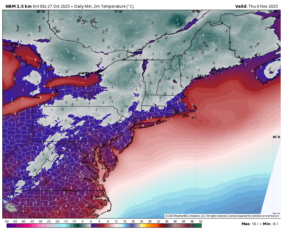
Temperatures shown in Celsius to highlight the freezing level.
Now we are of course in the fantasy territory of modeling, but synoptically this isn't that complicated of a set up so there is more confidence of this pattern generally occurring with a second smaller storm followed by cold. Modeling currently doesn't suggest enough cold to lay down enough snow to get a white ribbon of death running at Killington, Sunday River, or Sommet Saint-Sauveur, all of which will open ASAP. It generally takes 3 strong days (more than 12 hours of snowmaking) with temps in the low 20's for Killington and Sunday River to open, and Saint-Sauveur maybe a day longer as they make snow lower in elevation. If this confirms we will of course see many other ski areas also start to make snow, just not with the goal to open ASAP.
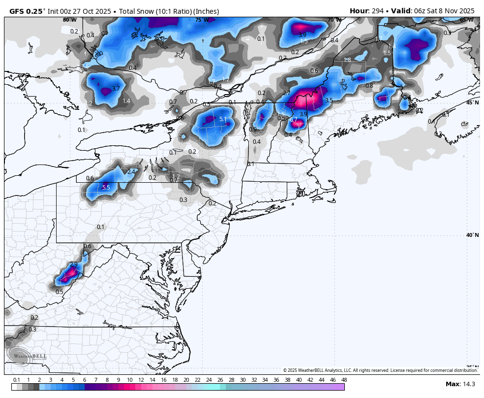
There could also be some natural snow building, almost all of it back end snow. The GFS doesn't pick that type of snow up very well so there could be significant upside on the upslope between this Friday and the following Friday:
I will stress again that this is in the extended range, and it is never a slam dunk outlook at that range, but it's the best chance of snowmaking temps and winter weather we have seen thus far.
-- Matthew Scott
POWDER TO THE PEOPLE


Comments ()