The wait is over! It's time to scrape off your storage wax, dust off your gear, and put your snow tires on because we're going to see openings sometime NEXT WEEK!
I'm going to get to specific expectations for our subscribers at the end but I'm going to first cover the upcoming weather for everyone starting with the water situation.
Water Will Not Be An Issue for Ski Areas
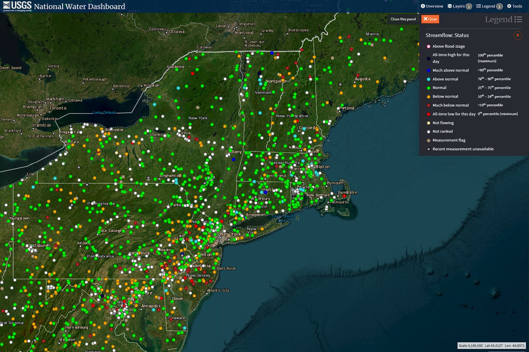
Let's start off by revisiting the water situation because I know many haven't been paying much attention to coverage until now. I'll make this easy, there are likely zero water issues at ski areas. The ponds are full, and runoff and streams are flowing with more to come. This map shows the current status of streamflows across the region and this will look even better by this weekend.
A Changing Weather Pattern
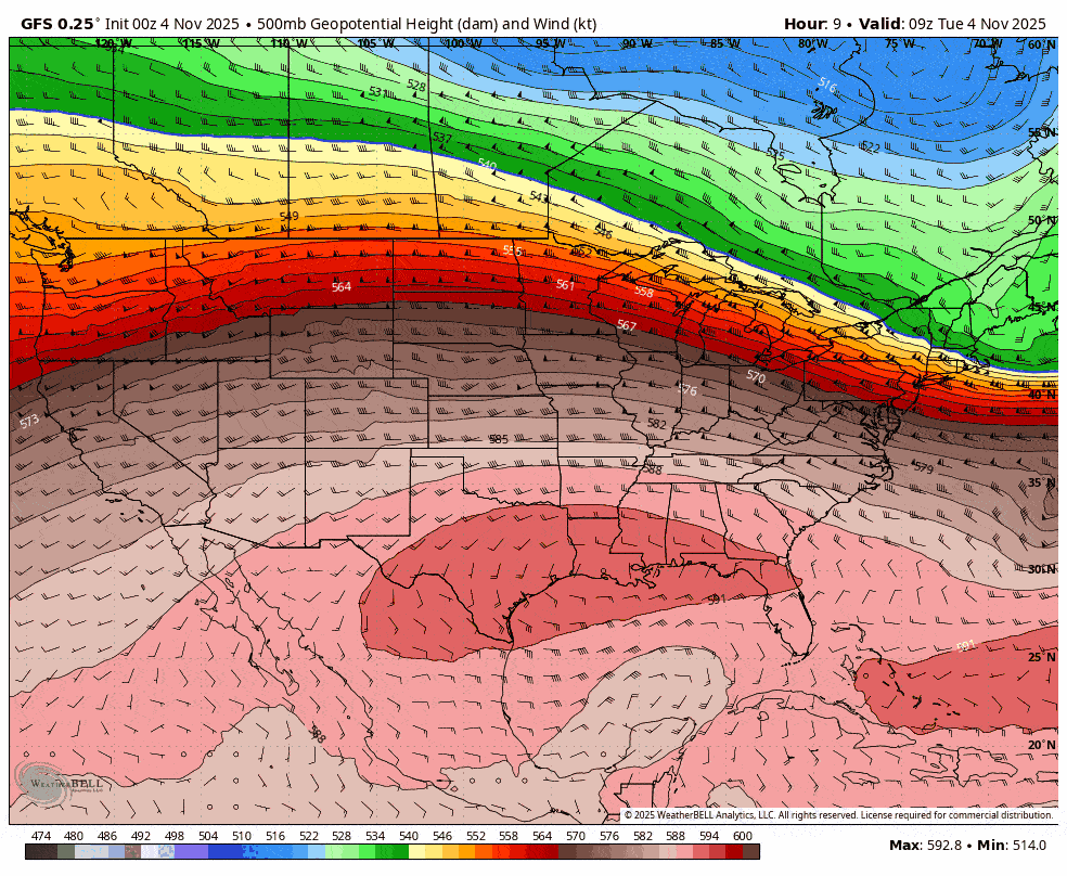
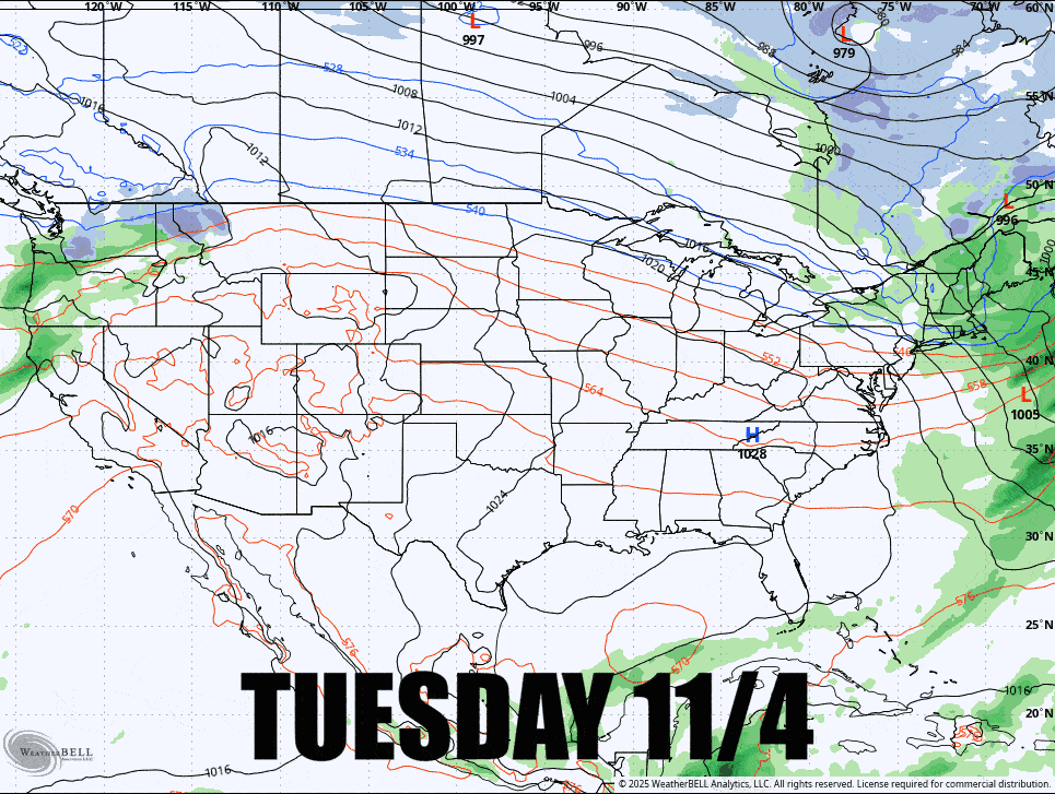
We're going to see a pattern change this weekend. Currently we have a train of fast-moving storms from the WNW, to semi-persistent troughing in the East. I'm going to use the 500 mb pressures to demonstrate this. This is where the primary steering flows are for storms and the Polar Jet Stream tend to be just south of the green areas. This loop covers the next 10 days.
We can also look at the 10 day 500mb pressure anomalies for this same period and there is a clear PNA+ pattern (Pacific–North American teleconnection) with low pressure off the Pacific Coast, ridging over the West, and troughing over the East. This is our favorite pattern!
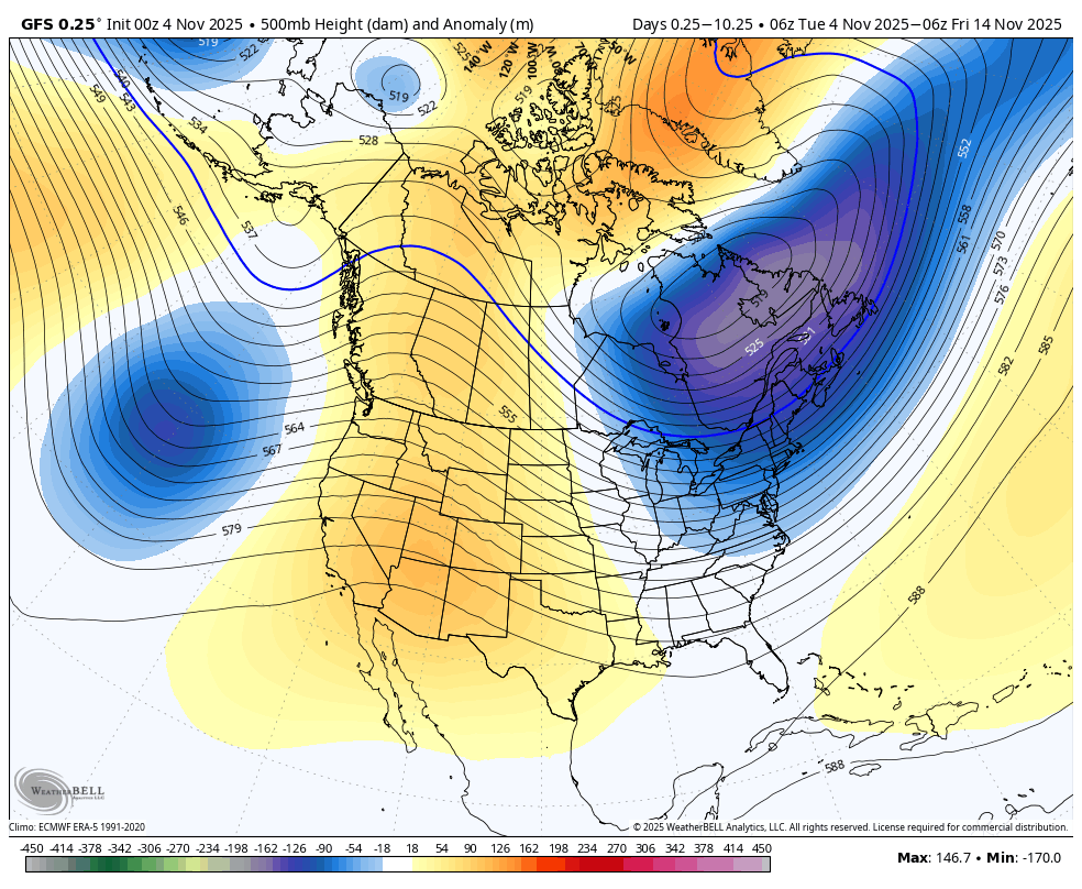
What is missing from this being optimal for the Northeast is the absence of strong low pressure over the Hudson Bay which helps create troughing and cold for us. While GFS is hinting of that starting to form mid-month, there's absolutely zero consensus among longer range models. I do not currently have an opinion on what the last half of the month will bring in terms of temps.
Now let's look at the train of storms according to the GFS over the next 10 days.
There are two storms to pay attention to here. First is the Wednesday evening through Thursday morning clipper that will start as r@!n, but it will end with back end snow and we are likely to see accumulations a little higher than last weekend and it should extend lower in elevation, further south, and we'll see some more notable lake effect snow this time also. There is a snowmaking window in northern areas from Thursday Evening through Friday morning and I do expect a similar number of ski areas to hit it as did last weekend.
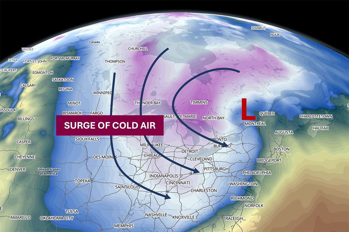
The second storm of note hits somewhere around Sunday-Monday. It looks promising for a dump in the 0z run of the GFS shown below but I'm still expecting this to cut up the St. Lawrence Valley based on both the GFS and ECMWF ensembles though chances of a coastal storm have improved. This will probably bring a swath of 6"-12" on the mountains somewhere between where it is shown to north of the St. Lawrence in Quebec. Regardless of what happens with the track, the extended blast of cold air comes in behind this storm and we need cold more than we need snow.

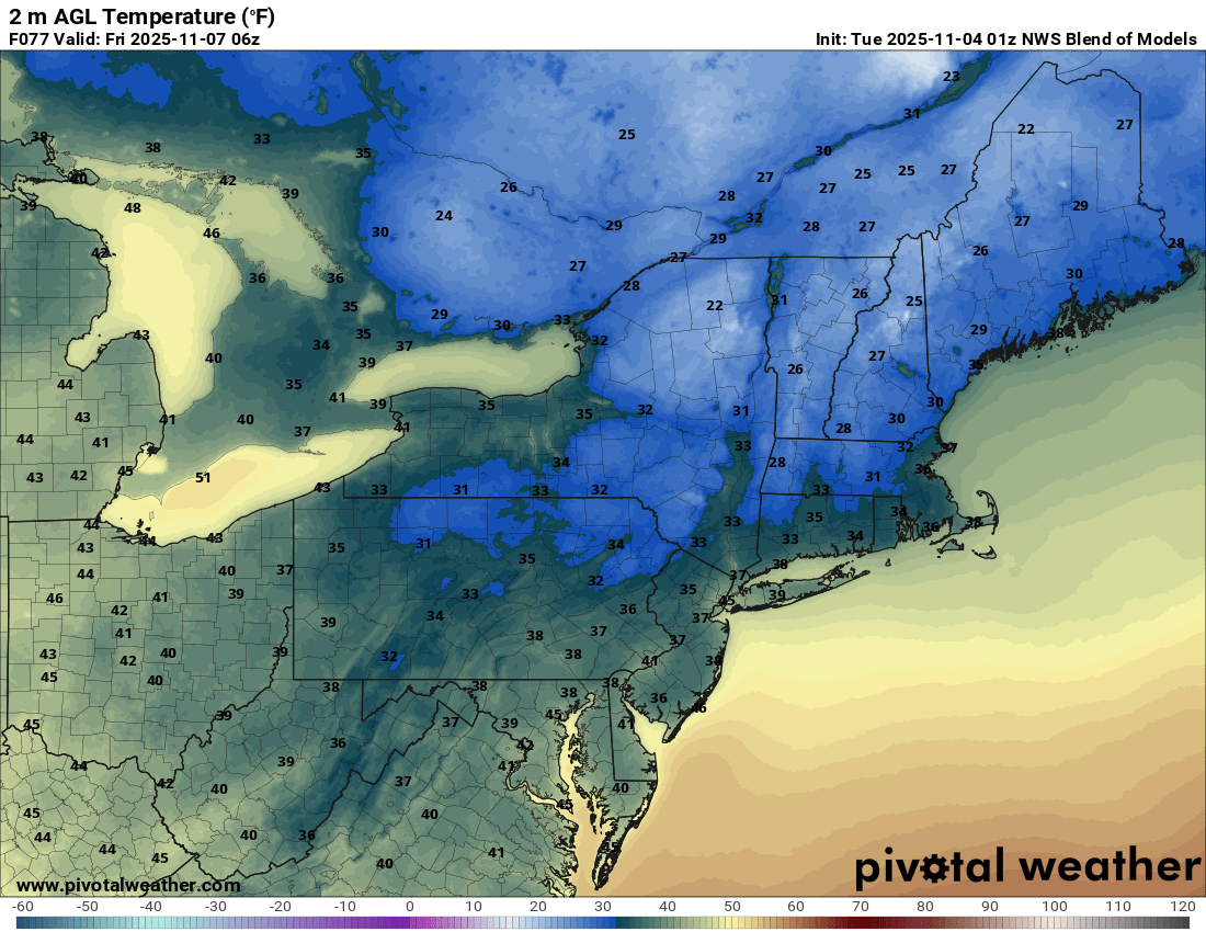
Temperature Trends
The latest GFS did temper the cold a bit from earlier runs, likely due to a weaker and less organized storm which is still an open question, but this flatter presentation is still deep enough and long enough lasting for snowmakers across many parts of the Northeast to get some serious hours in under the guns. Here are the temps every 6 hours from Sunday through Thursday next week according to the National Blend of Models.
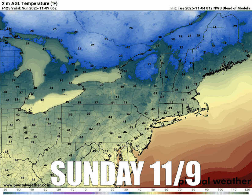
That's a lot of persistent cold for the ADK's, Greens, Whites, and Longfellows that should support some openings by the following Saturday. We're likely to see snowmaking also in the Catskills, at Wachusett, and possibly at Blue Mountain and Seven Springs in PA, but only a handful are likely to open by the 15th.


