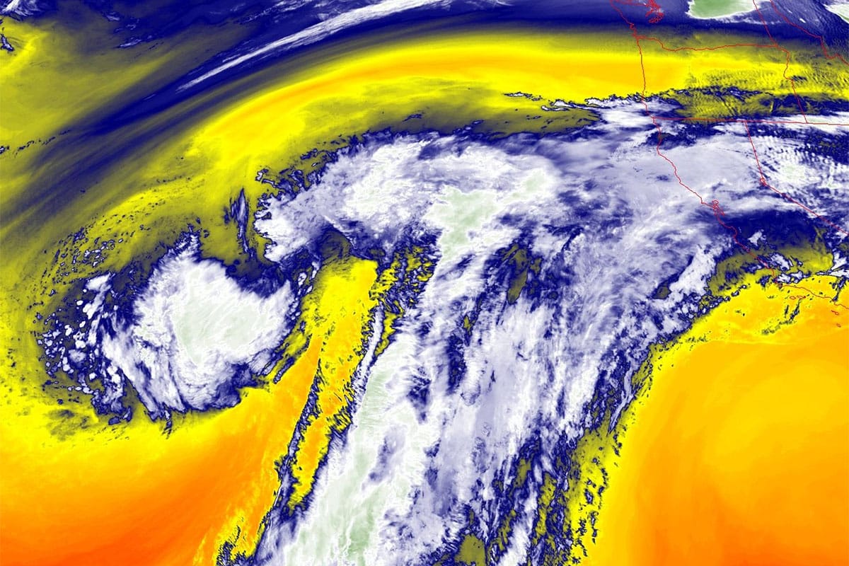

We probably have 3 different shortwaves that are going to pass through the Northeast between Sunday and Wednesday all associated with the same general setup. There is a large upper level low off the coast of California that is embedded in the Subtropical Jet Stream. The loop below shows the jet stream level winds and that upper level low is the circular thing with higher winds both south (the Subtropical Jet) and north (the Polar Jet).
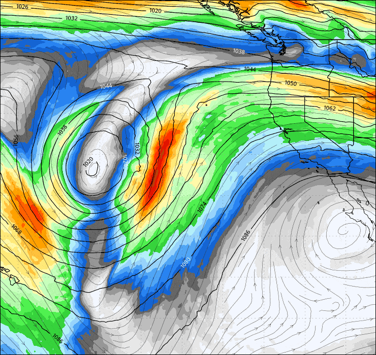
As it approaches the coast of California moisture and energy will be stripped away from it slowly and pushed into a trough in the Polar Jet Stream in the Midwest. There are probably going to be 3 different pulses of varying strengths. Likely none of these pulses has an opportunity to form a true cyclone in the East because there is very little opportunity for a trough tilting negative (leaning towards the southeast) in this setup which is a main ingredient, but these waves can enhance some with interaction with that trough and because these waves are stretched out horizontally and can travel mostly in a straight line, they can produce heavy localized snow in a tight area of less than 200 miles. I tend to call these sliders.
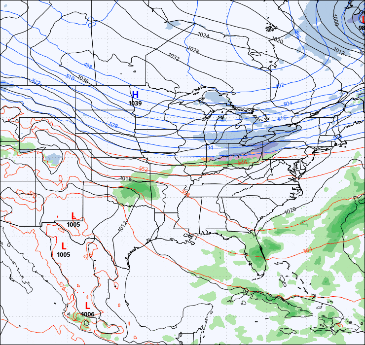
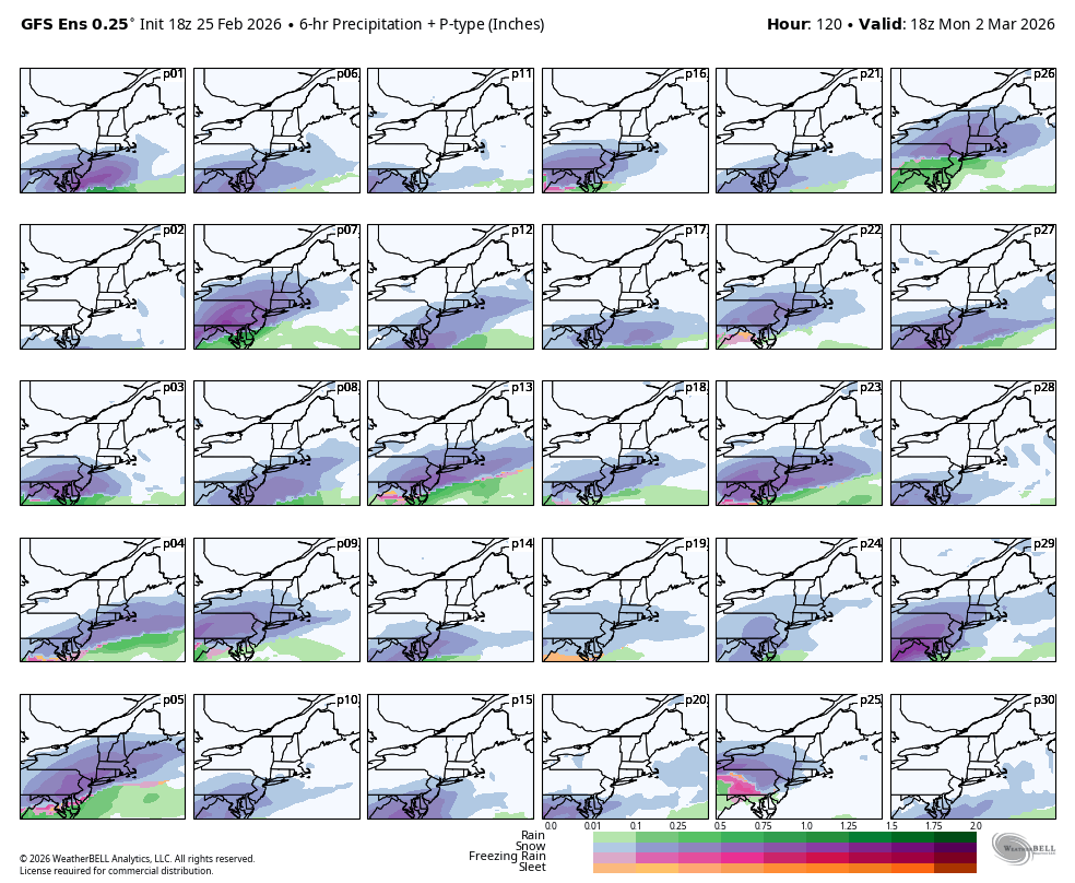
Here's a look at the current GFS modeling for Sunday through Wednesday of next week showing the three pulses. The larger pulse is on Monday though there is a possibility of that getting combined to some extent with the Wednesday pulse.
The ECMWF is having a much harder time with this series of pulses with larger shifts from run to run and just two pulses on Sunday and Tuesday. The sunday pulse seems to have decent agreement on being a light event traversing the region with maybe up to 6" of snow potential.
Focusing in on the Monday pulse as the GFS sees it, the ensembles have been in strong agreement for a couple days now on there being a slider somewhere in the region. This is what the GFS ensembles see for 1PM on Wednesday.
There are of course mets on Facebook cherry picking hot deterministic runs from the GFS and trying to make this out to be a huge storm, but it's in fact likely to be light to moderate in intensity.
At this range I like to use the GFS ensembles at the 75% percentile for snow, which basically means the top 25% of members. This helps correct for averaging the peaks down to give you a better idea of snowfall potential. Currently that is focused though on the Mid-Atlantic but that can definitely shift north or south. Just 18 hours earlier the GFS ensembles were more amped and about 200 miles north in focus. It's likely that the more north this is the more amped it will be because that involves more interaction with the Northeast trough than a southern track. This snowfall map from the GFS ensembles does cover a full week of snow from now through the end of next Wednesday, though it is at 10:1 ratios and lower amounts are still averaged down but this gives a good picture of where the ensemble sees the focus of the potential Monday wave.
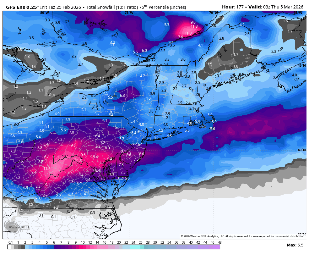
With this Monday wave weakening today and also model disagreement about how many waves there will be, I'm not ready to call this a "Storm Watch", but there is definitely potential of a wave early next week that has 12" potential in some areas and it bears watching.
I'll be sending out a Weekend Outlook on Thursday. The chief concern is the warm up on Saturday with sticky snow potential but in northern areas it may be cold enough above 1,500' to 2,500' to not get sticky in the ADKs, Greens, Whites, and Longfellows, but it will be mank city elsewhere. I'm afraid that by the following weekend models are strongly pointing towards another warm up, and likely even warmer with some r@!n potential so get those turns in! As we start the transition into spring, fresh snow often doesn't last too long before it manks, but crowds also lessen and it is by far my favorite time of the season.
-- Matthew Scott

Comments ()