While the big melt has already taken hold in the Mid-Atlantic we're going to see it progressively move north and in intensity through Wednesday of next week, but we've seen worse in the northern areas for sure. Those maps on the internets that doomcasters are showing for clicks with temps 30F above normal all over much of the Northeast are cherry-picked from a single moment in time while less than 24 hours later you could find temps 10F below normal. They cause so much confusion even among our subscribers so let's address the misinformation once again.
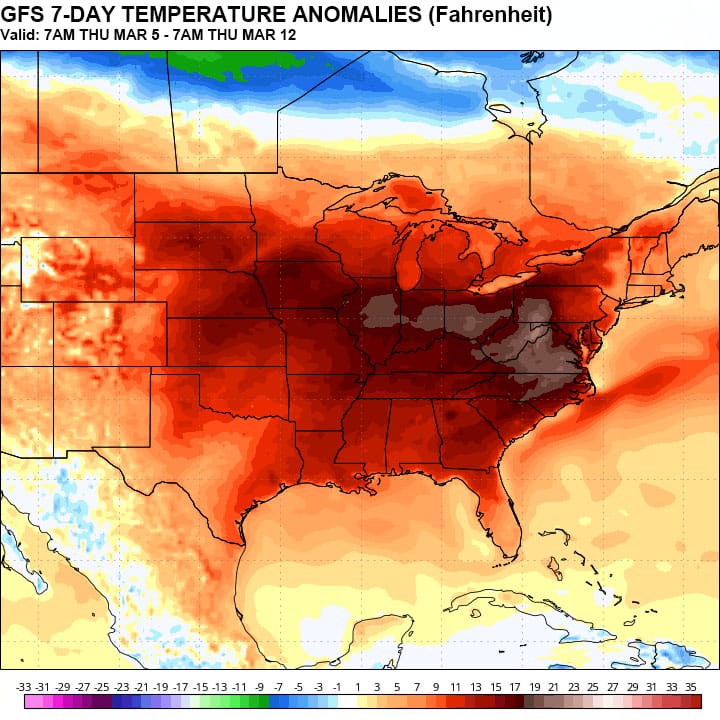
The next week will bring a very notable melt in the western reaches of NY and PA, but it won't be severe elsewhere, and this is an expected part of the transition to spring. Here's what the GFS shows for actual temperature anomalies over the next week, the worst of the warm up.
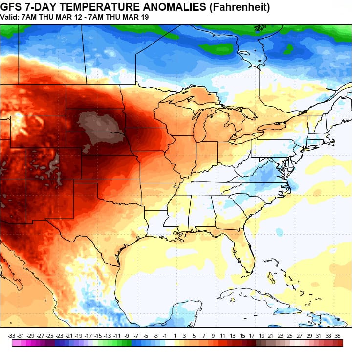
Modeling from 7 to 14 days out though presently shows a return to near average temperatures across the region. Looks like you can keep your golf clubs and mountain bikes in the basement for now.
Oh, and those maps that some doomcasters are showing with all of the snow melting; let me share something that they don't understand or don't care about. Snowpack modeling is universally awful, and especially so on the mountains. They underestimate snowpack and overestimate melt, and not by small margins either. That's why I never use these maps. Much of the water will also get locked back up in the deeper snowpacks and will refreeze next Thursday making it more dense and tolerant to future melts. Snowmaking snow is also much more dense to start and therefore more tolerant. We've had a great winter for snow preservation and there's still a reasonable chance that we could have a great spring despite one week of melting. Storm potential is definitely still there starting a week out and the pattern looks quite active with zonal flow returning.
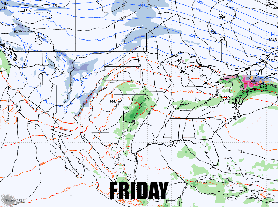
As far as this weekend goes we'll have issues each of the 4 days that I would recommend trying to avoid whether it is caused by freezing r@!n, freezing mist, wind, and temperatures that are too warm and cause slop, but about 3/4 of ski areas should avoid any notable issues every single day also. Let's start with the broad view from the latest GFS for Friday through Monday using 3-hour precipitation intensity.
I'm going to break down the Weekend Outlook with daily forecasts for subscribers focusing on the precipitation, wind, and temperatures. I will start though with a quick note about predicting sticky and sloppy snow so that you know what to expect as things warm based on the temperature forecast.


