
I know what some may be thinking...big deal, we're here for the pow, but every East Coast skier and rider is faced with mixed precipitation on the mountains from time to time and it matters a lot if that falls as sleet or freezing r@in, and no major weather resource has this capability.
Weather.com reports sleet and freezing r@!n together as mixed precip. Accuweather is the same. That weather app that comes with your phone likely does that too if at all. In the ski weather app world Mountain-Forecast/Snow-Forecast and OnTheSnow all only support snow and r@!n while OpenSnow lumps it together as mixed precipitation. Even the NWS doesn't forecast sleet separately from snow, and freezing rain is forecasted as ice accretion and not the liquid amounts. We really are the only ones who are doing this for ski weather, and we're doing it probably as accurately as it can be done.
Individual weather models do mostly support sleet and freezing r@!n separately but they use simplified methods and are not compatible with one another and no one else is taking model blends and then separating this out...and that says something about our capabilities. When I say that Snowology has the most accurate automated precipitation forecasting in the ski weather world, I am confident that is true overall, and we're not even close to finishing honing in our system.
How Did We Do This?
We've been planning our automated weather system for years and had many false starts and setbacks as weather automation is quite the undertaking. When we finally got moving in earnest last fall we had the benefit of much more mature AI programming tools and our team of programmers all use AI to create and manage our code. We're not talking about the slop you see across social media with content farms using AI to write articles about skiing or the meteorologists online who have ChatGPT create them summary graphics with questionable figures and likely from copyrighted resources. That's not Snowology, that's a lazy use of AI and it is absolute slop, though I do think the AI generated images of Ullr that we have used to announce the Powculator are cute and I'll probably keep using them for these announcements. And yes, I do have many misgivings about AI, some of those behind it, and the challenges it presents for society, but this is how best to do programming and we're not going to protest responsible uses of the technology while failing to deliver what we are capable of.
When it comes to data processing Snowology now often moves from an idea to production code in just 24 hours, though this change took about 60 hours from start to finish due to the complexity of the task, but only about 6 hours of labor from Cole and Luis aside from my own. People like Mark Zuckerberg have been saying that within 18 months almost all code will be written with the help of AI and corporate surveys suggest about 20% is already, but Snowology's programmers have been coding almost everything with AI tools already for 6 months despite being expert programmers on their own with decades of experience. I'm now also creating tested proof of concept code for more difficult transformational tasks that I can hand off to the programmers to integrate instead of documenting precisely what the code should do, helping the programmers understand the task at hand, and then reviewing the results after every change. This allows me to fine tune techniques in minutes rather than days or weeks of back and forth. We can test on live data what these methods produce and review the results across all of the ski resorts we track and make decisions in near-real time. We're ahead of the curve and what we are doing with so few resources continually amazes me. We're at the stage now where we are leapfrogging the competition and doing even more things that no one else does.
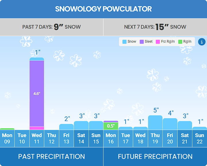
In version 3 of our automated forecasting system (we only launched 2 months ago) we're not just simply identifying sleet, this new system types all 4 major forms of precipitation using data transformations and physics. We are also calculating the loft of the sleet similar to snow (Snow Water Equivalent, aka SWE). Yes, sleet comes more and less dense just like snow. We're probably the only forecasting service in the world doing that at this time, but there are very few who support sleet at all outside of single models (which aren't good enough to be used as forecasts).
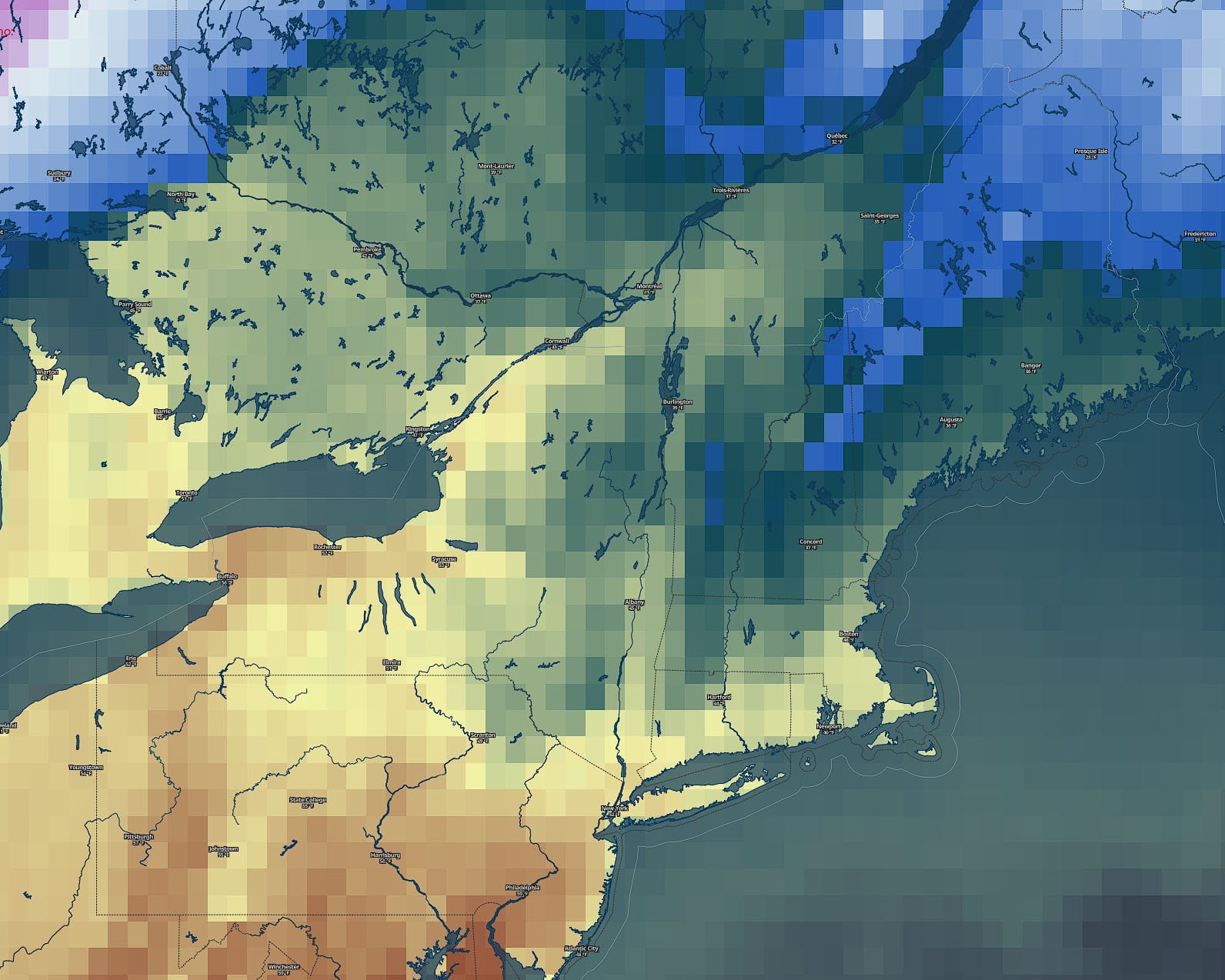
One of the biggest problems with weather modeling is the resolution of the data. The best resolutions that models support are 2.3 square miles in the short range, but for medium range models this goes up to about 2,000 square miles in some cases. Medium range models also lack resolution in the atmosphere for temperatures by height with +4,000' gaps between sample points and that creates big issues for detecting precipitation types accurately. Here's what the modeled temperatures look like from the ECMWF showing the raw forecast grid sizes, and this medium range model is actually higher in resolution than the GFS.
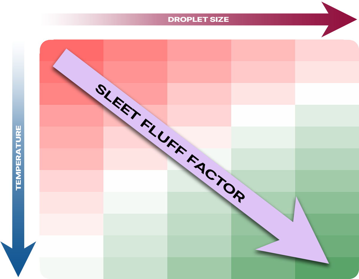
Sleet forms when there is a 'warm nose' generally somewhere between 3,000' and 10,000' above the ground where strong wind is pushing warm air up an over the pocket of cold air closer to the ground. When the snow passes through this region of above freezing temperatures the snowflakes melt into r@in, and then whether they fall as sleet, freezing rain, and rain depends on the physics of those droplets refreezing before the hit the ground as well as the ground temperatures.
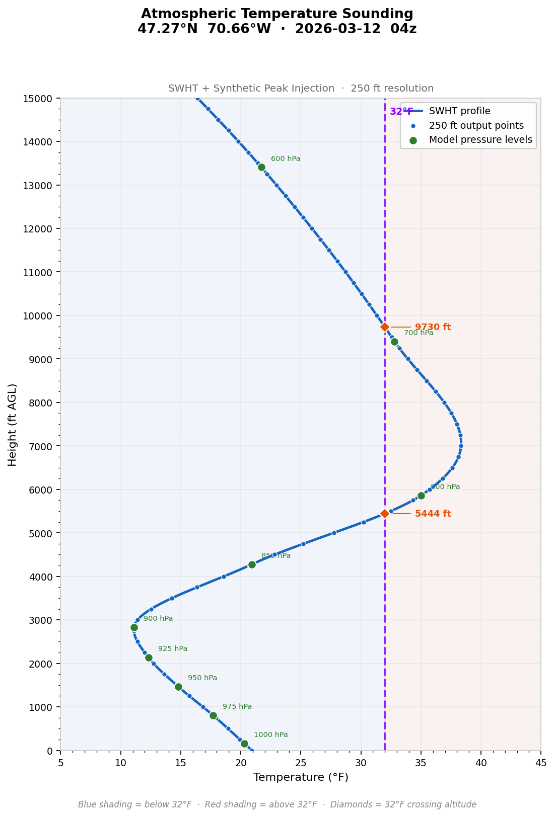
All point forecasting (like our forecasts for base and summit temperatures) needs to interpolate or downscale this data through transformations. We were able to create a custom transformation that handles modeling inversions and atmospheric lapse rates in general much more accurately. In the example below which is built from real data from the GFS for this last storm for a point over Le Massif, our downscaling transformations allowed us to accurately detect sleet for 3 additional hours out of 8 vs when using the standard methods.
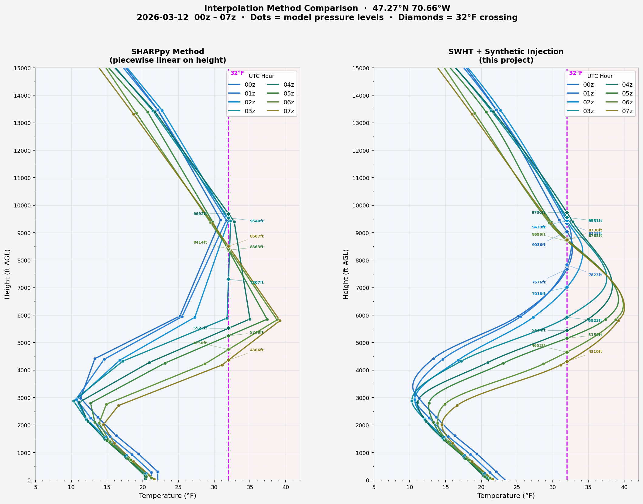
You might think that AI created all of this, but doing things with AI that you don't know anything about will get you burned. In reality I tried multiple standard methods that would create the curves between points while adjusting the methods, but in the end I created an additional layer to inject synthetic points before reprocessing a second time so that we could get sharper inversions which are even closer to reality. We may be the only ones doing something like this to this degree of accuracy with lower resolution atmospheric data.
This level of precision allows us to calculate the temperature and size of the droplets and the thickness and temperature profile of the freezing layer below the inversion more precisely so that we can then apply physics calculations to determine if the droplets will refreeze into sleet before hitting the ground and what the loft of the sleet is, or if it fails to refreeze and falls as freezing r@in instead or r@!n if the surface is above freezing. We couldn't do this nearly as accurately using the more basic linear interpolations that we were using which is why we waited until we had this problem figured out. Compared to our previous methods we found these new transformations added up to 5F at the peak of the inversion and changed the height of the peak temperatures by over 2,000' in some cases, and that matters a ton when it comes to accuracy. Reliable higher resolution modeling data is really only available out to 48 hours, so this greatly extends our accuracy window.
We are storing this data in 250' resolution so that it can also be used in other forms of modeling such as surface temperatures. When we update our temperature forecasting we will also be applying additional physics with the terrain data to determine sun exposure, cold air pooling, and other elements so that we can achieve much better accuracy than any other ski weather resource for any point across every ski area we cover. That level of detail might not matter for skiers and riders, but it does matter for snowmaking and even grooming, and we want to build a product that can't be beat. I know that pretty graphics sells apps better than accuracy, but as a small fish in a big pond our cornerstone will always be accuracy and doing things that no one else is capable of doing.
One more very unique thing about Snowology vs the others is that our forecasting system is point based rather than grid based (whole map). This means that we can make adjustments specific to mountainous environments and apply different transformations in certain circumstances all the way down to a single ski area rather than making modifications that affect every piece of land. This gives us significantly more flexibility and allows us to do more involved transformations.
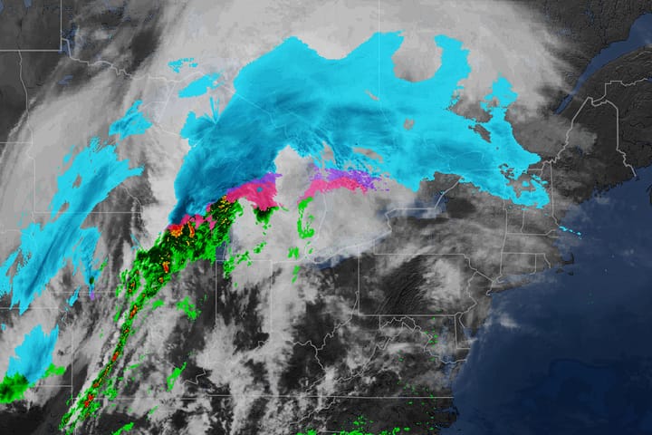
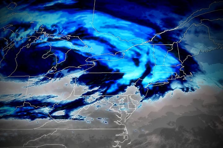
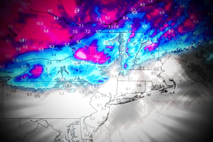
We still have a lot to do before next season starts, and yes, we're still working on our app launch, favorites, and comparison tools which I know our subscribers are very much looking forward to having, but the massive sleet and freezing r@!n storm in Quebec last week gave us an opportunity to roll out these new methods and test, and I'm happy to report that it passed with flying colors in forecasting both sleet and freezing r@!n and it is now in production for everyone to benefit from.
Much, much more to come!
-- Matthew Scott
Comments ()