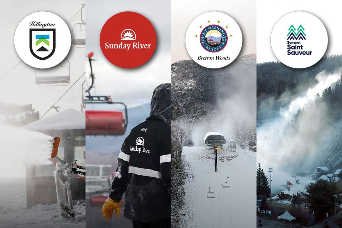
As of Noon today the race has already been won by Sommet Saint Sauveur who announce this morning that they will open until 9PM with both day and night skiing after just 30 hours of snowmaking. This is the 2nd time in 3 years that they have claimed the title of First to Open in the East and they were also last to close the prior season when they edged out Jay Peak by 8 days as Killington shifted to different terrain due to the Superstar lift replacement.
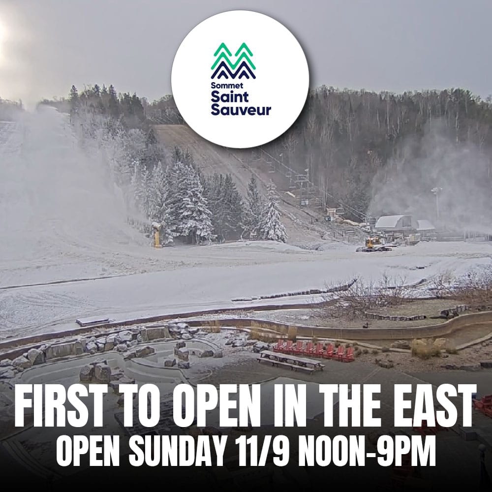
I will admit that I didn't see them opening until Tuesday at the earliest but I was looking at the webcams this morning and spotted the groomer moving snow and knew something was up. Sommet Saint-Sauveur has the advantage of grassy slopes that are lower in pitch than their competitors' opening terrain which allows them to open with less cover, and their location just northwest of Montreal can give them an advantage in temperatures at times despite their lower elevation when systems like the one we are seeing cut the region bringing warmth to the Northeast while it is cold in the Laurentides of Quebec.
I should also mention that while Ski Ward in Massachusetts opened for two days on October 18th and 19th and then again this weekend using their Latitude 90 snowmaking system capable of making snow above freezing, but they have not yet opened for the season and the terrain is just a 300' long by 30' wide swath off of a magic carpet. We consider Ski Ward to be first to offer lift-serviced skiing and riding, but not first to open for the season due to the sporadic operations and very limited terrain.
I'll cover the weather this week and then jump into my predictions for who will open and when.
The Week Ahead in Precipitation
The Northeast is currently in a snowmaking lull as a cutter tracks up the St. Lawrence Valley, though this will bring snow north of the St. Lawrence on the front end and up to 1" of r@!n to northern Northeast resorts, but come Monday the winds will shift behind the storm as a deep trough engulfs the region bringing a prolonged lake effect and upsloping event. We'll start off with the wide view covering the entire week.
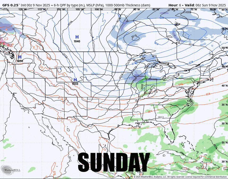
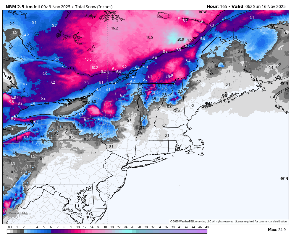
As far as the current storm goes here's the modeled snowfall from the National Blend of Models (NBM) through Monday.
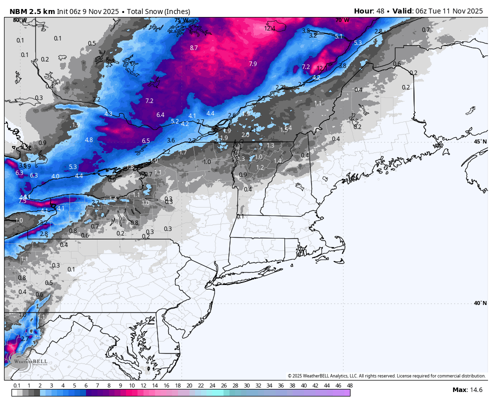
This storm has put a literal damper on the high elevation pow party in the northern parts of the Northeast but things will fill back in during the week and between Tuesday and Saturday we should see over a foot of snow in parts of the ADK's and Northern Greens, and possibly more than 6" in the Northern Whites, W-NY, and C-NY. This snowfall map from the NBM covering the entire week does tend to underestimate lake effect snow somewhat and upsloping snow a bit more, so consider this to be on the low side of possibilities on the mountains. If you are looking to score some turns in the Northern Greens it looks like Thursday is when things start to get good again.
The Week Ahead in Temperatures
Here's a loop showing the temperatures at 4 times every day through Saturday. Well start seeing freezing temps return to the early openers late on Monday.
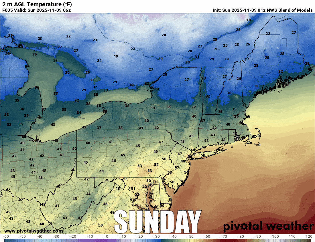
This does look better than our last update as far as the cold goes. There is a small warm up on Wednesday night that will interrupt some snowmaking, but otherwise there are opportunities at the early openers for most of the week starting Monday afternoon.
Snowmaking will primarily occur at ski areas in the ADKs, Catskills, Greens, Whites, and Longfellows of Maine. We will also likely see the snowguns fire at Wachusett, and possibly at Berkshire East, Jiminy Peak, Holiday Valley, Green Peak, and Seven Springs. I don't think there are enough cold temps to start making snow in NE-PA though they will probably fire up just to please the masses.
I have looked into the following week as well but right now modeling is not consistent enough and the patterns are borderline enough that I really can't say how much snowmaking opportunity will exist after next weekend. My estimate would be somewhere from very limited to somewhat limited snowmaking opportunity as there are no troughs currently modeled to come our way.


