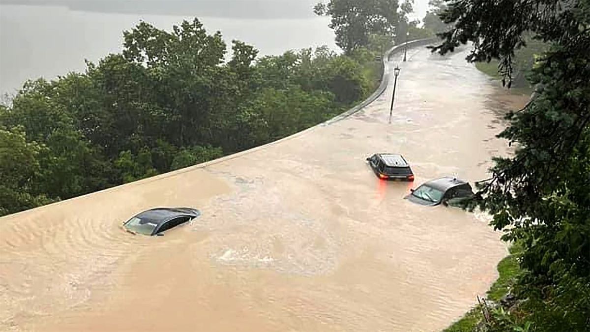

Slow moving moderate to heavy rain has dropped over 9" on some parts of New York causing notable flooding last night in the lower Hudson Valley. As of this morning widespread flooding is now also being seen in Vermont where VTDigger is reporting that 19 people had to be evacuated from their homes by boat this morning. Other flooding issues were also seen in parts of Pennsylvania, New Jersey, Connecticut, and Massachusetts. Rainfall totals from Saturday through 2 p.m. on Monday are shown here:
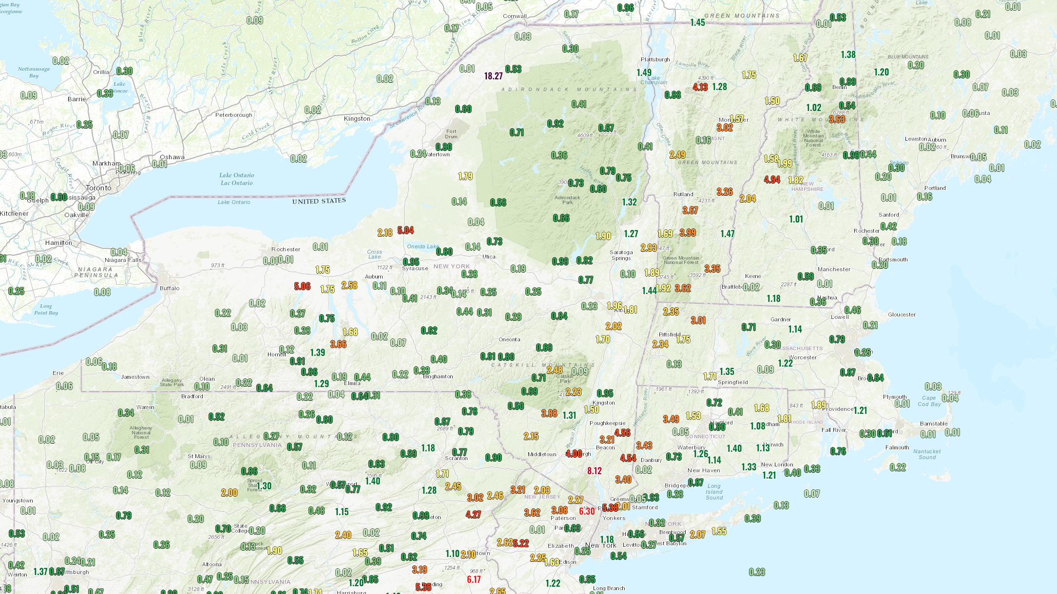
These rainfall totals mostly come from the valleys, however upsloping into the mountains will enhance the rain by 50% or more in many cases, so we have already likely seen over 5" of rain on parts of the Greens with more to come tonight. This simulated radar loop comes from the NAM3K and covers noon Monday through noon on Tuesday.
There has already been flooding near Killington, Magic Mountain, and Okemo which is shown below. We have not yet heard of serious issues at the resorts, but there has been some damage and it will take them time to inspect and repair. The surrounding communities are taking the brunt of this however with the small rivers running along the Greens flooding into streets, businesses, and homes. This video shows the scene in the center of Ludlow where there was a mudslide that moved down from near the Okemo access road, and the Black River also overran its banks. Flood waters in this area may not crest until after midnight.
Video of Ludlow provided by Ian Nugent
Magic Mountain in nearby Londonderry, VT shared the following update this morning showing the impacts on the town. While there was at least some minor damage at Magic they have yet to fully assess the impacts.
Our hometown 🥲
— Magic Mountain (@SkiMagicVT) July 10, 2023
While there is damage up at the mtn that we haven’t fully assessed, the new snowmaking dam is performing well. Unfortunately, more rain today…road closures all around so don’t venture out in the Londonderry/Weston area. 🙏
📷 R. McDonough, P. Maitland pic.twitter.com/reBd1gw4TJ
Tonight the focus will be on Northern Vermont and mountain communities in New Hampshire. NWS forecasts through Tuesday at noon are predicting up to 4 more inches of rain on top of mountains that in some cases have already seen that much fall, and this will surely create more flooding issues and probably some landslides also. Presently there are road closures on multiple highways all over Vermont near the Green Mountains. Non-emergency travel should be avoided in these areas until conditions improve, and it is important to share that one should never drive through water covering the roads as this is frequently what causes people to need to be rescued along with the likely damage to vehicles and the possibility of worse.


Comments ()