This update is primarily meant to dial in the next day a bit more. The heaviest snow will depart by the early morning on Monday giving a potential window to make a journey out but the roads will be far from perfect in NY and New England by daybreak.
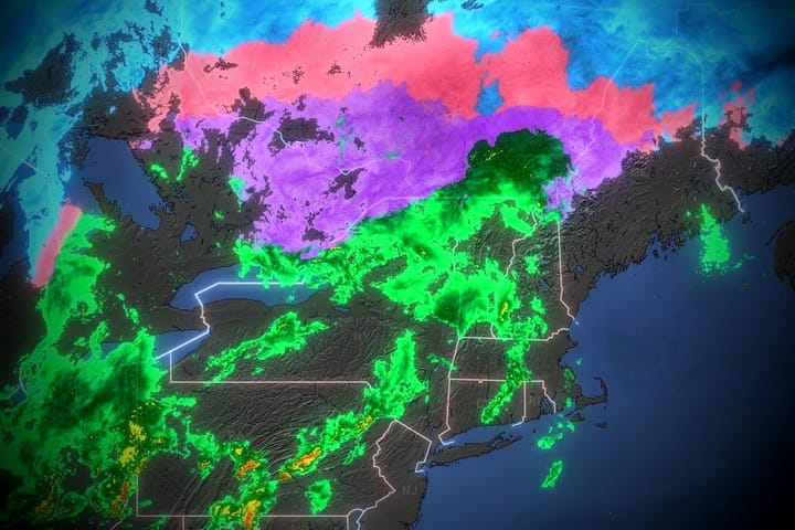
This is what the radar looks like on our website at 7PM this evening. Lots of heavy snow falling at rates of 1-2 inches per hour especially in Southern New England presently, but that will shift north and east through the early morning.
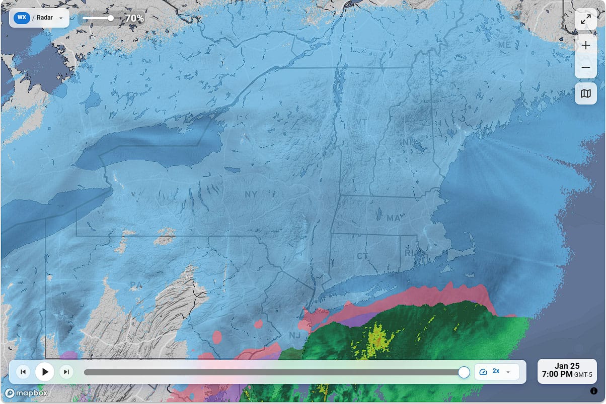
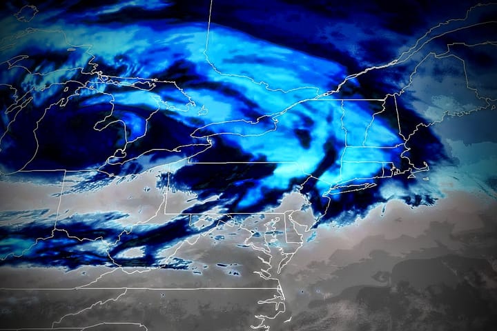
Note that our radar is not paywalled and it is the most accurate radar there is for precipitation types though in a storm like this with warm air moving up and over the cold air it can be less accurate than in an elevation type storm where the warm air advances primarily at the ground level.
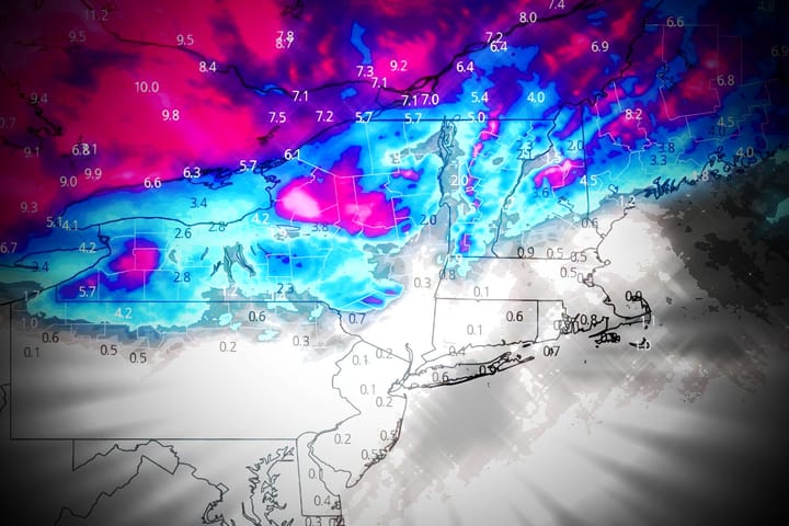
I'm going to go over the Snowfall Forecast one last time with updates to the simulated radar, travel guidance, and updated snowfall forecasts across the region including what has already fallen. While wind will pick up at times, I still don't see any notable impacts to lifts during the ski day through Tuesday.