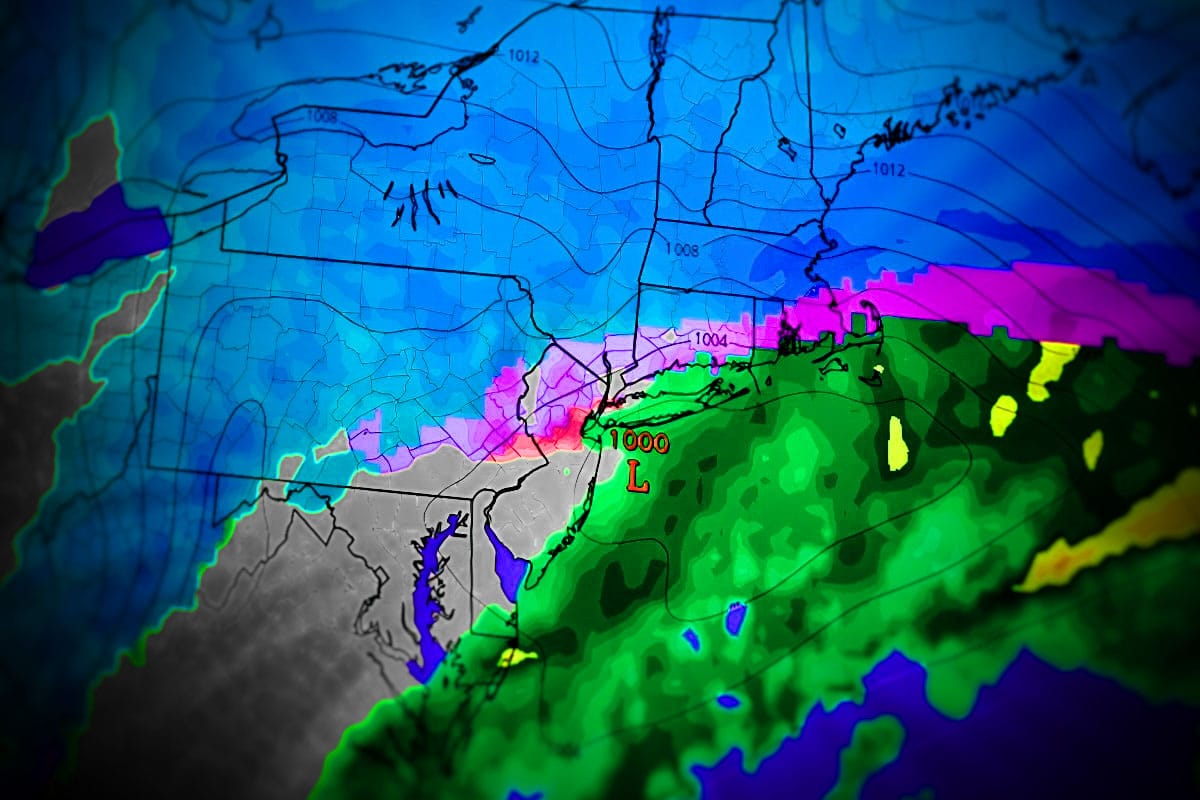
We've got some better model agreement this evening and we are about 26 hours out from the impacts starting in Pennsylvania and 82 hours from when the snow should be tapering off in New England. We'll start with the broad view of the storm from the GFS.
There have been shifts in the GFS and the ECMWF. I would say that this was roughly about a 2/3 blend of the GFS and 1/3 of the ECMWF in terms of the changes. The GFS is seeing two secondary lows develop, one off the coast and another weaker one in the Smoky Mountains before it jumps the energy to the coast. The ECMWF has pulled back from the western low tracking up into WV and keeps it dominant in the Smokys before sending the energy to the secondary on the coast a bit further north. These are the two tracks as they roughly sit in 18z modeling.
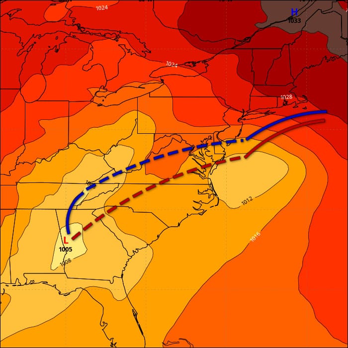
The net effect has been to reduce some of the snow as a result of less snow in the ECMWF and more snow in the GFS, maybe roughly a 10% to 20% reduction in general as an average between the two models.
I'm going to cover the storm primarily in a Snowfall Forecast focused on snowfall, timing and the Powculator. I will then cover the Travel Forecast, and I do have some minor wind hold concerns that will be addressed in the Wind Hold Forecast also. This is being sent out to subscribers on Saturday evening and will be shared on social media early on Saturday morning.


