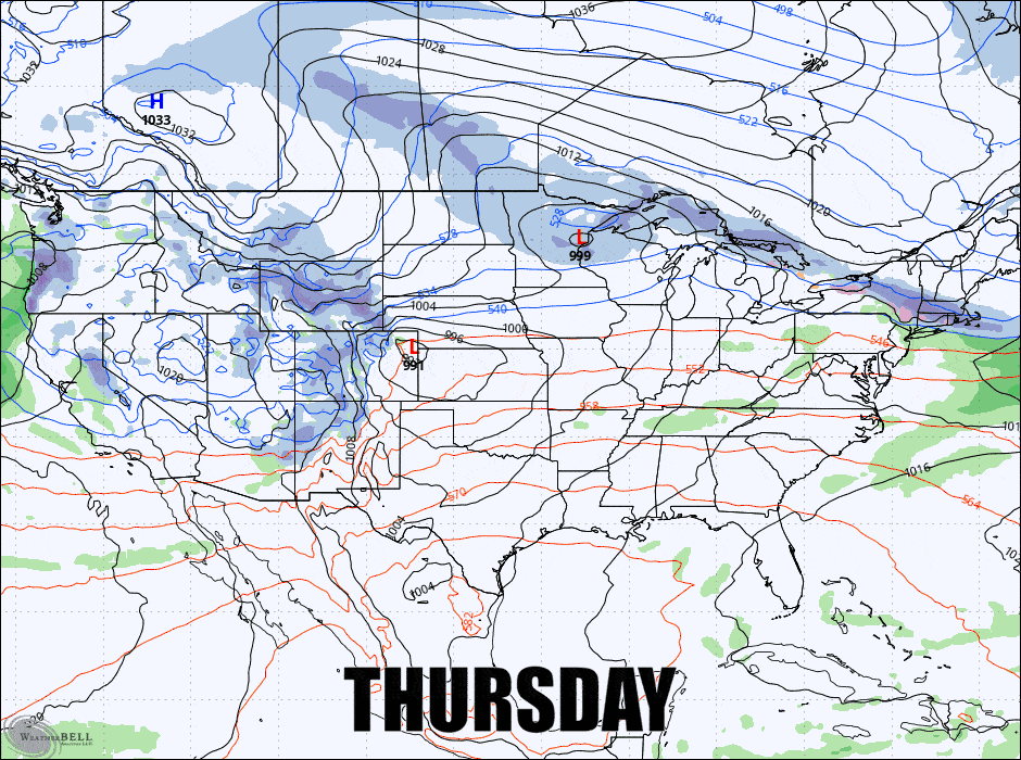
Wednesday's little system is just a tease or even a disappointment if you are south of the line, but you need to get ready for another storm and maybe two before the weekend is done. I'll start digging into the Friday-Saturday storm with this update but I'm going to start with a Storm Watch for the Monday-Tuesday system that is looking promising. Here's the GFS from Thursday through Tuesday to start this off.
Now I have to warn you, while the GFS and the GEM models see a sizeable nor'easter forming on Sunday that doesn't mean it will track close enough to the coast to throw snow far inland and the ECMWF sees a weaker storm and mostly out to sea at this moment. I like what I am seeing in modeling, but I would like it to hug the coast more.
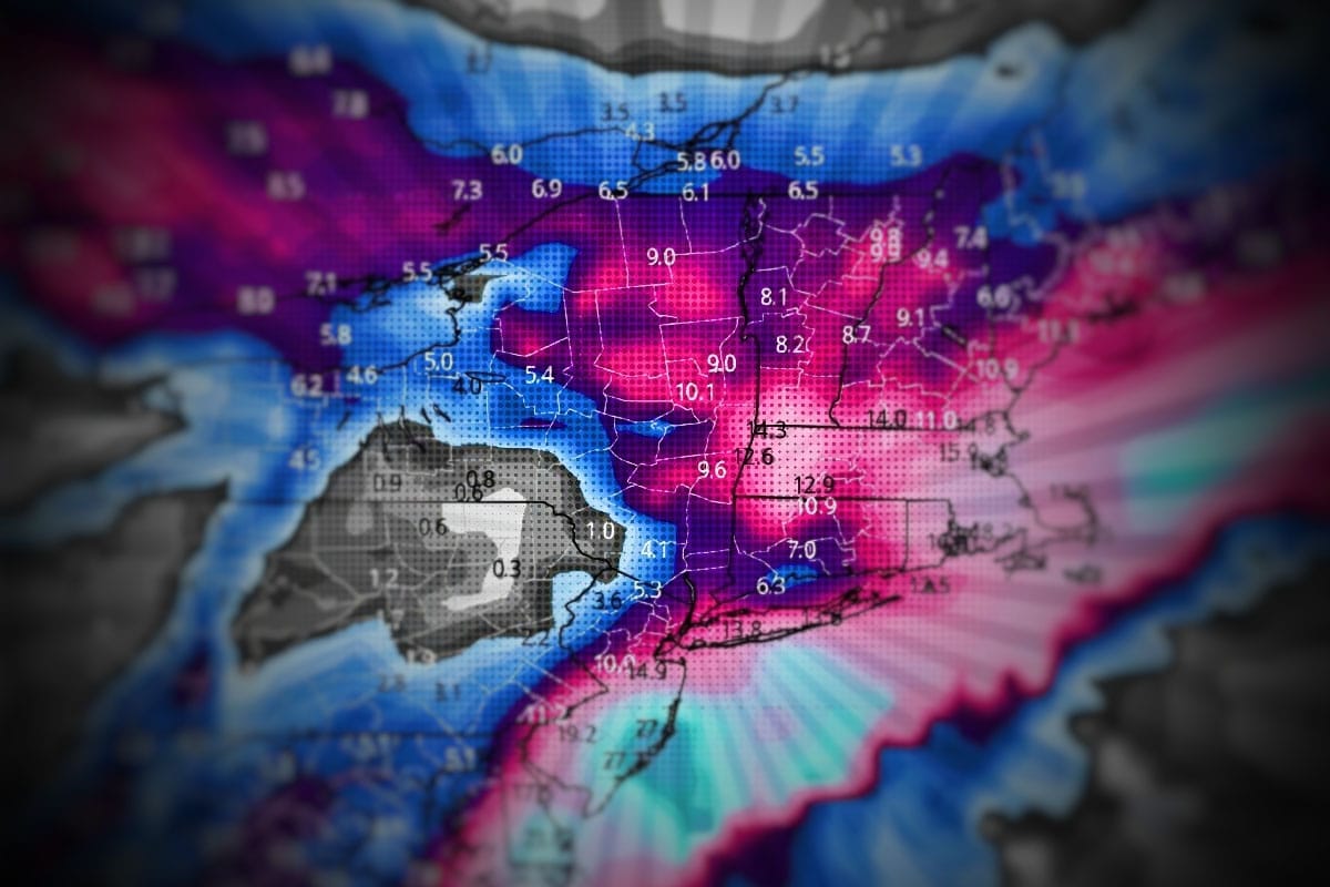
I also like this next storm starting Friday. It's not too big and not too small, meaning that driving won't be atrocious to start the tail end of the holiday (not great either of course), and plenty enough snow to make almost everyone happy as long as they are north of that boundary where it mixes to the south and stays all snow to the north. It will have a focus in the ADK's and Northern New England and maybe Massachusetts also, and modeling suggests totals topping out somewhere around 8"-12" (I favor higher). From now through Monday I'm also seeing widespread totals of 12"-18" across parts of NY, MA, VT, NH, and ME in the Powculator. It doesn't come all at once, but that's a solid showing from 3 systems this week even if we miss the brunt of the Sunday-Monday storm.
So let's get down to business starting with that Storm Watch and then the Storm Update!
Storm Watch: Sun-Mon 2/22-23
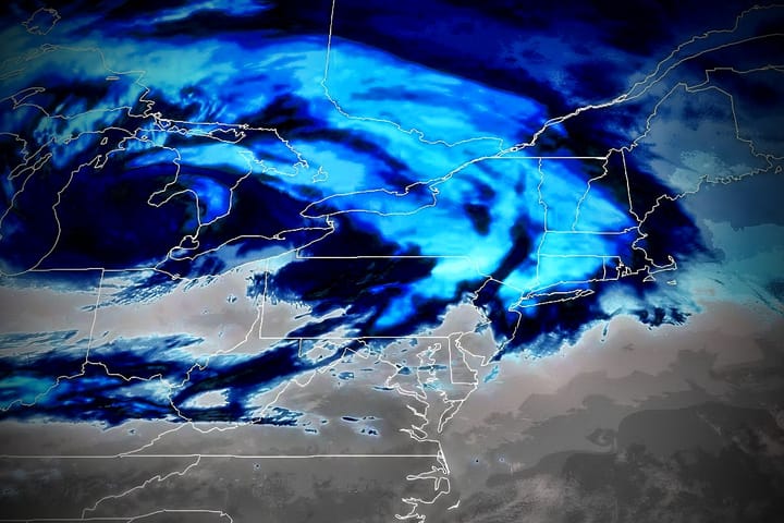
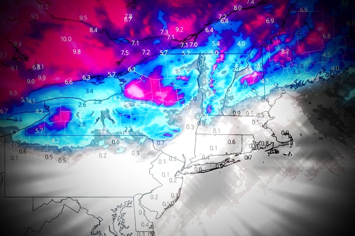
We'll start with a quick Storm Watch before we dig into the more guaranteed action. I believe there is about a 70% chance of a rapidly intensifying storm forming somewhere near the Outer Banks of North Carolina and tracking northeast into our region. We're talking a drop of 35mb in a 24 hour period which is technically bombing out and then some, but there is a but... Modeling generally is keeping this storm far enough offshore that it might not have far reaching impacts. Let's jump straight into the deterministic modeling from the big three showing 10AM on Monday:
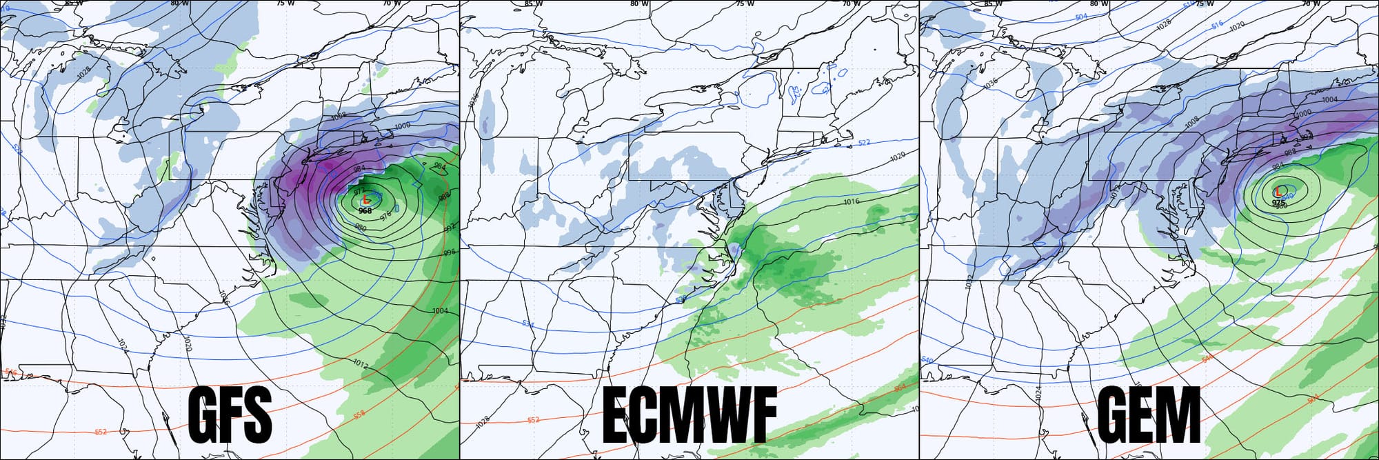
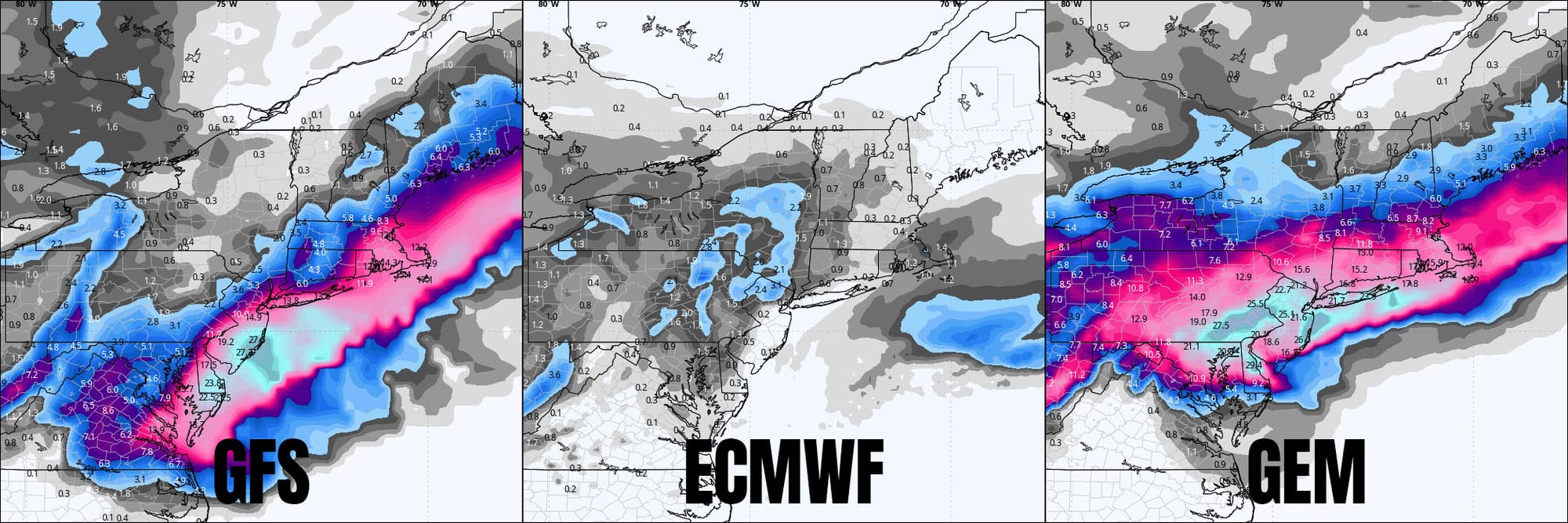
I've dug around in the vorticity maps (roughly storm energy in the mid levels of the atmosphere) and the reason why the ECMWF is showing a miss is due to subtle changes in how this is modeled, and it may be related to the Friday-Saturday storm as the ECMWF is still leaving a bigger chunk of energy up in the Great Lakes while other models see most of that energy siphoned off to the coastal low from that storm. Needless to say, the storm can still break 5 days out. The ECMWF ensembles though show almost the same level of support as the GFS so the ECMWF could flip any run now and go full bore but so could the GFS. The GEM (Canadian model) plays very little in my judgement but right now the beer goggles are looking mighty fine. Here are the snowfall maps covering all of Sunday and Monday:
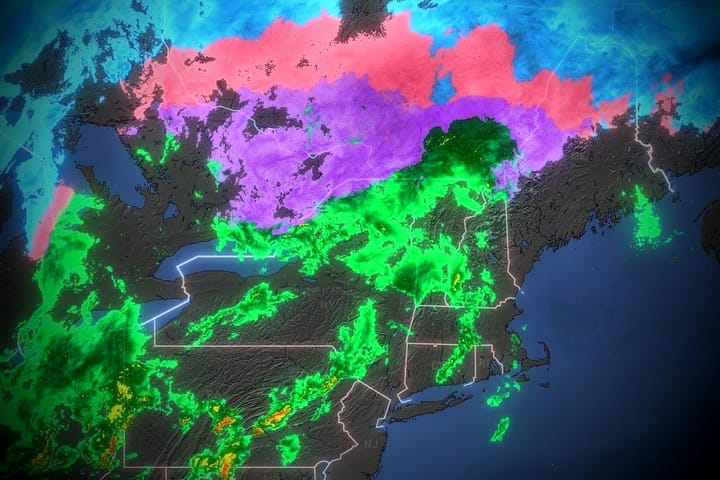
What matters the most is if, when, and where a trough tilts negatively and amps up a low and then where it tracks, but there's no sense at this distance in pretending that I know exactly where it goes. Even ensemble averages will shift notably from run to run at this distance so we'll just give it a bit more time. Modeling is widely suggesting that practically everything that falls from the sky will be snow with this one through the entire Northeast. Things would have to shift notably for that to change given the setup.
I'll keep you updated on this and I will start full Storm Updates probably on Friday so as to not cause confusion with the next storm. If there are wind issues with this storm it would likely be Monday near the coast and possibly Tuesday on the back end, probably mainly in the Longfellows if so.