Now I know that everyone loves Snowology in large part because of the snow, but if you are going to be out skiing or riding this weekend then our insight can be even more valuable with the incoming r@!n on Friday, the flash freeze that follows, and the wind through Saturday. That doesn't mean that you shouldn't go, rather it means you should pick your time and place carefully, prepare for the conditions, and set your expectations appropriately in order to maximize your enjoyment. Snowology is way more than a weather app, it's a guide to Northeast skiing and riding that merges the weather with the what to expect as far as conditions and operations goes.
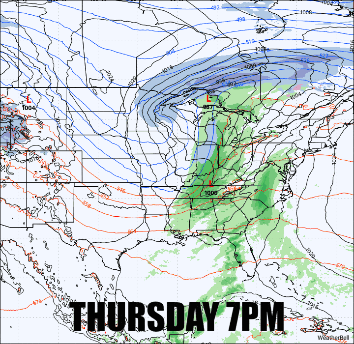
We may have been a little spoiled by the last season and so far this season with the lack of cutters, but they are generally a part of our winter cornucopia. This is just a moderate event as these go, with about 1"-1.5" of r@!n expected on many of the taller mountains. Here's a look at the ECMWF showing 3-hour precipitation intensity (radar won't feature such broad swaths of r@!n and snow) from Thursday evening through Saturday morning.
This storm is pretty well dialed in already with the exception of the finer points which will come into view in future daily updates. I'll cover the Precipitation Forecast and then the Wind Hold Forecast but I'm going to start with a written Storm Overview to set things up.


