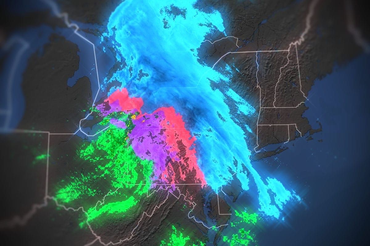
The storm has already started and should go strong until early Saturday morning when it slowly starts to taper off through noon in the NYC Metro area. I've got one last update to dial the forecast in a bit though the previous forecast was mostly on point. I'm mainly pushing the focus of snow a little more north in this one and expanding the reach of the snow a bit. Here's a timestamped simulated radar for everyone before I jump into the details.
Use this for timing of precipitation types and intensity for planning your travel as it should be within 1 hour of the major impacts though the light stuff on the tail end is going to be more variable. Delays from accidents and even road closures are likely especially in PA and NJ through sometime in the AM. Sleet is the worse precipitation type to drive in as it works to keep your tires from contacting the road and providing something to grip on.
I'll once again lump everything into a Storm Forecast covering all of the precipitation types but significant detail about the dynamics of this system started with Update #1 and then was dialed into in Update #2 and I don't like to rehash things that don't change in order to keep things shorter.


