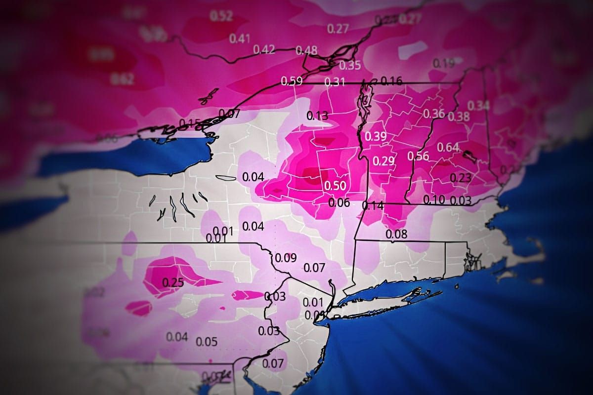
And just like that we get our second pretty good dump in a matter of days and now we're looking down the barrel of a powerful cutter coming right at us with its warm side smack dab in the middle of the holiday. So here's what that looks like from the latest GFS covering Sunday and Monday.
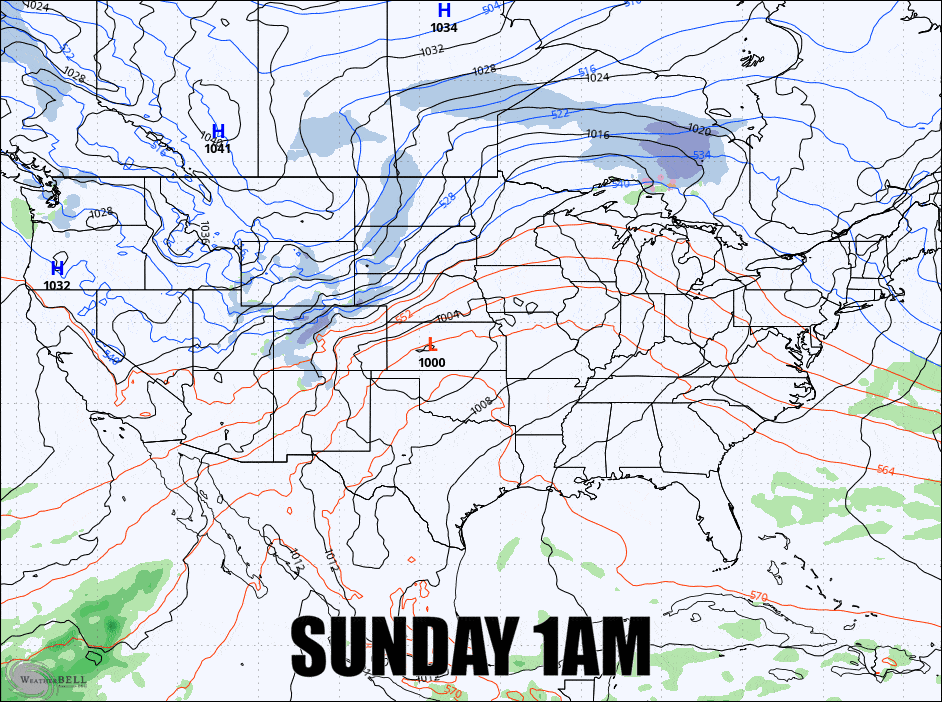
This is a "Colorado Low" which often emerges from the Front Range after the Cascades, Sierras, and Rockies weakens lows that come on shore in the West. It seems that at least half of the time we see a low come out of Colorado it hooks up with the Polar Jet Stream, phases into a more powerful storm somewhere over the Midwest and then cuts through the Great Lakes putting the Northeast in the warm sector of storms.
We're going to see some substantial amounts of freezing r@!n on Monday with some isolated wind issues just to make it even more challenging, and then on Tuesday wind will be strong from the west and will likely cause some severe holds. Make the most out of Saturday and Sunday because you might be taking a couple of days off depending on your location. After Tuesday we do have a back end event with both upsloping and lake effect that will be boosted by two different shortwaves and should keep the snow going through at least Friday.
I'm going to break this down in greater detail for subscribers covering both the Front End Forecast and the Back End Forecast. Note, these first updates are almost always more wordy as I like to set up the entire storm, and in this case we have a multi-day back end event that follows.


