
Snowfall Forecast
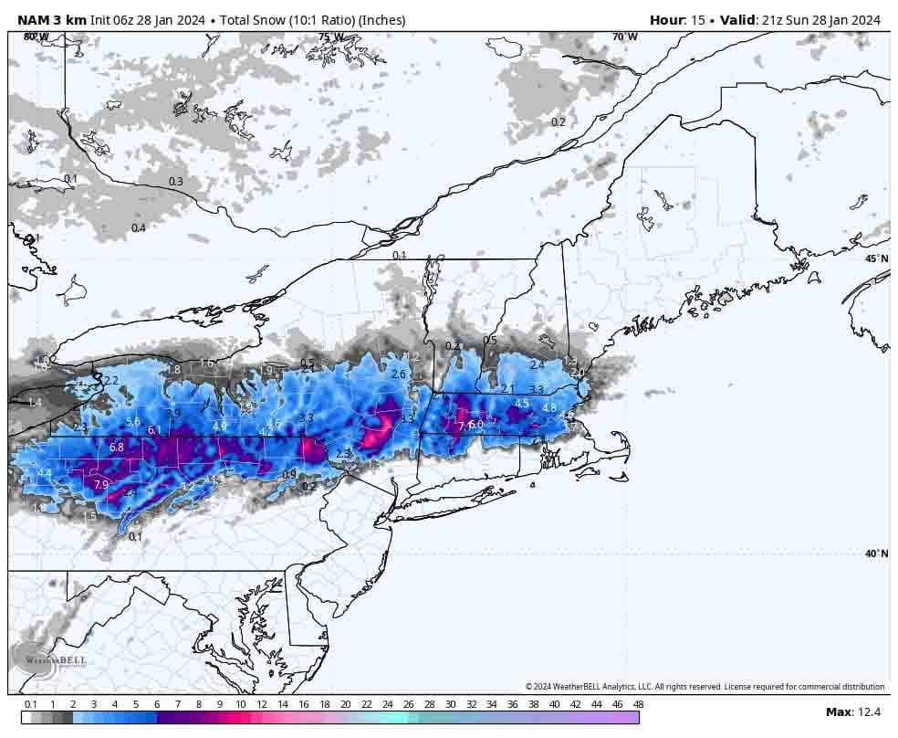
We'll start off with the updated snowfall map. The snow shield has continued to condense, and as always there will be greater variability on the northern and southern edges of notable snow where a shift of just 25 miles with a storm so tight can either double or halve the amount of snow at a given location.
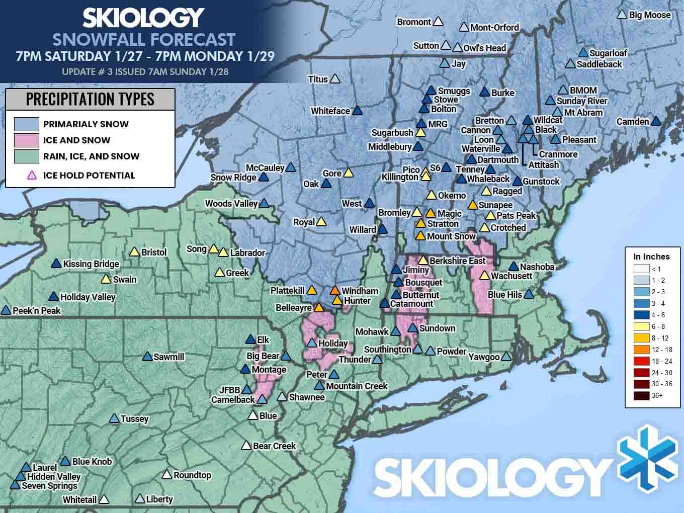
literally no two models agree and the NAM3K notoriously wobbles all over the place from run to run and when you have a mixing situation no other model lays a hand on it for precipitation types. I feel pretty good about this forecast except for one thing, how fluffy the snow is (SWE ratios). If I'm expecting 10:1 and it comes in at 8:1, it's still the same amount of water, but it will fall short of my estimates. I have about 6" for instance forecasted at Sugarbush and 6" forecasted at Okemo, but Okemo should get about double the amount of water in that snow and the difference is how fluffy it is. Ratios are a major factor in forecasting snow and it is not an exact science. They're literally still studying how to best calculate this.
After yesterday's update NWS offices pulled much closer in line with my forecast after bumping some, but unfortunately some areas took a turn for the worse and the NWS is now also trimming and they are generally below my own forecast once again. Here's the 5AM update from the NWS.
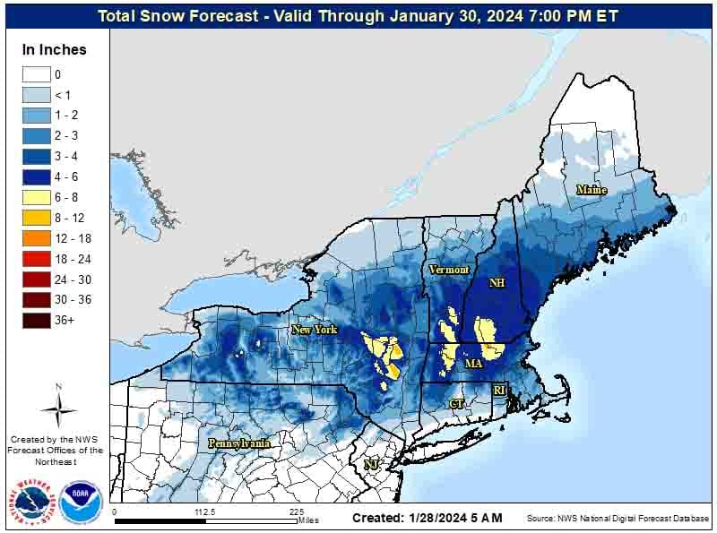
We'll see who gets this one right I guess, but I feel pretty good about my forecast as it stands. NWS offices are in at least some cases treating this as an elevation storm, and they forecast accumulating snow, some of which will melt and settle after falling on bare ground, but I forecast for the top 2/3 of ski areas for what falls on top of snowpack. Those are two different types of treatment, but mixing those two different treatments together is pretty difficult and gives me an edge by only forecasting for ski areas. I also make other sorts of manual adjustments; call them judgement calls.
Wind Hold Forecast
We'll start off with the forecast map, then there will be a loop showing gusts from 8AM through 4PM and then there will be a discussion regarding timing and scope.
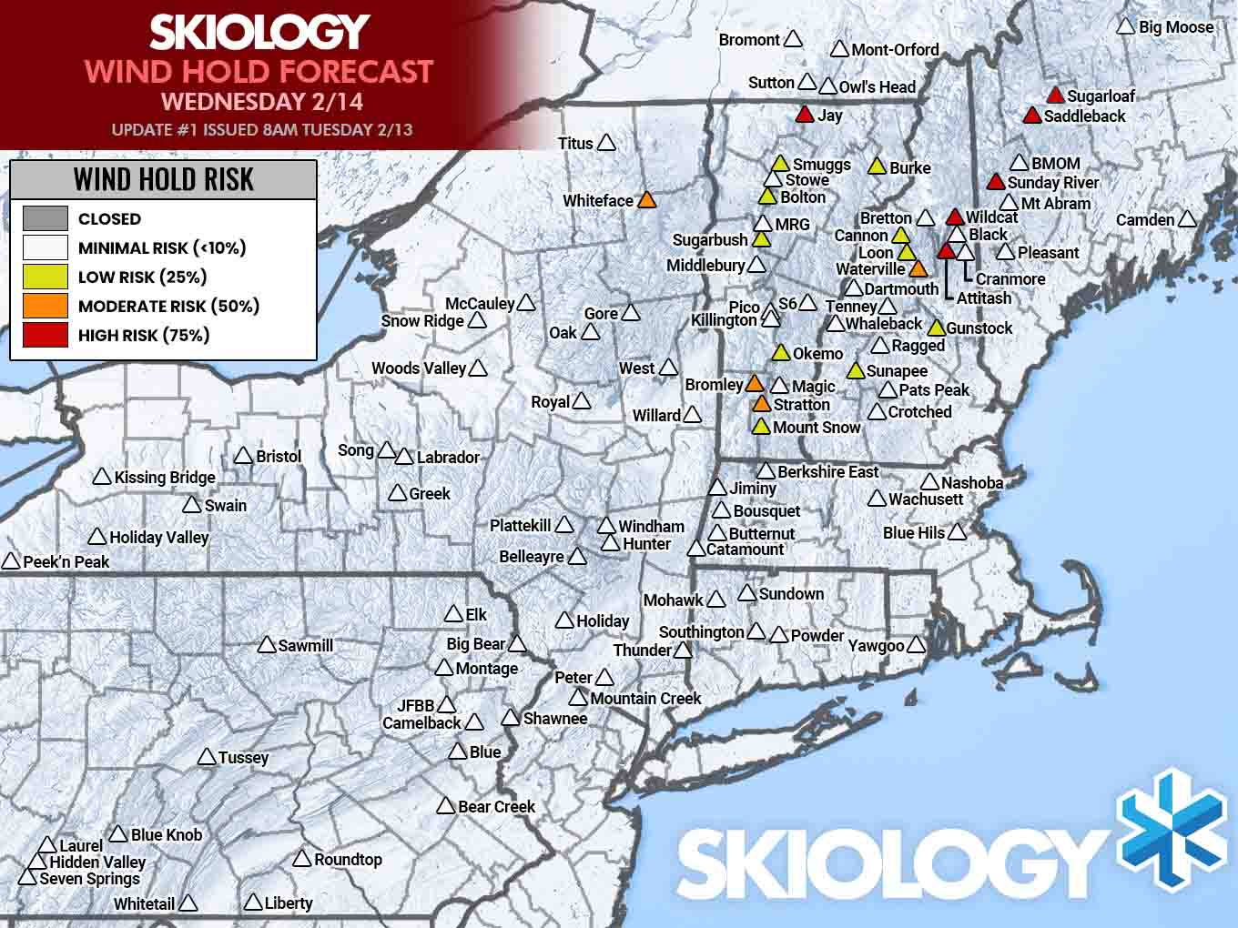
This is a bit better than what it looked like from longer-range, but part of this is due to the fact that wind will increase through the ski day and keep increasing beyond it, so we're going to miss some of the worst winds.
Here's the loop showing wind gusts on Wednesday by hour. Every ski area is different based on many factors. Some can tolerate up to 50 mph as modeled here, while at the other extreme some can only tolerate up to 30 mph, but only from certain directions. Generally in Northern New England the danger zone though starts at 40mph.
Timing and Driving Windows
Here's a timestamped simulated radar from the NAM3K showing 7AM today through 7PM on Monday. This run shifted much warmer in Southern New England but I'm not completely buying that. The pinks and purples are freezing rain and sleet I don't really expect any freezing rain issues at open ski areas though, and sleet skis just fine, but it stings without something protecting your face is all.
Do not take the totals literally as this model overestimates snowfall on higher peaks especially above 15F. Treat this like a ratio.
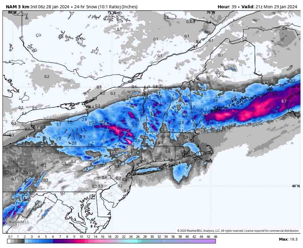
I don't expect any issues in NY and VT at open, though Jay Peak starts getting into the danger zone shortly thereafter. NH and ME are a different story. Wildcat, Sunday River, and Sugarloaf are borderline in danger at about open and it will grow.
Knowledge Is Powder!
-- Matt