
The lake effect has no doubt been stacking up so far and by 4PM somewhere around 12"-20" has fallen at WNY ski areas and about 8"-12" in the Tug Hill area, and even Royal Mountain overperformed on the long-tail of the streamers with at least 10" so far. Streamers have been waiving all over parts of NY and into the Berkshires and Southern Greens but the Northern Greens have been mostly waiting their turn to shine after around 4"-8" fell following the changeover.
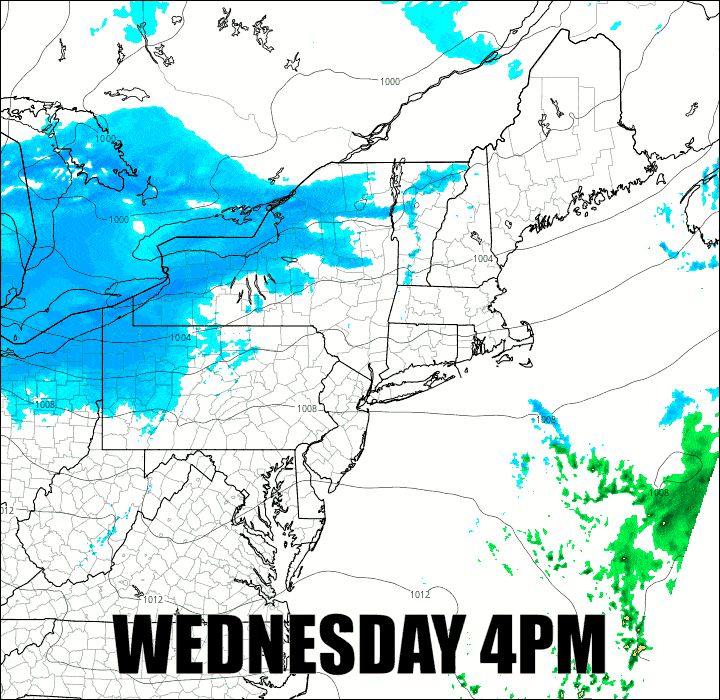
Tonight however we are seeing a weak clipper come through that is going to add moisture and enhancement to the lake effect and the upslope along a broad light snow across the region before things settle down to mostly just lake effect that will continue through Monday with one more very weak pulse of extra moisture on Saturday. Unfortunately we'll see some wind on both Thursday and the first half of Friday and there will be some cold air downsloping accelerating the wind again on Thursday as the temperatures plunge behind the clipper. Here's a 48-hour simulated radar from 4PM Wednesday through 4PM on Friday.
I'm going to cover the Snowfall Forecast through Friday and also the Wind Hold Forecast for both Thursday and Friday for subscribers below.


