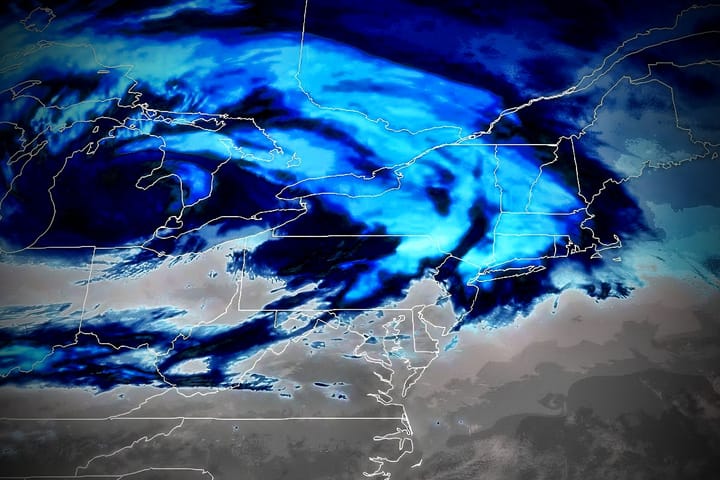
The warm-up is over and the cool down is going to slowly progress across the region through Sunday as two different storms impact the Northeast through Monday. This does mean that conditions are going to be rough in where temps had warmed and especially where it r@!ned in the last few days and then dip below freezing, but the incoming snow will correct that for some.
This update will primarily deal with the Fri-Sat storm but I will also provide an update for the Sun-Mon storm. Here's the latest GFS below showing the surface weather Friday through Monday.
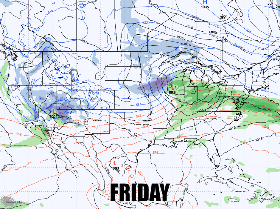
I should note that there is presently no model as strong or as near the coast as the deterministic GFS shows above. Other models as well as the ensembles are showing generally a weaker storm and further out to sea with less impacts on land, but stronger storms do tend to turn more north.
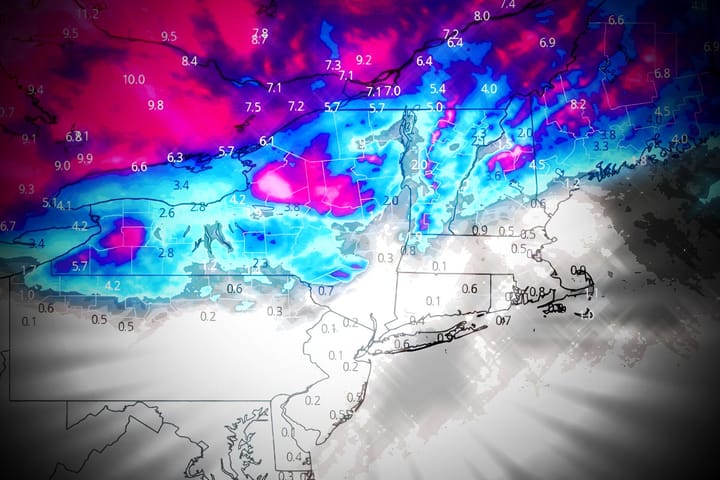
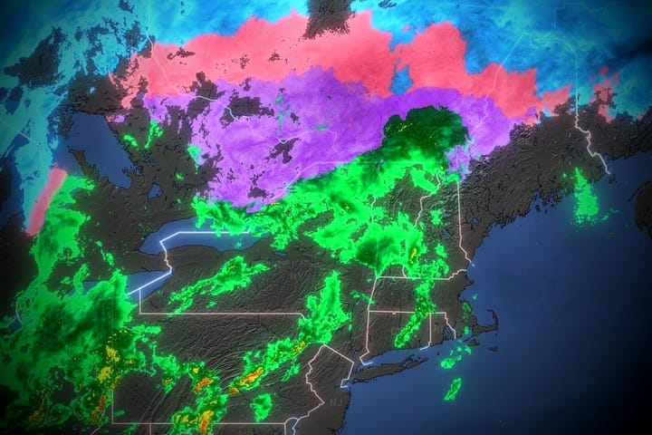
We are likely however to see much more significant snow as well as mixed precipitation on Friday than we see with the coastal storm. There will definitely be some widespread travel impacts on the Friday evening commute, and we are likely to see up to a foot of snow by Sunday morning with a broad swath of +8" expected.
I'm going to break this down into the Fri-Sat Storm Update where I cover not just snowfall potential, but also operational and travel impacts from the sleet and freezing r@!n, and then I'll provide a Sun-Mon Storm Update with a briefer look at snow potential from that system. This is a little long, but it covers 2 storms.