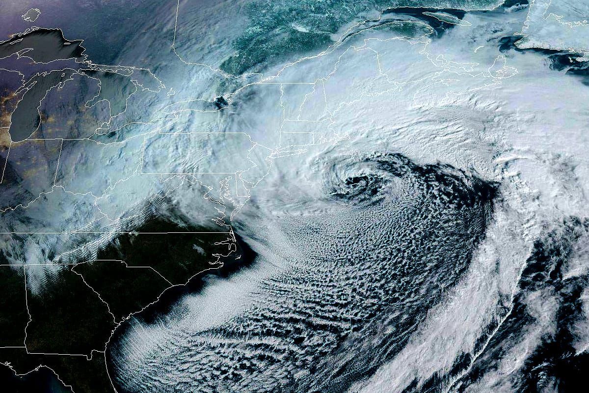
This storm definitely moved even more southeast since yesterday afternoon than I gave it space to in the forecast, which was conservative and slightly below the Powculator at that time which itself was below the NWS forecasts from the same time frame. Keep in mind that the storm didn't actually move, it was always going to do exactly what it did but modeling was unable to pin it down precisely enough until it happened, and with a storm like this with heavy banding a shift of 50 miles can make or break regions like the Catskills and Poconos, and generally reduce the snowfall all over. Cyclogenesis is a major component of what makes East Coast forecasting tough. Models have a much easier time predicting storms that have already formed.
The problem I think was the storm ended up about 5mb weaker at midnight than modeled even yesterday afternoon, and the stronger the storm the more north it generally tracks, so this didn't track as far north. Probably also the wobbling from a slower 'phase' as it formed caused some of this drift from modeling and ended up about 50-75 miles more southeast. Those small shifts resulted in large shifts in snow and wind modeling especially further inland with very tight bands. The Powculator has been keeping up with this however with updates every 3 hours and I have some new storm forecast totals and a comparison with the other forecasts as well as wind hold updates for both today and Tuesday.