It looks like we will get a bit of snow out of this system on Sunday, but some ski areas will wait until the end of the day for it to flip from r@!n to snow. If you want a good ski day then aim for the snow of course.
Before I get into the forecast for what happens on Sunday I want to revisit the wind threats for today. Jay Peak still has a 75% chance of losing Flyer and Tram of course is near 100% with even moderate winds though there might be a lull mid-day before wind picks back up in the afternoon which is where most of the threats lie. Saddleback and Sugarloaf likely won't get hit with threatening winds until sometime between 2PM and 4PM. I'm not worried about holds anywhere else today.
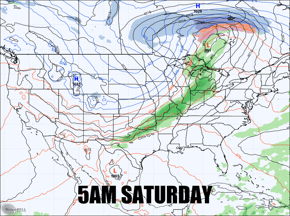
So let's jump into this system. It's not going to bring a lot of r@!n, and we're expecting up to 5" of snow from this by the end of Sunday but since it is spring and there's some dampness with a blast of cold behind this front it's quite possible that we see some unmodeled back end snow in the Northern Greens that could mean overperforming and there's also a weak disturbance Monday afternoon that could add to that (and a bit of snow on Wednesday also looks likely). Here's what the latest GFS shows with the 6-hour precipitation intensity through the end of Monday.
I'm going to cover this for subscribers in just one Sunday Forecast section this time and let's dive in.


