We have another potential storm brewing around Sunday for the Northeast as you have probably have already heard. There is so much up in the air at this distance though that issuing a Storm Watch and examining what could happen is the right way to approach this rather than trotting out dueling snowfall and surface maps every 6 hours as models update. The proper way to do this is to try to get a sense of how likely the storm is to form, where it might form, and how it may track.
How Likely Is a Storm?
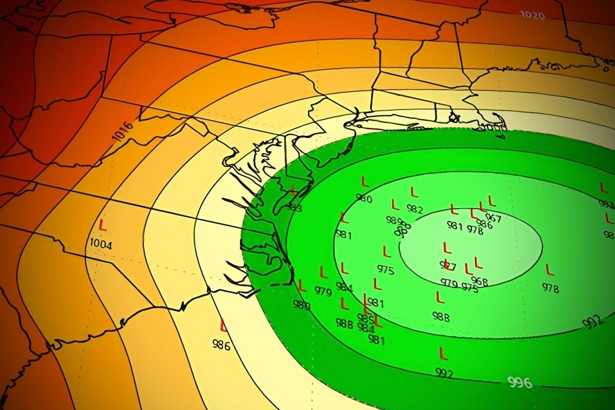
I would put the storm at an 80% chance of forming roughly in line with current modeling which spawns the storm off the coast of North Carolina where it then tracks up the coast, possibly bringing impactful snow to the Northeast. All three major medium-range models see the storm forming and tracking in roughly a similar manner currently and their ensembles also have very strong support for this. The problem I see is the complication of the setup.
In this case this storm forms not from activity to our west, but from an anticyclonic wave break that happens in Europe when a ridge of high pressure gets squeezed and it pinches off a cut-off high at the level of the jet stream which then moves east over Greenland and then into an upper level low sitting over Quebec.
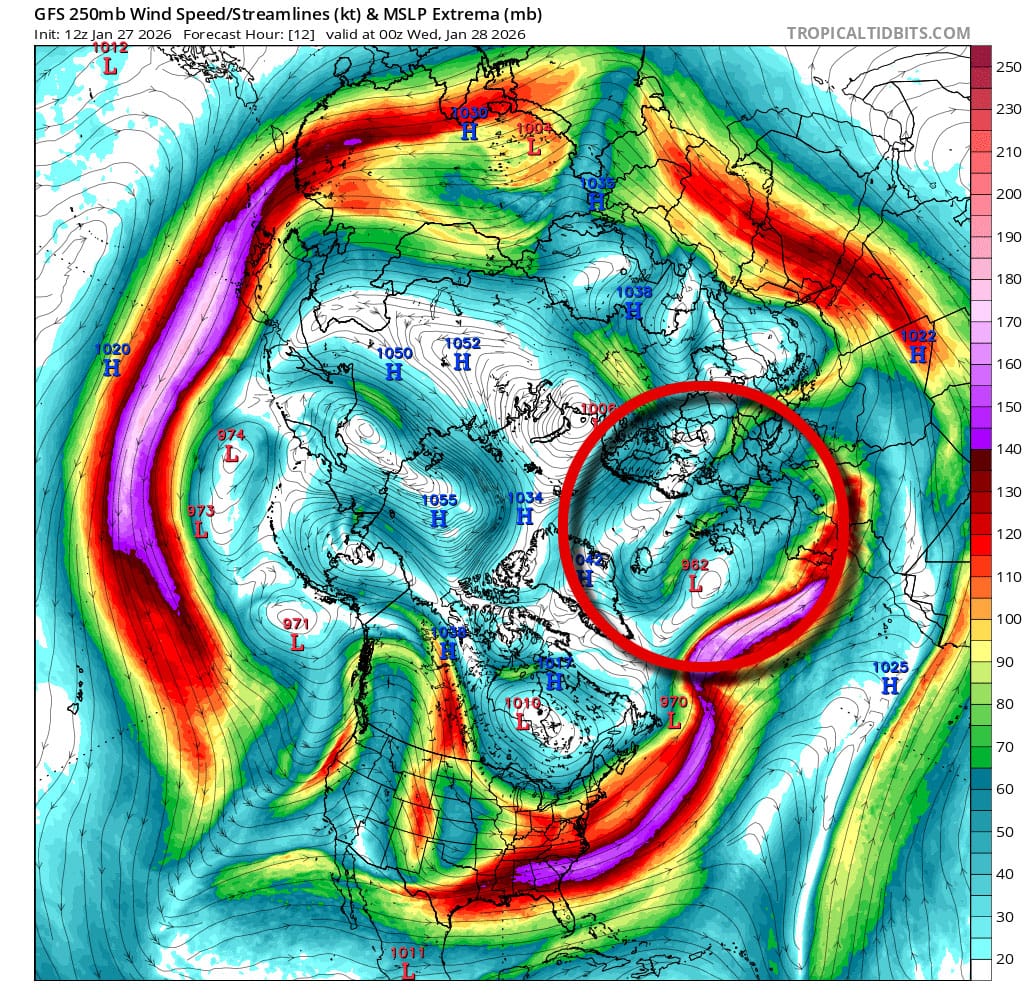
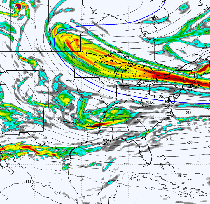
This action will flatten that low forming an enormous trough and cause it to swing counterclockwise that at first will be pointed due west (strange), and then it continues to circle around until the rotational energy triggers a surface storm to form. This is what that part of the process looks like using a vorticity map which I generally just tell people to consider it 'storm energy'
So this is a very odd way for a nor'easter to form to say the least. Typically we see a deep digging trough pick up moisture and energy from the Subtropical Jet or the Gulf, or a random piece of energy in the right place at the right time, but a retrograding upper level cut off high squeezing an upper level low into a wildly swinging trough is something I would normally dismiss at this range as looking too complicated, but all three models see this so it's likely to happen roughly.
Will it happen exactly as shown? Well, shifts are likely of course and it's hard to say if we are near a breaking point where there is no storm at all if something shifts 300 miles, which is well within reason at this range.
Where Might the Storm Form?
So this is where things get complicated as far as whether or not there are impacts to the Northeast. Right now all of the ensemble versions of the models point to the storm forming off the coast of North Carolina. I'm going to show the GFS ensembles for where the low center is expected late Saturday across 30 ensemble members but the others are roughly in agreement.
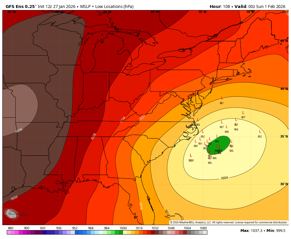
Storms like to form over water when they can of course, but where exactly that trough swings will determine where the storm forms and what the ensembles currently show as the spread could very well change. This could form inland, further out to sea, further north and further south. Around where the low pressure is the deepest on the above map is the favorite place right now but there is a high likelihood of this shifting by hundreds of miles.
Where Will It Track?
This largely is dependent on where it forms and how strong the storm is. Here are the GFS ensembles again but for late Sunday showing the spread. You will note that the spread is actually larger than where the storm forms, which is sort of abnormal.
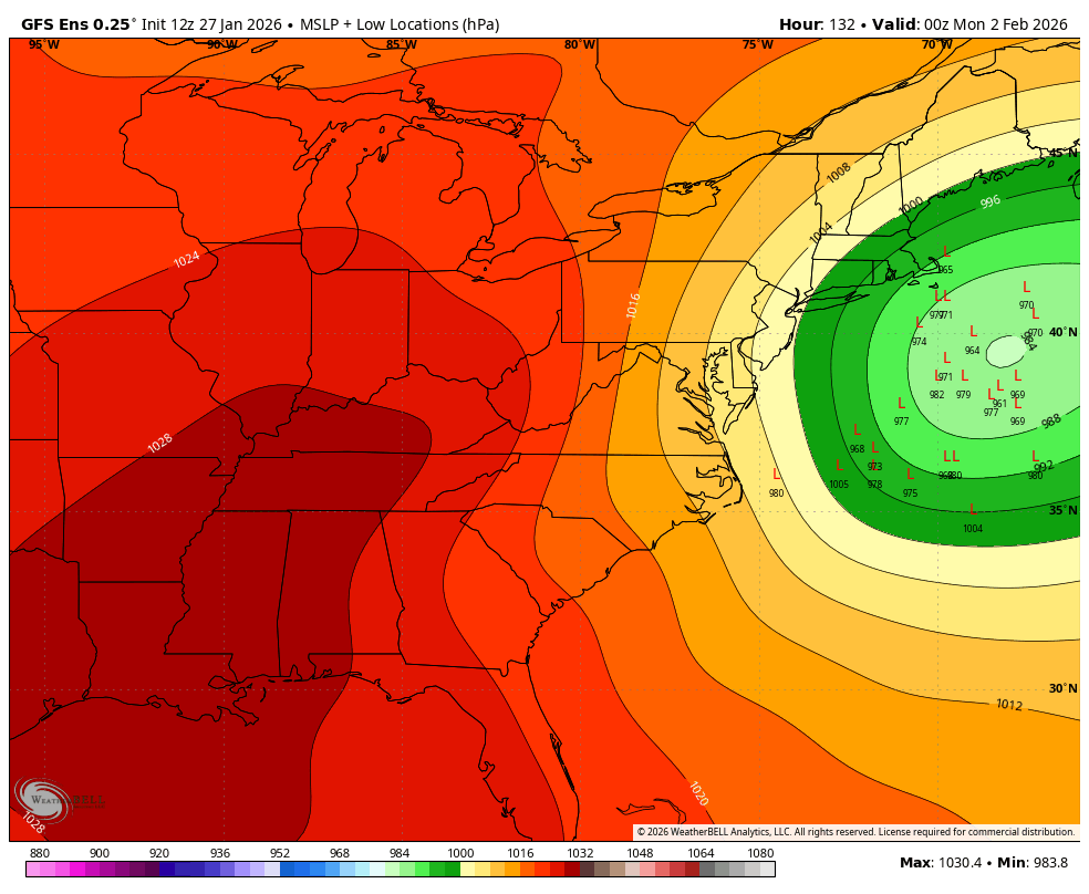
Examining this closely you will see a pattern where the lows that are closer to the Cape are the strongest ones generally, while those further south and east are weaker. The primary reason for this is that stronger storms turn more strongly to the north. This storm is modeled to form nearly due south of NYC and it needs to either form further north or be strong enough early on to turn strongly north otherwise we are going to get missed.
Here is what the storm looks like across all 30 GFS ensemble members:
At this range for snowfall I like to use the ensembles showing the 75th percentile snowfall as a rough guide because it doesn't include the outliers on the low end. This roughly means the average of the top 25% of ensemble members. This is what both the GFS and ECMWF ensembles show at this time.
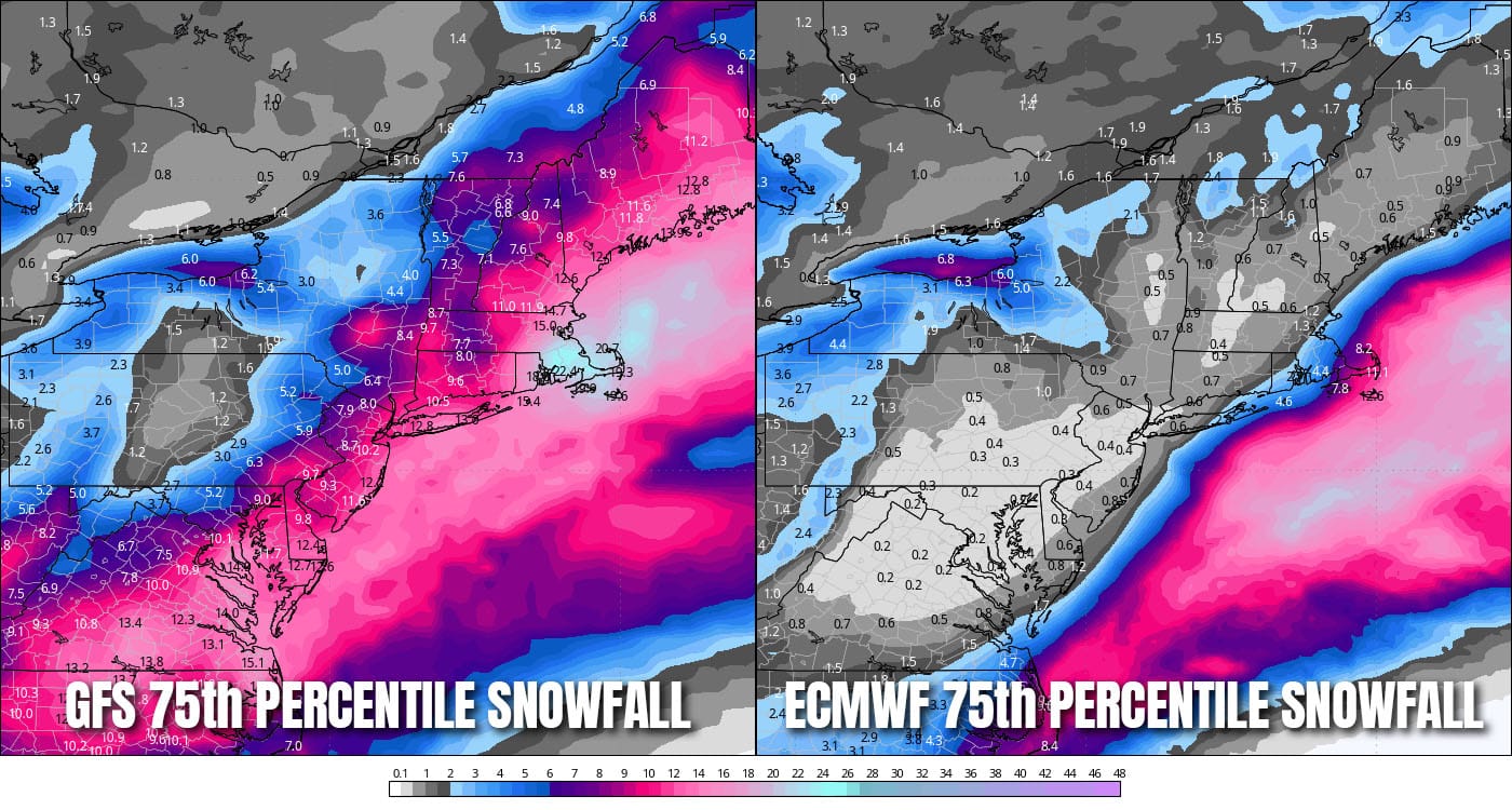
The GFS is just a swipe but that's a decent storm for ski country, but the ECMWF is near a complete miss. Note that these maps are at 10:1 snow to water ratios and we would likely expect 15:1 to 20:1 ratios so 9" on the map could be 13.5" to 18".
The bottom line is that while I think there is an 80% chance of a storm to form, I think there's only about a 50% chance overall of the storm actually being notably impactful (+6") to more than a handful of coastal ski areas if that.
If the storm forms we may have some isolated wind issues on both Sunday and Monday regardless of whether or not it brings impactful snow.
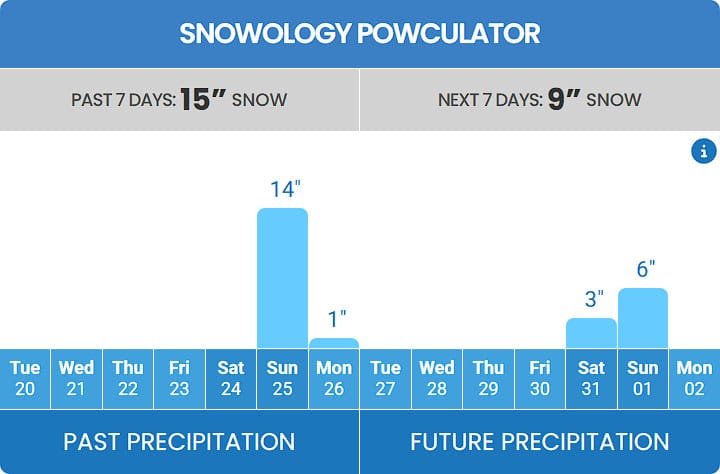
I won't be posting snowfall or surface maps every 6 hours from every run like this is play-by-play football coverage, that's not beneficial to anyone who isn't forecasting. When trends and/or stronger agreement emerges and if the snow is likely to be more broadly impactful I will then start covering this with storm updates or at least share that it is not going to impact us. You can also watch the Powculator for shifts in snowfall on Sunday. Yawgoo in RI is presently showing 9" of snow between Saturday night and Sunday. If this goes up, it is tracking more towards New England, but if it goes down it is tracking more out to sea. If it starts showing r@!n then it is tracking much more to the west (nearer to NYC).
There is a chance...
Knowledge Is Powder!
-- Matthew Scott


Comments ()