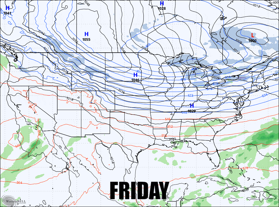
Well, today's a warm one relatively speaking and I hope everyone is getting some nice turns. I think we all know that there's a whopper of a storm coming, and also some really cold air. Let's start off with the 6-hour precipitation intensity loop covering all 4 days from the GFS:
I will be working on a Storm Update as soon as this outlook goes out, so expect that around 4PM today.
Here I'm going to cover the 4 day period starting out with the Snowfall Outlook & Powculator Discussion, then jump into the Temperature Outlook, and finally the Wind Hold Outlook discussing issues that are likely on Friday and Saturday.
Everyone planning on being out in the northern areas should check those snow reports starting the evening before for the possibility of announcements of delays. Night skiing is the most susceptible to being canceled, though Titus did decide to close for the weekend starting Friday night in order to save staff and their customers from the cold weather there.
With that said, conditions are fantastic all over and if you are dressed right you will likely find this to be one of the quietest weekends, though if you are driving towards the coast on Sunday evening you are definitely going to want to check out our Storm Update later today or just stay at the mountain through Monday and get some pow.


