Hey, we're past the peak of summer and we even saw some snow in the Rockies this last week, so the countdown to the next ski season is in the final stretch, in fact we may be skiing and riding within about 80 more days. Yes, it's that close! Time to do that exercising that you promised yourself that you would do during the off-season :)
In the meantime it's still summer though, and dry weather has been hard to come by and this weekend will be no different, though there will be no reason to cancel plans generally. Temperatures will be pleasant and those campfires at night will have some utility beyond cooking smores.
Precipitation
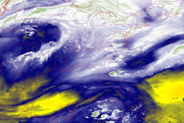
We have another system coming through the Northeast and Quebec beginning early Saturday in the western part of the region, and exiting Maine late on Sunday. This doesn't look like a full on rain out, but some moderate intensity thunderstorms are likely in parts on Saturday, with even less potential of stronger storms on Sunday as the rain departs. The following loop from the NAM12k model runs from Saturday morning through Sunday evening.
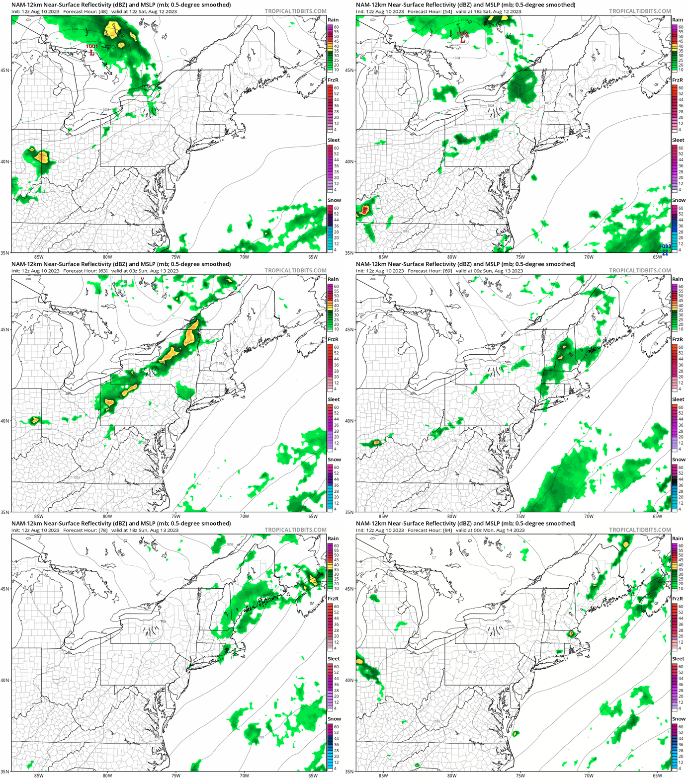
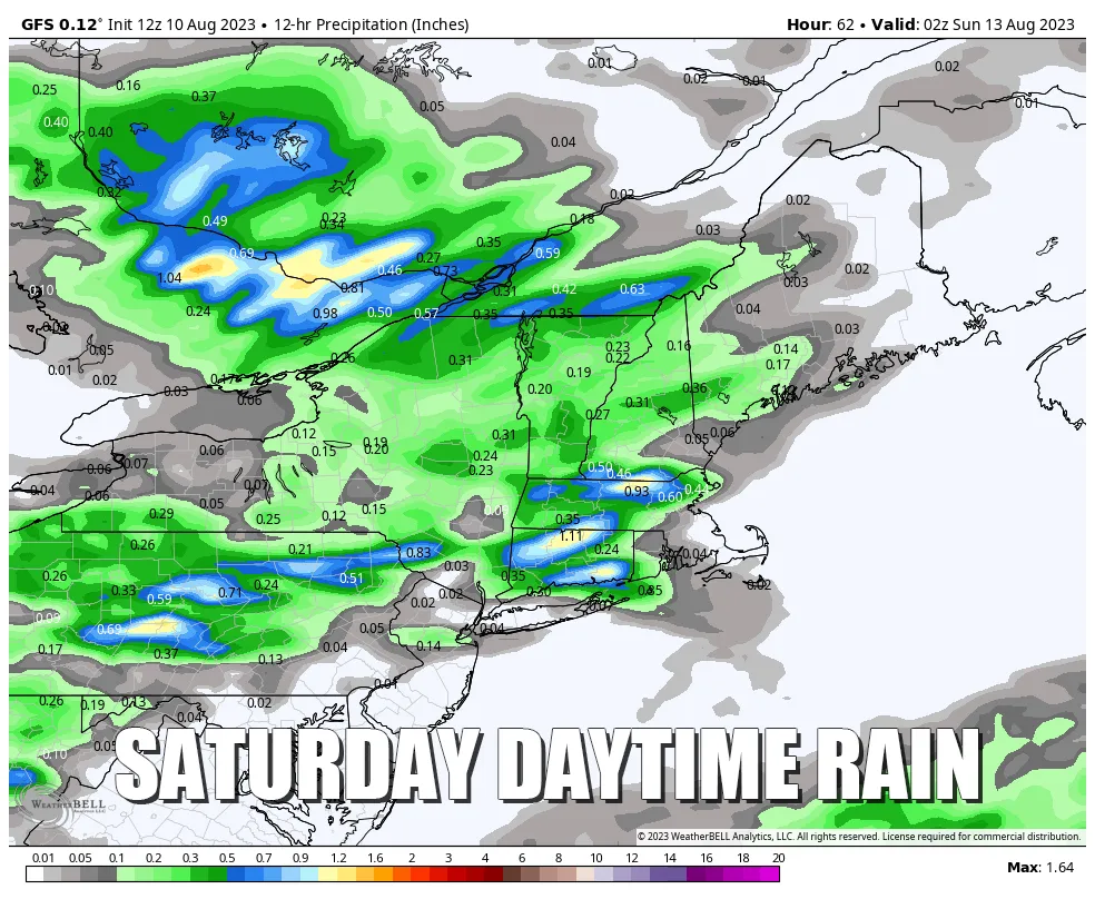
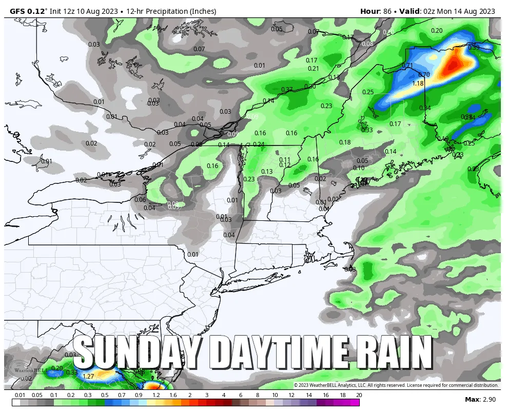
Through Saturday evening we should expect most of the rain to fall west of the Connecticut River, while on Sunday during the day we should expect most of the rain to fall east of the Connecticut River. The maps below show daytime rain on Saturday and then Sunday according to the GFS. It's best not to try to pinpoint at this distance with this type of precipitation since convection can be quite random. Should it rain where you are, generally you should expect it to last for more than 2 hours on both Saturday and Sunday.
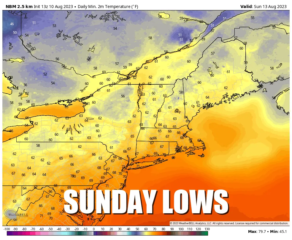
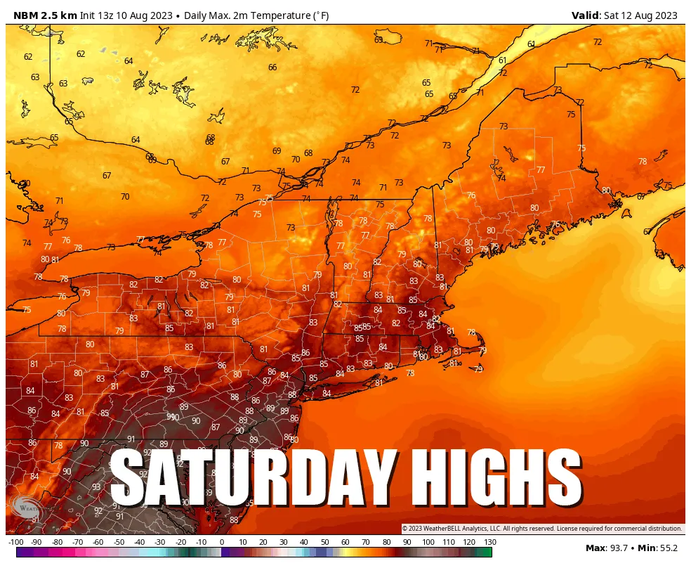
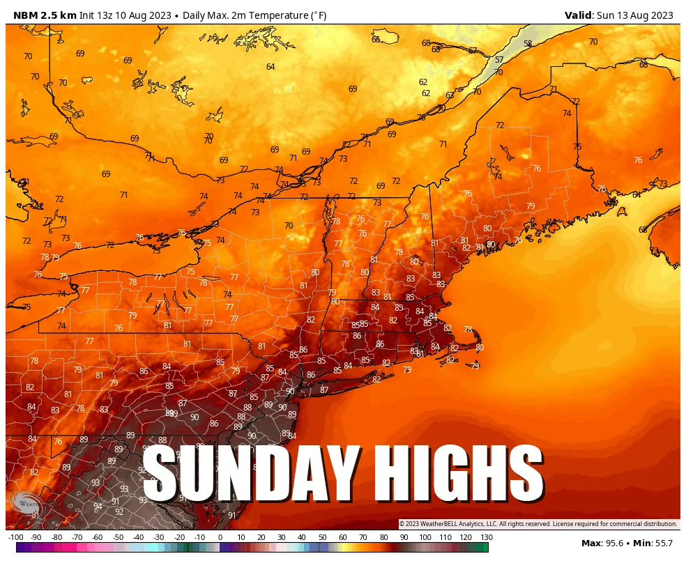
Temperatures
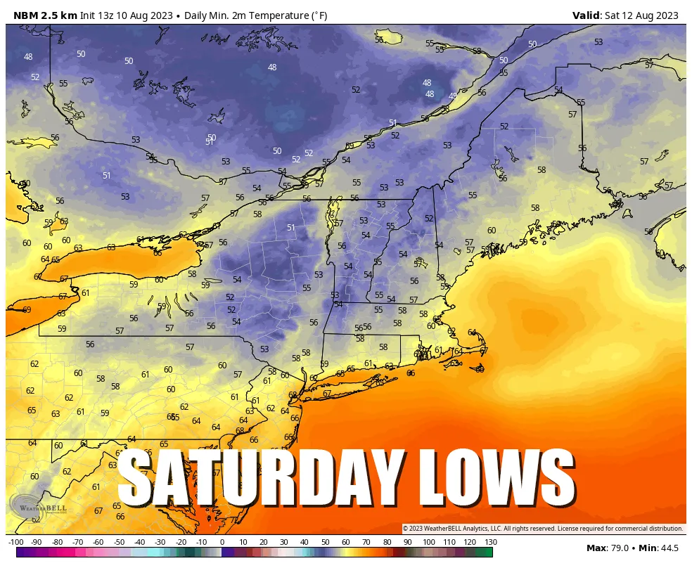
We're looking at pretty average weather outside of a somewhat chilly start Saturday morning. Nothing to write home about, but if you are out hiking the mountains then you'll need some layers. People do get seem to get into far more trouble in the late summer and early fall while hiking in alpine environments, especially around Mount Washington. Please leave the sandals at home, and yes, that really happens... a lot!
The Snow Ridge Tornado
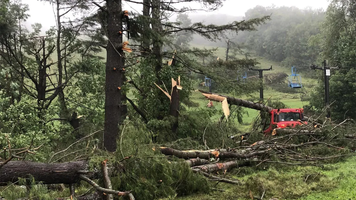
Snow Ridge in Turin, NY was hit by a remarkably strong tornado for this area of the country on Monday that impacted three of their lifts, threw warming huts and lift shacks around, and snapped trees off at their base. When you see mature trees snapped near their bases then you know you had a strong storm. The NWS did an analysis and found that winds up to 140 mph were experienced along a 16 mile path. That's EF3 intensity, and that's generally about as strong as they get in New York.
Snow Ridge has kept everyone updated about what happened through their social media channels. Their insurance will cover the infrastructure, but not the tree removal and replanting, and they are asking for some help. Small ski areas are small businesses, and even cleaning up the trees following a tornado can be hard to cover, especially in the off-season when money is not flowing freely so consider giving them a hand through their GoFundMe campaign.


Comments ()