
It's going to be a bit of a mixed bag of weather this weekend with rain passing through part of the region on Saturday with some hot and humid weather that will help fuel thunderstorms in the afternoon and evening. Sunday there will be little if any rain, the humidity will drop to very comfortable levels, and the temperatures will also moderate a little making for a very comfortable day for outdoor activities all over.
Please remember that these forecast discussions are always focused on the mountains of the Northeast unless otherwise indicated.
Precipitation
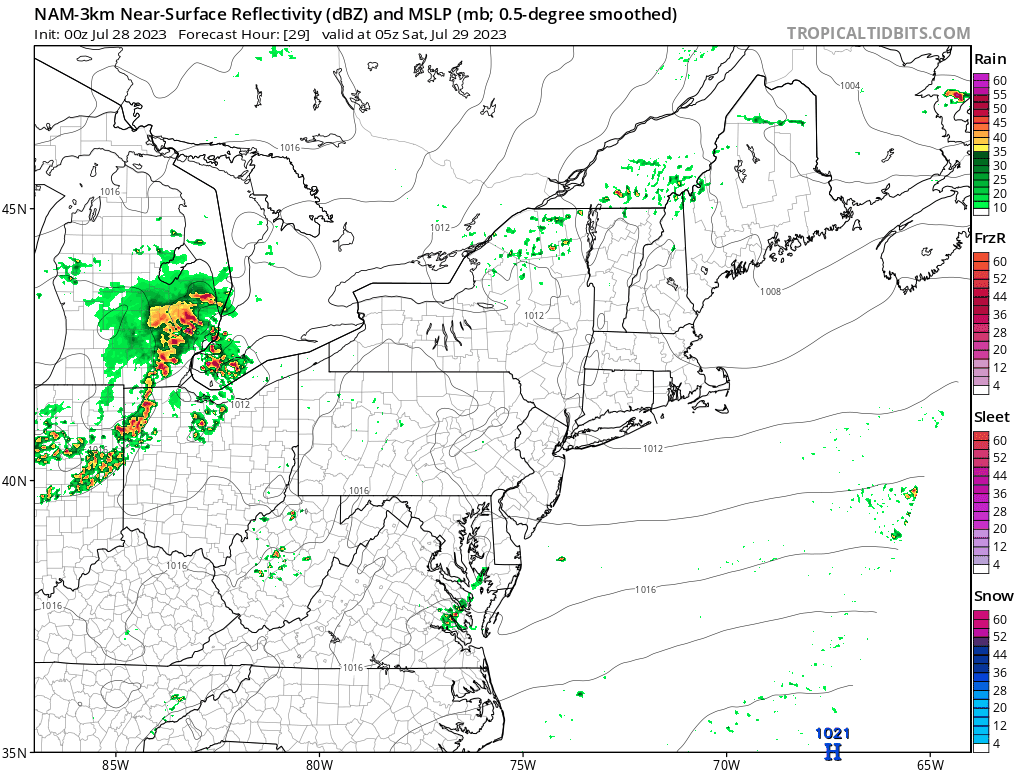
Saturday we have a weak low pressure with a trailing front that will move across the Northeast during the day. In the afternoon thunderstorms are likely to start to develop and become more intense in the early evening. Models unfortunately seem to be generally in two different camps for where this system will track which makes the exact impacts far less certain. The ECMWF and NAM3K see more of a southern path with the low moving from Western New York to Connecticut and then out to sea. This would put the thunderstorm risk mainly in Southern New York, Eastern Pennsylvania, New Jersey, and Southern New England. The loop below is from the NAM3K and spans all of Saturday. The GFS and HRRR models however see the low tracking due west, but with a secondary low forming around Philadelphia. This would mean an early drying of the northern areas and less intense thunderstorms. NWS forecasts seem to prefer the GFS/HRRR solution, but I'm going to call this a coin flip with everything in between a possibility. The long and the short of it is that your best chances for mostly dry weather in the afternoon on Saturday will be in the western and northern reaches of the Northeast. If you are planning to be out in the mountains Saturday, go prepared for some rain and possibly even some thunderstorms, especially from the Gore, Killington, Gunstock latitude and south, and east of the Finger Lakes longitude.
Sunday should be dry almost everywhere, but some very widely scattered light to moderate showers will be present in the Northeast, and in Quebec some less scattered and slightly more intense rain will work its way into the Laurentians during the afternoon.
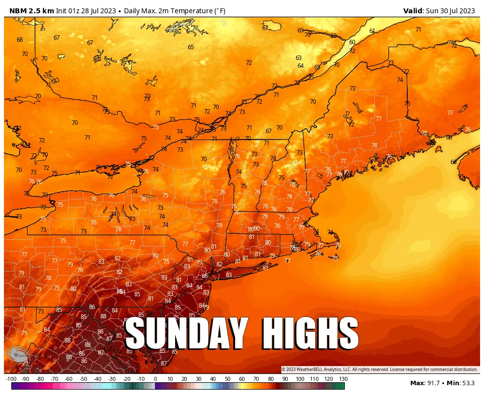
Temperatures
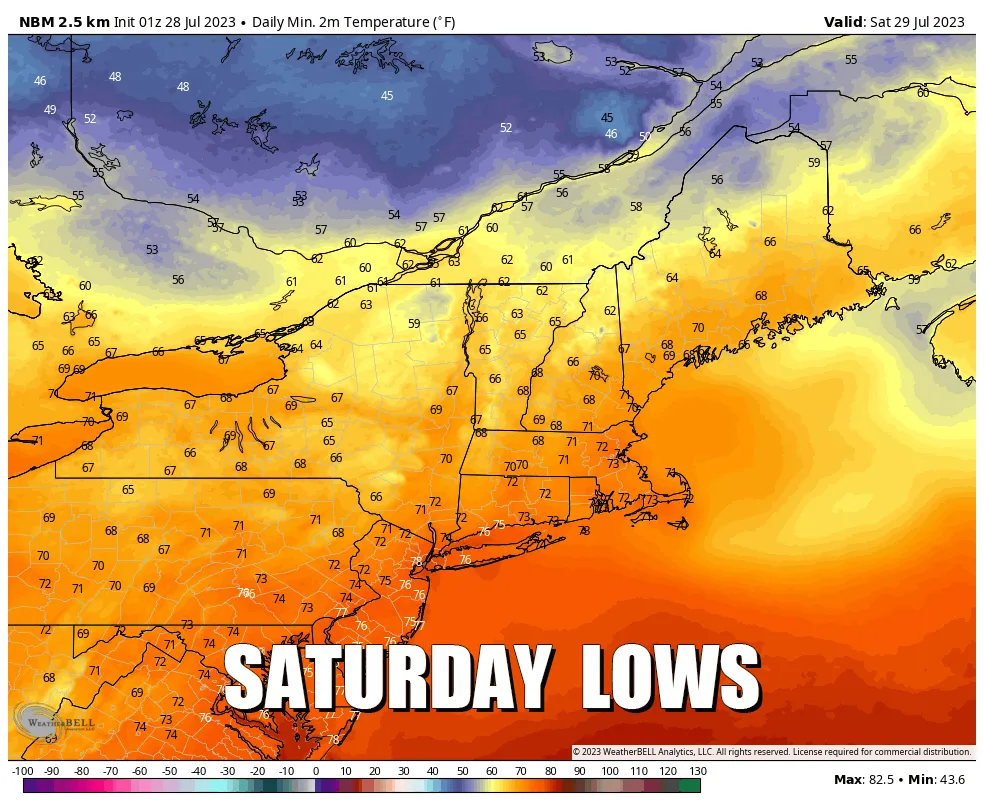
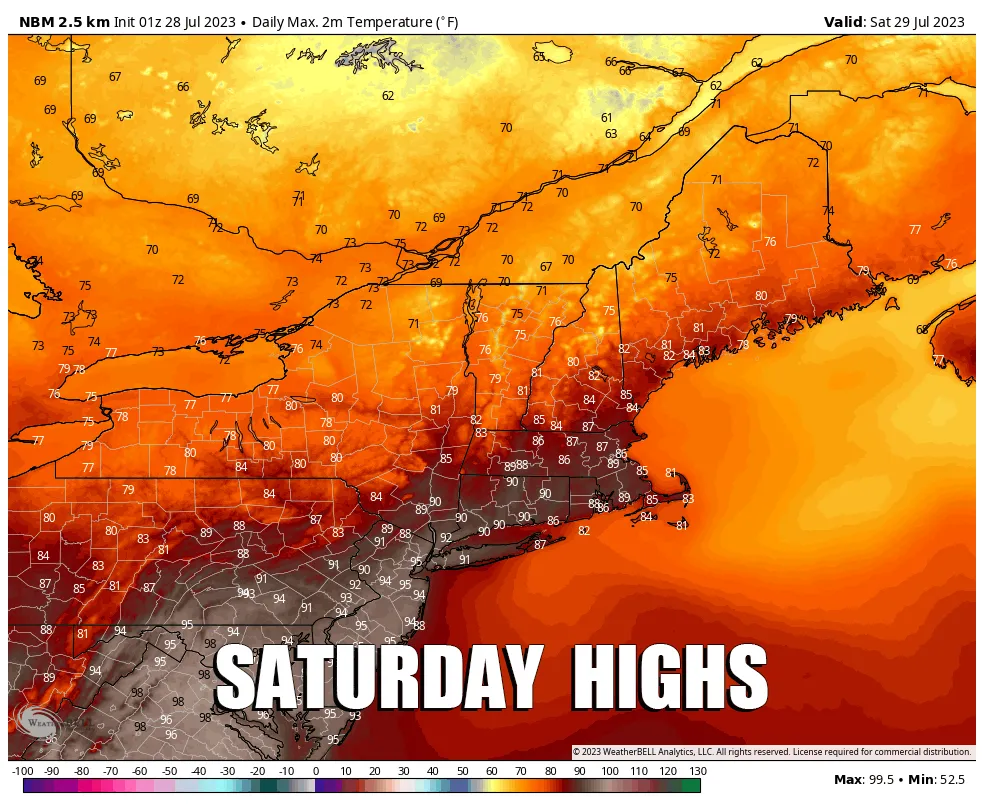
There was some concern about excessive heat late this week but forecasts have moderated. Saturday it will be muggy and fairly warm, but not excessively so, with some heat indices reaching the mid-90's and above in the corridor from Philadelphia to Boston. Further inland the precipitation and slightly cooler weather will help keep things way more tolerable. When it's hot in the summer you can counter it with altitude, in fact the more northern mountains will struggle to break 70F on their peaks. Beaches also work, but I don't really cover beach weather so head for the hills!
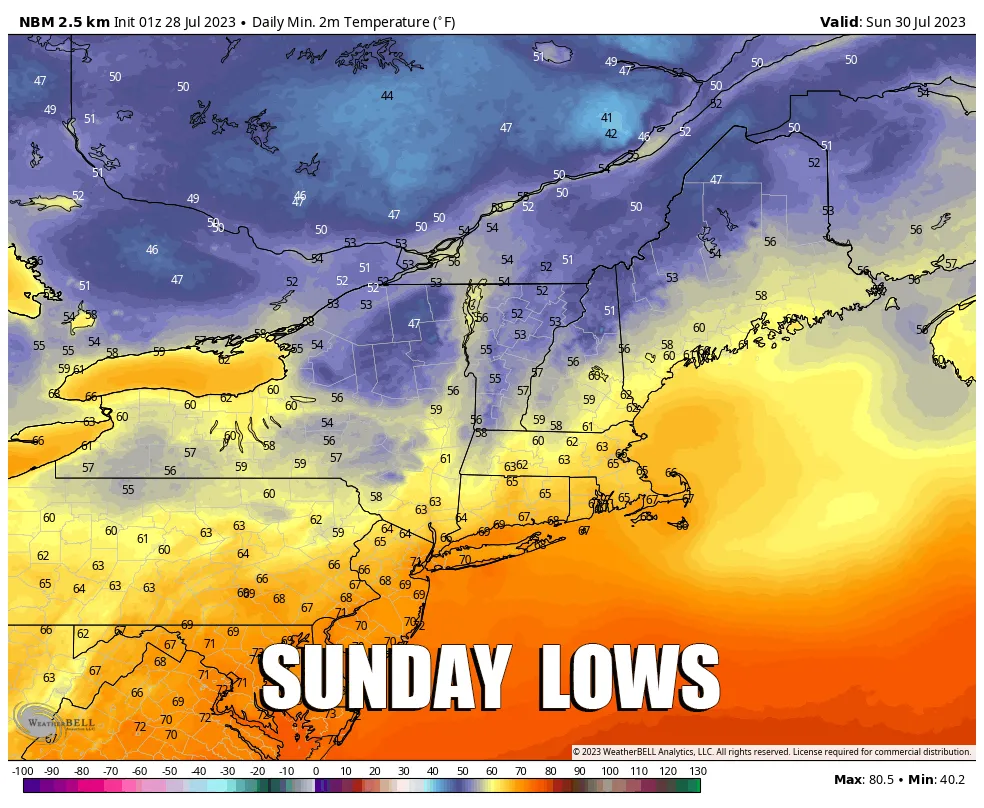
Sunday the temps will be a little lower, but the humidity will be much lower as high pressure starts to move into the Northeast. There will still be some clouds hanging around many of the mountains, but generally it will be partly cloudy. Sunday is definitely the pick of the weekend!
What's Going On This Weekend?
Our feature image comes from the Flow State Vermont Mountain Bike Festival held at Ascutney Outdoors, in Brownsville, VT. This is a sizeable gathering with rides, races, demos, music, food, beverages, and camping among other things. Definitely one of the larger mountain biking events in the Northeast. It's great also to see a non-profit recreational mountain expand into various activities serving the broader community. We need more of this for all recreational activities.
Mount Snow is also hosting a MAXXIS Eastern States Cup downhill mountain bike race as part of their series on both Saturday and Sunday.
-- Matt


Comments ()