Well, the grumpy clouds and their party pooper friends are going to crash our sunshine and foliage parade this weekend in some of the most popular areas, but some will make due. We have a large trough and upper level low that will impact the Northeast along with another tropical system that may make landfall in Maine, but this one is pretty weak and faster moving so we don't expect widespread serious impacts, though near where it makes landfall people should of course prepare appropriately and tune into official sources for guidance.
It will be breezy all over, especially on Sunday, and the clouds will hide the sun for most of the region. There will be more rain on Saturday than Sunday, but chilly temps do come in during the day on Saturday spreading from west to east. There will be a lots of festivals going on, and they are generally rain or shine, and while many will experience rain at some point there will be some long stretches of dry weather to make one day or the other this weekend work for your outdoor plans. We'll dive into the foliage again also and do a little extra weather discussion for those who enjoy that.
For those getting itchy for snowmaking we can confidently write off all snowmaking capable of creating lasting snow through at least October 15th. We do not yet see a cold hit reliably signaled in the models capable of opening resorts. We are concerned that we may miss skiing in October for the 5th season in a row.
Please remember to subscribe if you haven't already. We've obviously made changes for this season with the launch of our new site and moving content over to it, and our own weather coverage for storms this season will require a paid subscription. The paywall is coming as soon as the weather does, so subscribe today and get that out of the way if you haven't already. $29,99/year really is not that expensive especially considering the cost of the activities and how being better informed can both save money and make it better spent.
Leaf Peeping
This will be the best weekend for foliage in the northern areas of NY, VT, NH, and ME, but the weather will not cooperate like it did during this last glorious week. We have the following map from Explore Fall that shows today's estimate of where fall colors have progressed.
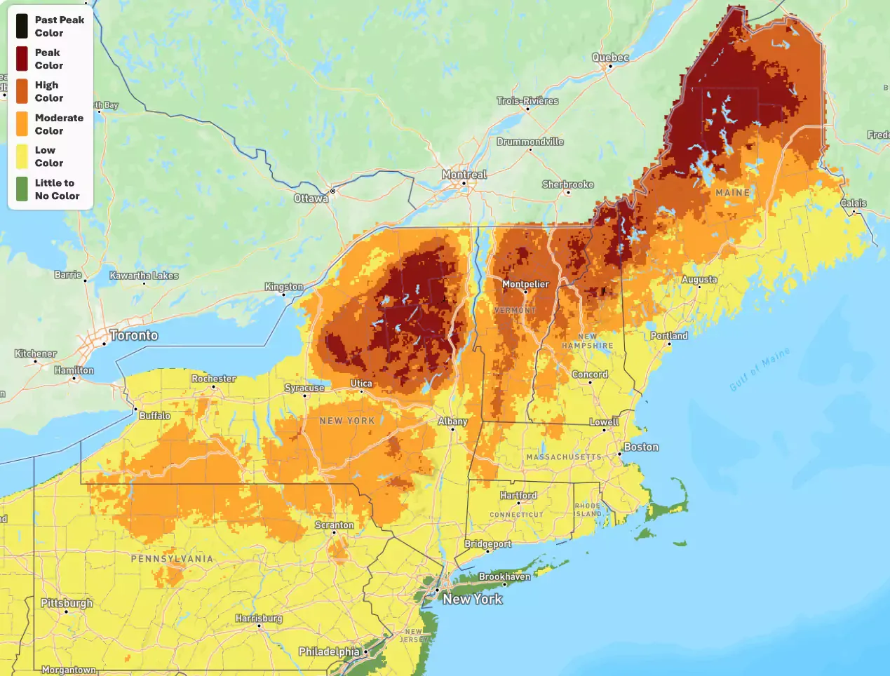
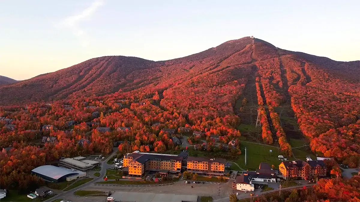
We're definitely entering full-on fruity pebbles territory up north where the sugar maples are popping. They start changing higher in elevation and also lower in wetlands. What you see as being peak on the map right now will be past peak by the following weekend and the hunt starts to move south. We do believe this map is a pretty good representation of the current situation.
Crapolicious Weekend Weather Discussion
There's nothing worse than temperatures in the 30's and rain. To a skier or rider this is the equivalent of broken dreams. Some early snow potential in the Northeast, albeit never expected to be more than just for show, has dried up as the coldest air will remain in Quebec and Ontario under the upper level low. Production snowmaking absolutely will not happen, but early next week there's potential for some test runs at the break of dawn or possibly marketing will want to water the lawn to amp up the stoke.
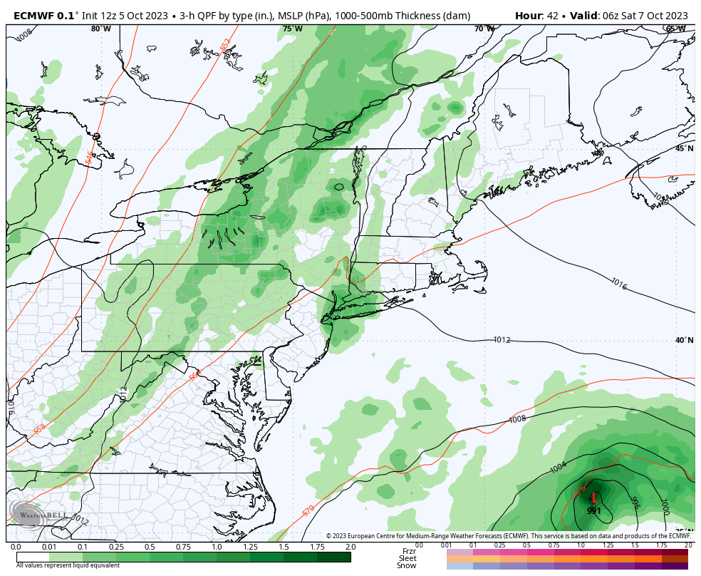
Let's first take a look at the 3-hour precipitation intensity loop from the latest ECMWF run that covers all of Saturday and Sunday. Note the cold front advancing from the west, the upper level low spinning up in Ontario, and Tropical Storm Philippe being extra-tropical and getting sucked up by that monster upper level low. If you are trying to figure out the timestamps in any weather model map, we are currently 4 hours behind "z" time which is the same as UTC time. When we fall forward in November "z" time will be 5 hours ahead of our local time under DST. Note that "z" comes from military "zulu" time and is the exact same thing as UTC time.
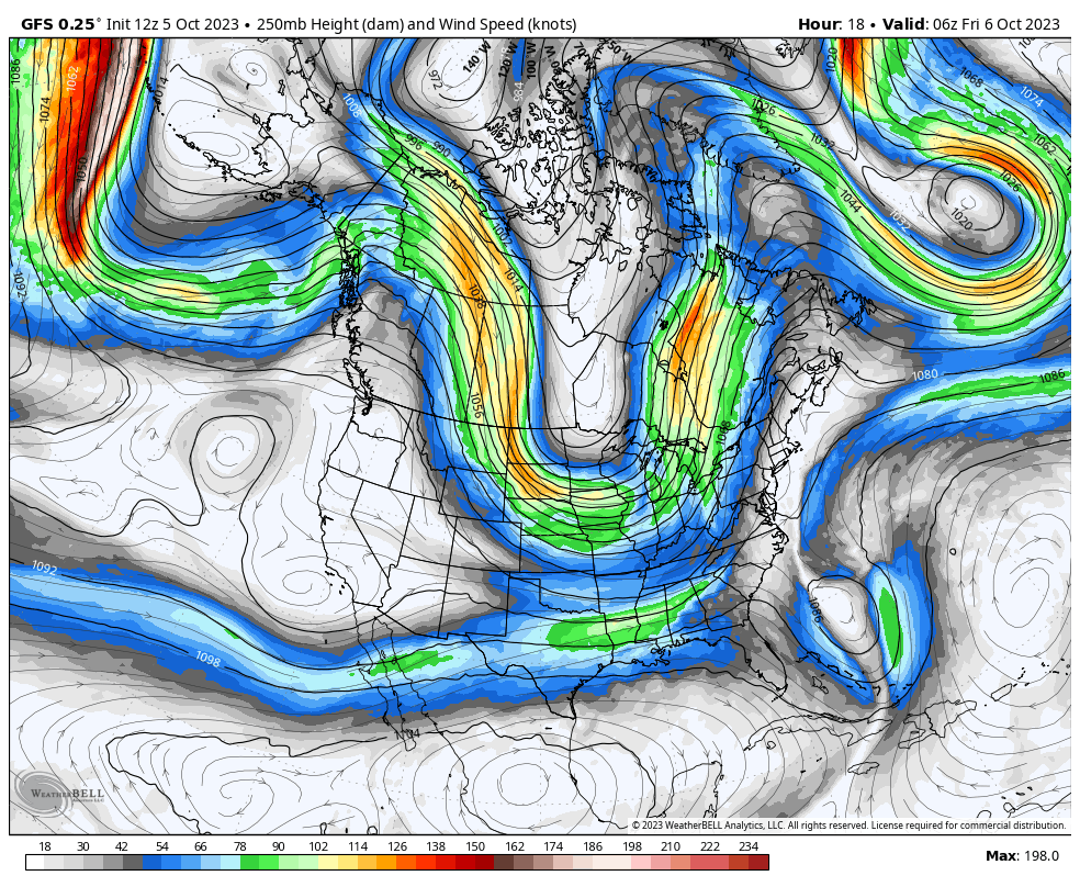
Let's also take a deeper dive into the weather just for fun and zoom out to look at the setup of this approaching trough and upper level low developing. We don't typically get these forming here and it's quite a dynamic event. The left loop shows the 500mb pressures, essentially the middle of the atmosphere's mass where the primary steering currents exist, and the right loop shows the vorticity, which is a fancy term for the movement of air that we are going to call simply energy that feeds storms. With our new formatting capabilities we'll be showing and discussing winter storms in similar ways, though more detailed when the stakes are high! These loops are from the GFS and run from Friday through Wednesday and will often load so that they cycle through frames at the same times.
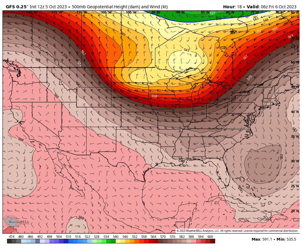
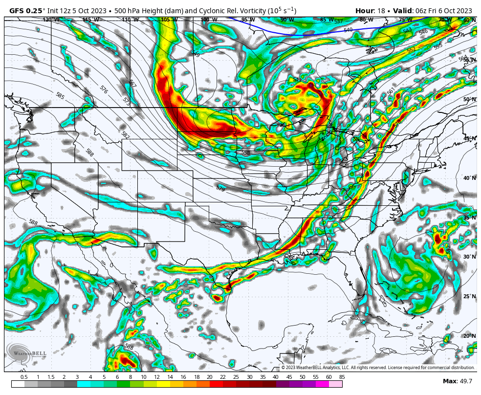
That upper level low is going to get jammed up in the atmosphere until something else comes along to nudge it out of the way. The Polar Jet Stream has a major blocking pattern spanning the entire circulation with omega block after omega block causing very slow west to east progression. We're also seeing a split jet stream with the Subtropical Jet exhibiting a typical El Nino pattern streaming along the southern border without much interaction with the Polar Jet. This is just transient, but I wanted to demonstrate what the average El Nino pattern looks like in real-time, but it will vary widely of course from week to week with some things just occuring more often than others.
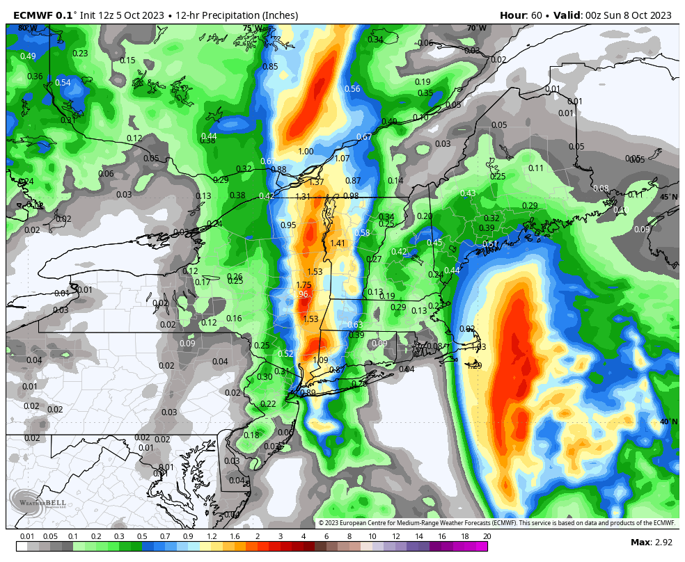
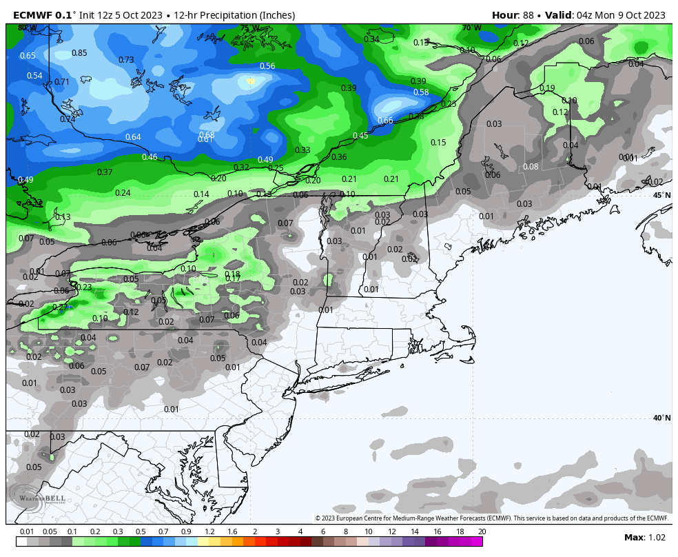
Thankfully much of the precipitation will happen during the overnight hours between Saturday and Sunday, but We're going to have some heavy rain around on Saturday in Eastern NY and Western New England. We're showing the 12 hour rainfall for both days from just 8 a.m. to 8 p.m. to correspond with outdoor activities. Don't try to pinpoint this precisely as these elements likely shift a little, so 50 miles east or west for those persistent bands of rain on Saturday would be the best call. Morning lows and afternoon highs are also shown for each day.
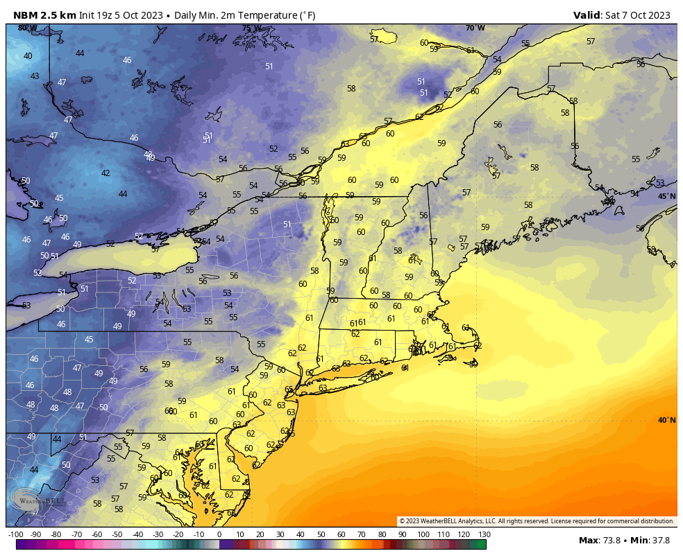
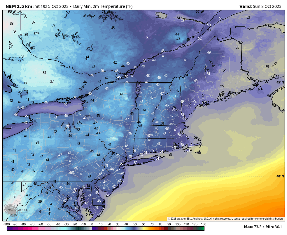
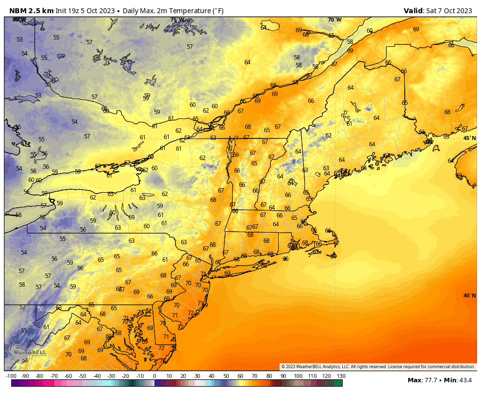
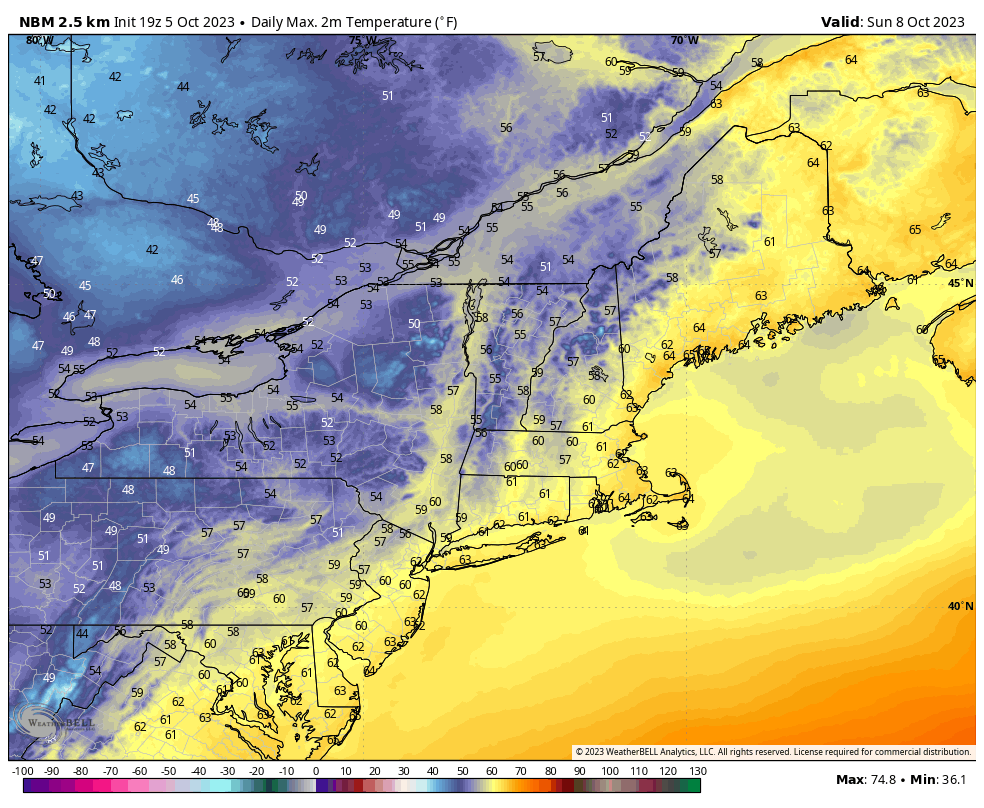
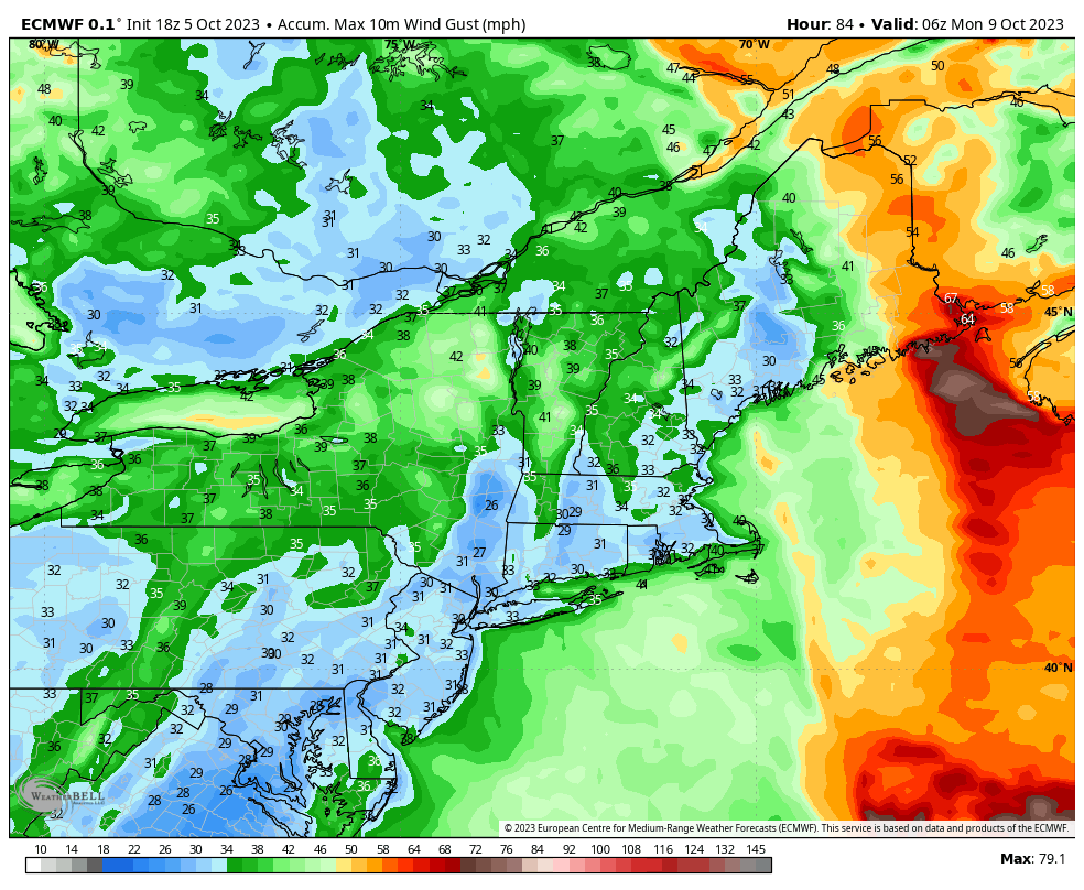
Lastly, there will be some wind issues too. Things will be breezy on Saturday, especially in Northern New England, but Sunday is looking windy enough to put some of those scenic chairlift rides on hold and it will be chilly to boot. We won't issue wind hold forecasts for scenic chairlift rides, but keep this in mind if you are venturing out as a high through the woods may be a better way to experience fall this weekend rather than suspended from a cable exposed to the elements. This map shows the peak gusts for the entire weekend and most of these peak wind gusts are expected on Sunday.


Comments ()