It's going to be an interesting weekend on the Ice Coast with Hurricane Lee making landfall in either Maine or the Maritimes on Saturday. That's not to say that the weather will largely be a disappointment, though it will be windy and people do need to dress appropriately for fall weather if they plan on some adventures this weekend.
Hurricane Lee
Let's start off with the 800 trillion gallon of water gorilla in the room. Modeling has remained very tight for the last 36 hours and we don't expect any real surprises from Lee, but some jogs east or west of up to 50 miles from the current forecasted track would not be extraordinary. The impacts of wind and rain will also follow those shifts.
Highlights from the 5 p.m. update for Hurricane Lee from the National Hurricane Center (NHC) appear below. There is now a Tropical Storm Warning issued for the entire coast stretching from Rhode Island through Maine with a Hurricane Watch covering from Deer Isle through Eastport, Maine. Canada has also issued a Hurricane Watch for parts of New Brunswick and Nova Scotia with Tropical Storm Watches issued further away from the expected location of landfall.
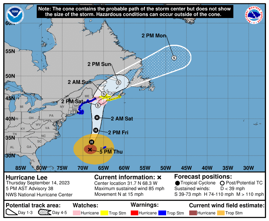
The storm is now moving north and has accelerated to 15 mph. Sustained winds have now dropped to 85 mph, which is a more rapid weakening than was previously forecasted. The central pressure has risen to 957 mb which is an increase of 9 mb from yesterday at this time. The NHC now expects the storm to weaken to tropical storm strength in the AM on Saturday and become extratropical in nature.
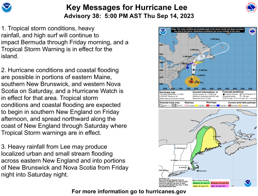
Please consult the NHC, NWS offices and other government entities for guidance on the impacts of this storm. There will likely be heavy surf with riptides and beach erosion, high winds, power outages and other damage caused by fallen trees, heavy rains, and flooding experienced in parts of the Northeast and the Maritimes from Friday evening through Sunday morning.
Precipitation
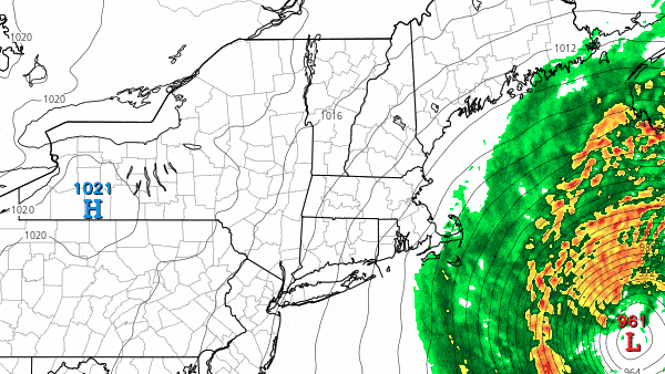
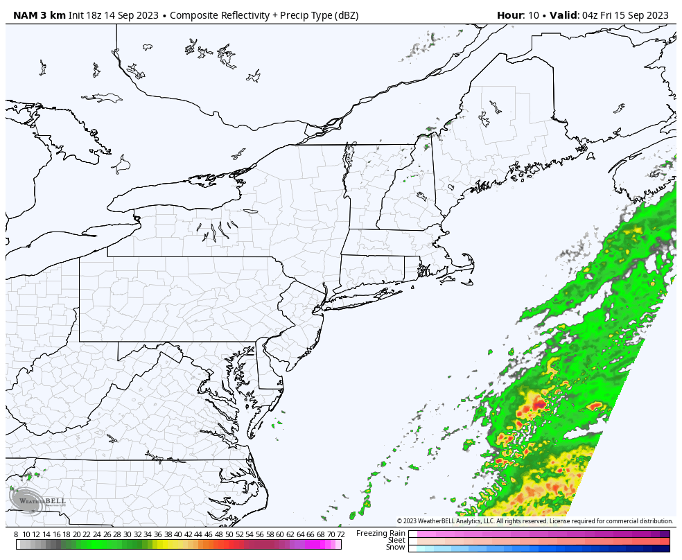
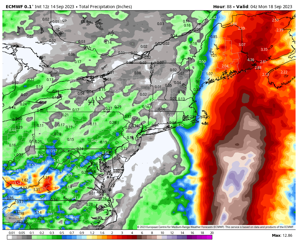
While you do not track hurricanes using the NAM3K (the model isn't designed with the appropriate physics to model such storms well), the model can be useful in predicting the distribution of precipitation when track and intensity are roughly in line with other skilled models. We do believe the following NAM3K simulated radar provides a good representation of what to expect and the loop covers all day Friday and Saturday. Also included is the rainfall through the end of Sunday from the ECMWF which most closely approximates the NWS forecasting while including Canadian provinces. The NWS is more bullish on rain overall than shown. The rain seen in Pennsylvania is expected mostly in the afternoon on Sunday, and rain in New York and New Jersey will mostly hold off until Sunday evening.
Wind
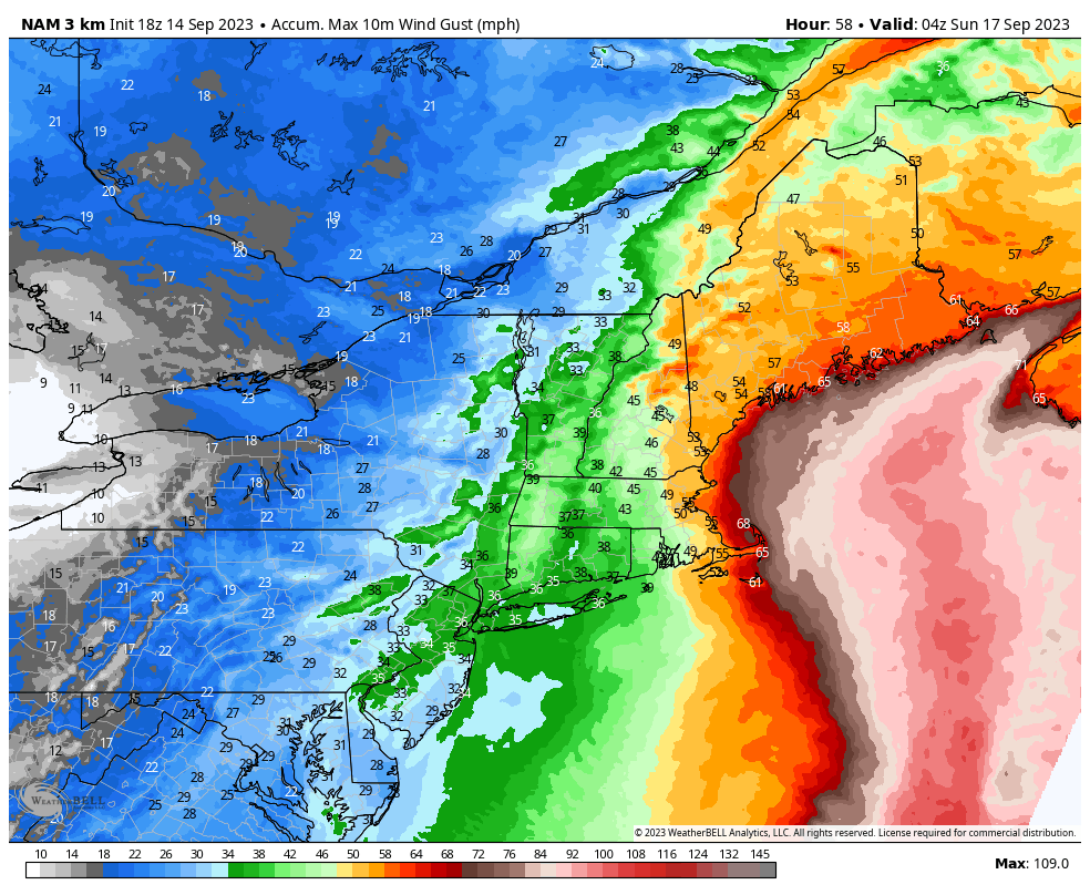
Tropical storm force wind gusts may be seen all over New England on Saturday, especially at elevation, on Cape Cod, and throughout Maine. The ADKs, Catskills, and even the Poconos may experience gusts at tropical storm speeds also. We'll see much stronger winds along the coast of the Gulf of Maine and inland on the mountain tops, most notably in N-NH, and Maine. While wind will diminish on Sunday, those same mountains may remain extremely windy with gusts over 50 mph on Sunday, especially in the morning.
Fall is unfortunately a popular time to get hypothermia, especially when doing alpine hiking in the Whites. Add in a little bit of rain, overcast skies, and wind that can practically pierce plastic and things can go south very quickly for those who are unprepared. Remember the summits can feel easily 30F cooler than the base so always bring layers for alpine hiking especially in the Fall, and it might not be a bad idea to avoid the windiest areas this weekend.
The following map shows the NAM3K peak modeled wind gusts through the end of Saturday. We believe this is a good representation of what to expect though the wind will of course vary by time of day.
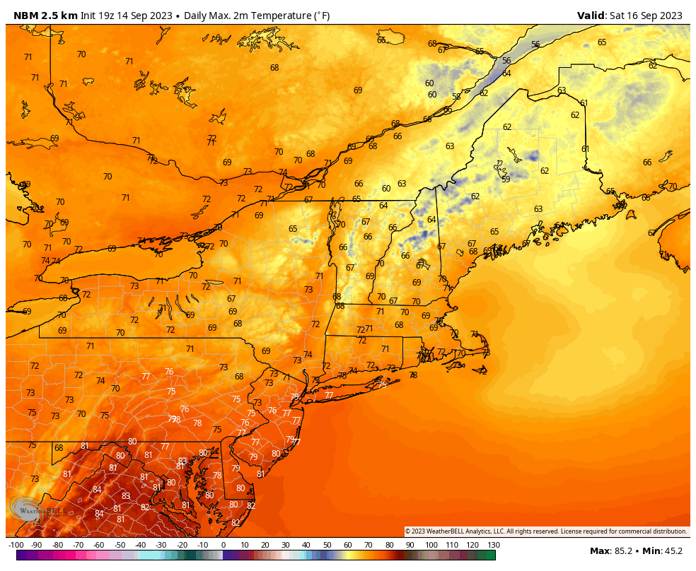
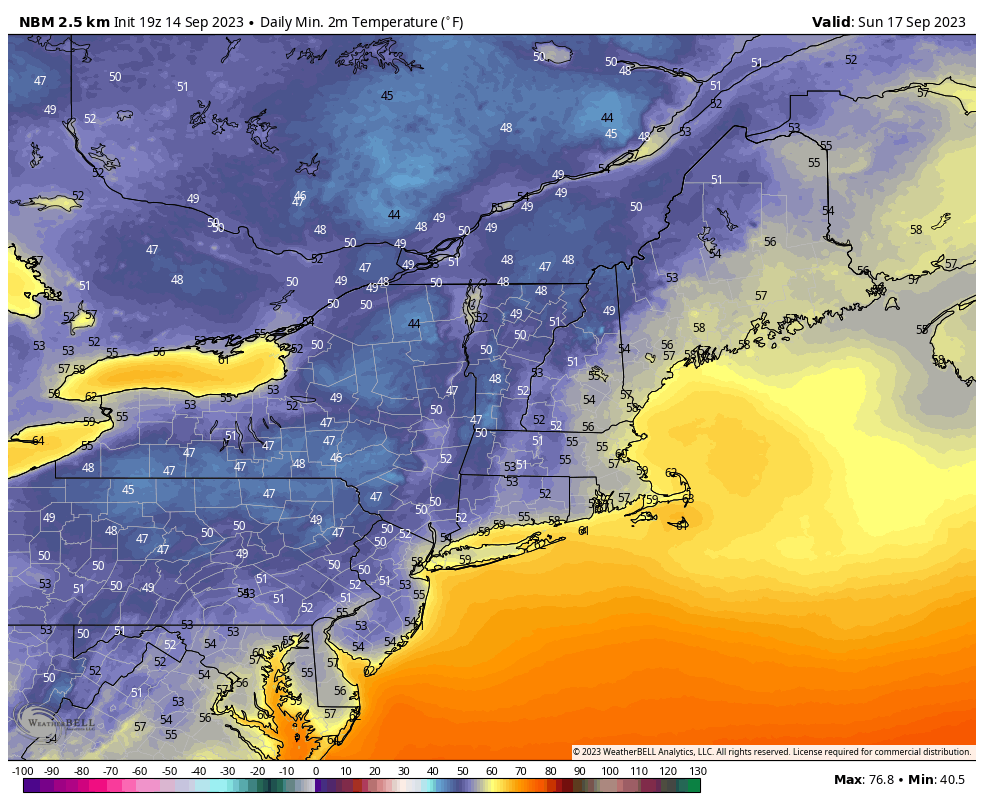
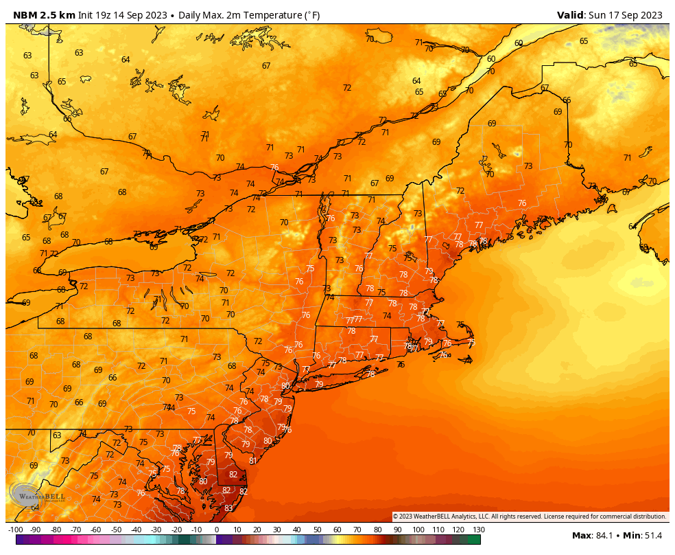
Temperatures
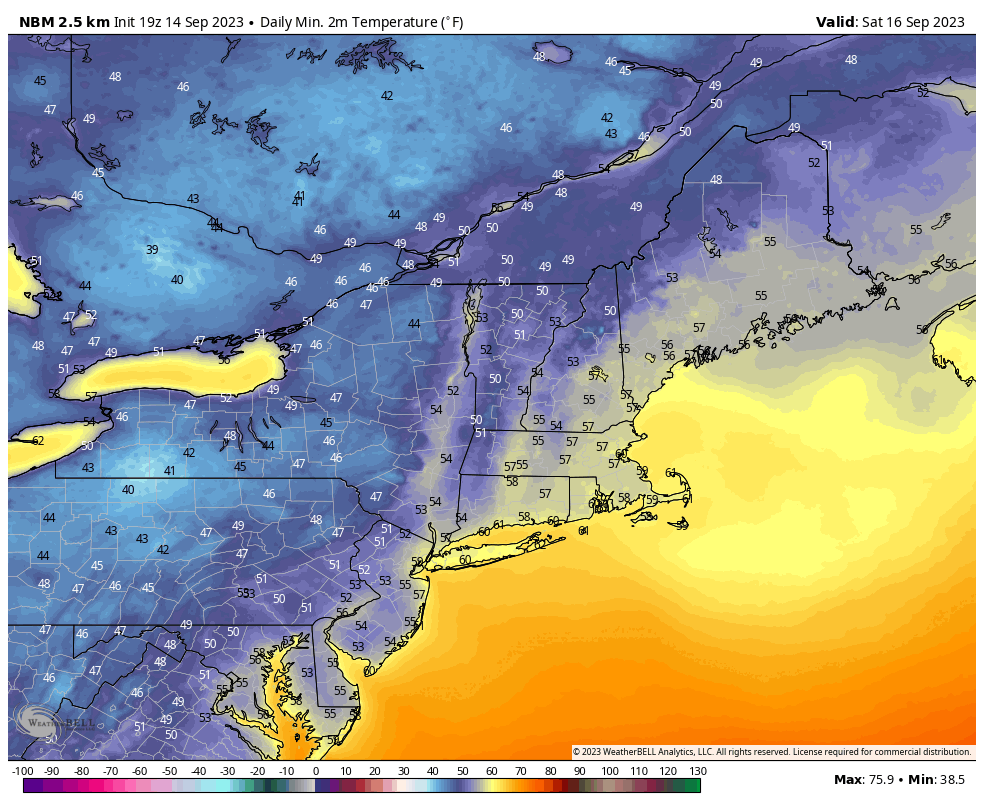
We'll end the weekend outlook with a quick look at the morning lows and afternoon highs on both Saturday and Sunday. The daytimes will be very comfortable in the western half of the region away from the storm, and the nights will for the first time in quite a while feel pretty chilly. Fall is here!


Comments ()