Fall has finally decided to pay a visit to the Northeast and with that the evenings get dark earlier, the nights are getting cooler, and the leaves are starting to change; oh, and we have another tropical system bringing some rain along the Northeast corridor. It's not all bad though as further inland we should have a pretty decent weekend. Translation: skip the beach and head for the hills.
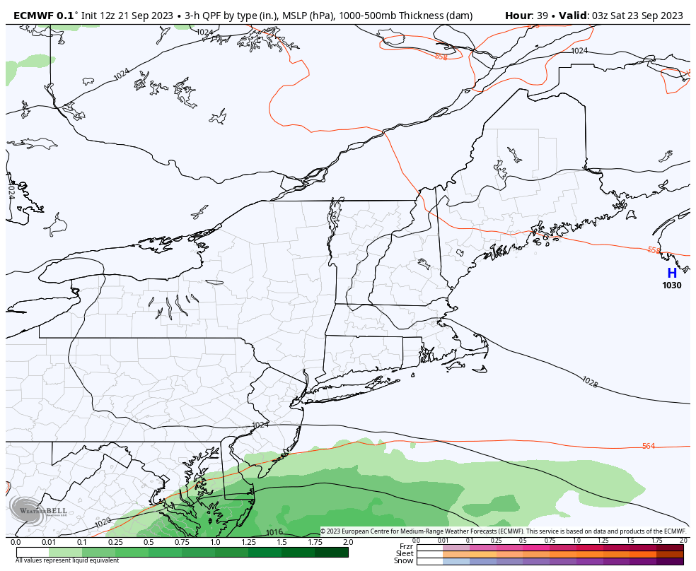
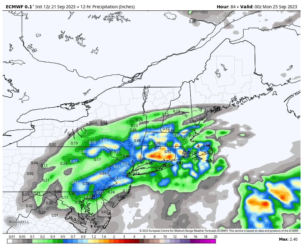
Let's start off with the rain. The NHC has dubbed this system "Potential Tropical Cyclone 16" as it forms in the Atlantic north of the Bahamas. By Friday morning it should become and Tropical Storm Ophelia where it should track into North Carolina. This storm is going to move slowly over the coastal plain towards the Northeast and bring rain to our region Saturday through Monday. Wind gusts should not reach much above minimum tropical storm strength and will be seen primarily where there is rain and strongest very near the coast. The storm should start tracking east by Sunday as it runs into resistance from a blocking high that will span all of Southeastern Canada. The following loop will give you an idea of where the rain is to be expected, though with a meandering storm outside of the primary atmospheric steering currents there's potential for some variability in how far north the precipitation from this storm might reach due to variability in both speed and how the blocking high pressure in Canada sets up.
Leaf Peeping
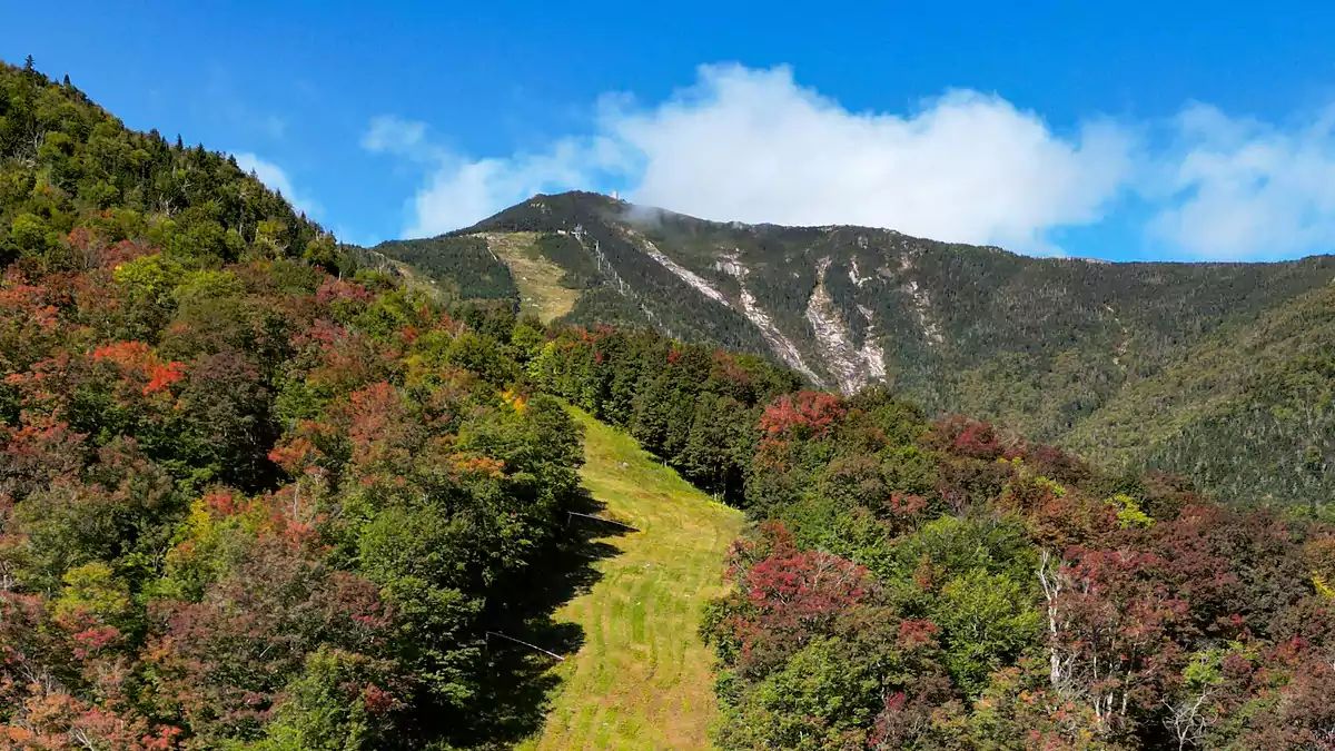
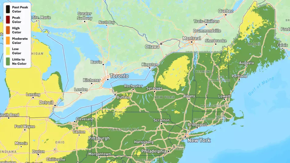
Leaves are starting to pop with color by we're still very early and from afar you are mostly going to see color in the higher altitudes of the most northern and western areas. Peak color is still about two more weeks away in these places and it will spread generally southeast. Be wary of social media posts that use older photos, selectively choose small patches of bright foliage, or are otherwise over-enhanced. It's still early and even some ski areas treat foliage like they do snow by both underreporting and overreporting it.
The following map comes from Explore Fall which was developed by meteorologist Evan Fisher. Note that many of these areas are elevation dependent at this time with the valleys trailing the color change on the mountains.
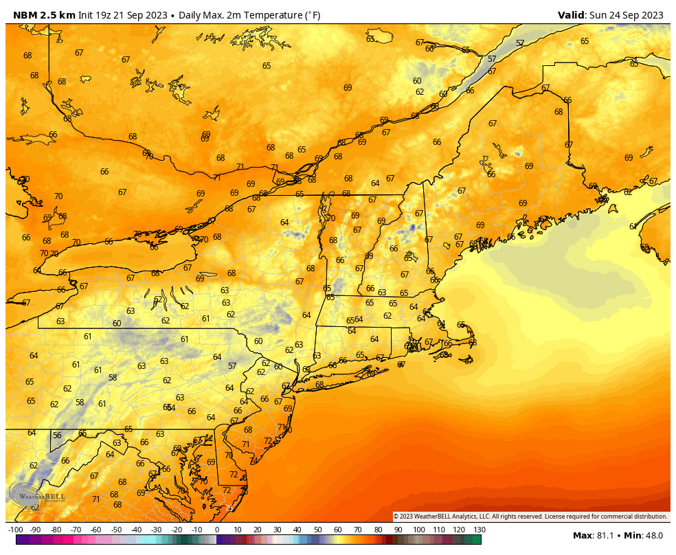
Temps and Precipitation
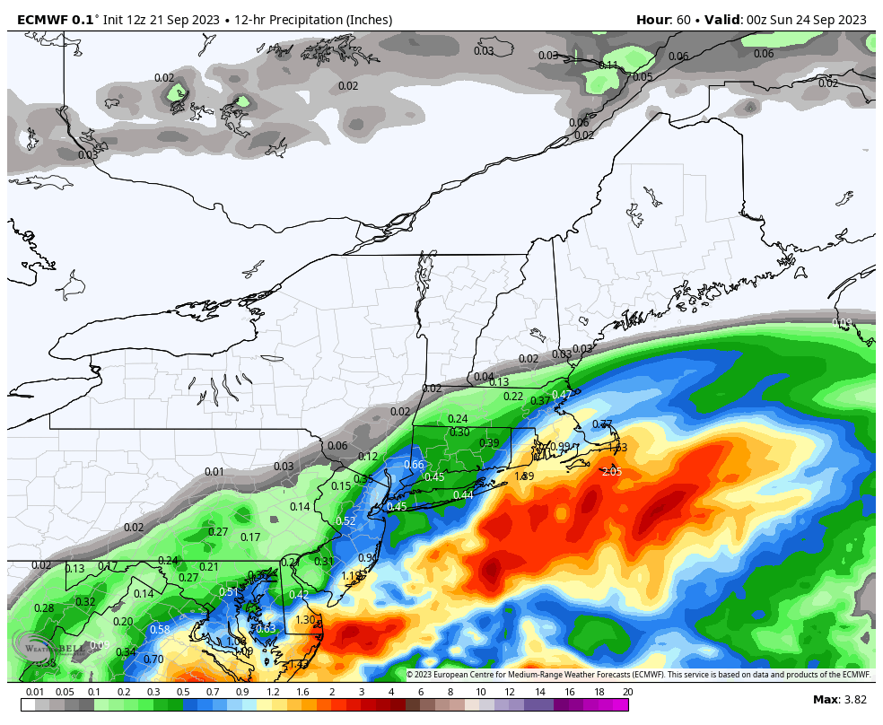
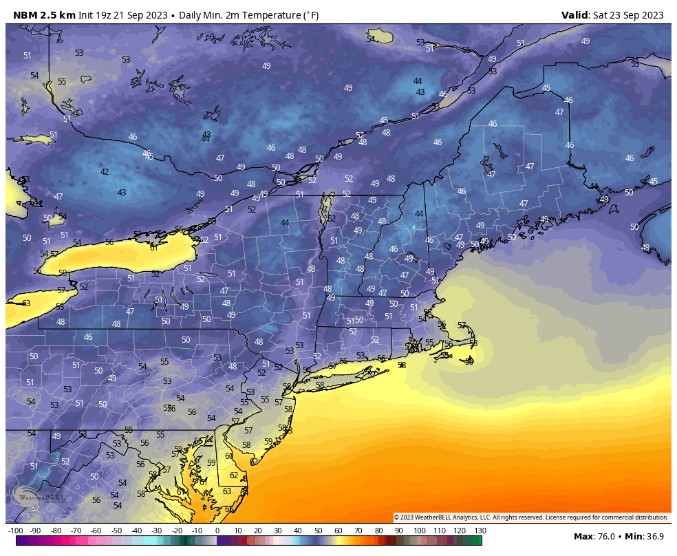
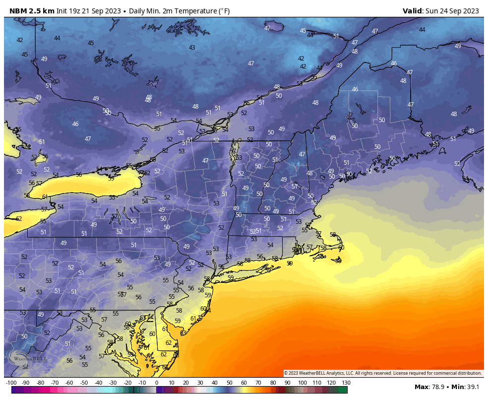
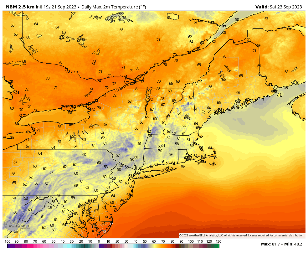
Here's a rundown first showing the modeled precipitation from the ECMWF for 12 hours on both Saturday and Sunday between 8 a.m. and 8 p.m. followed by the highs and lows for each day as expressed by the National Blend of Models (NBM). We're not displaying overnight rain as we primarily do recreational forecasting, but nearer the coast will be quite wet through the weekend.


Comments ()