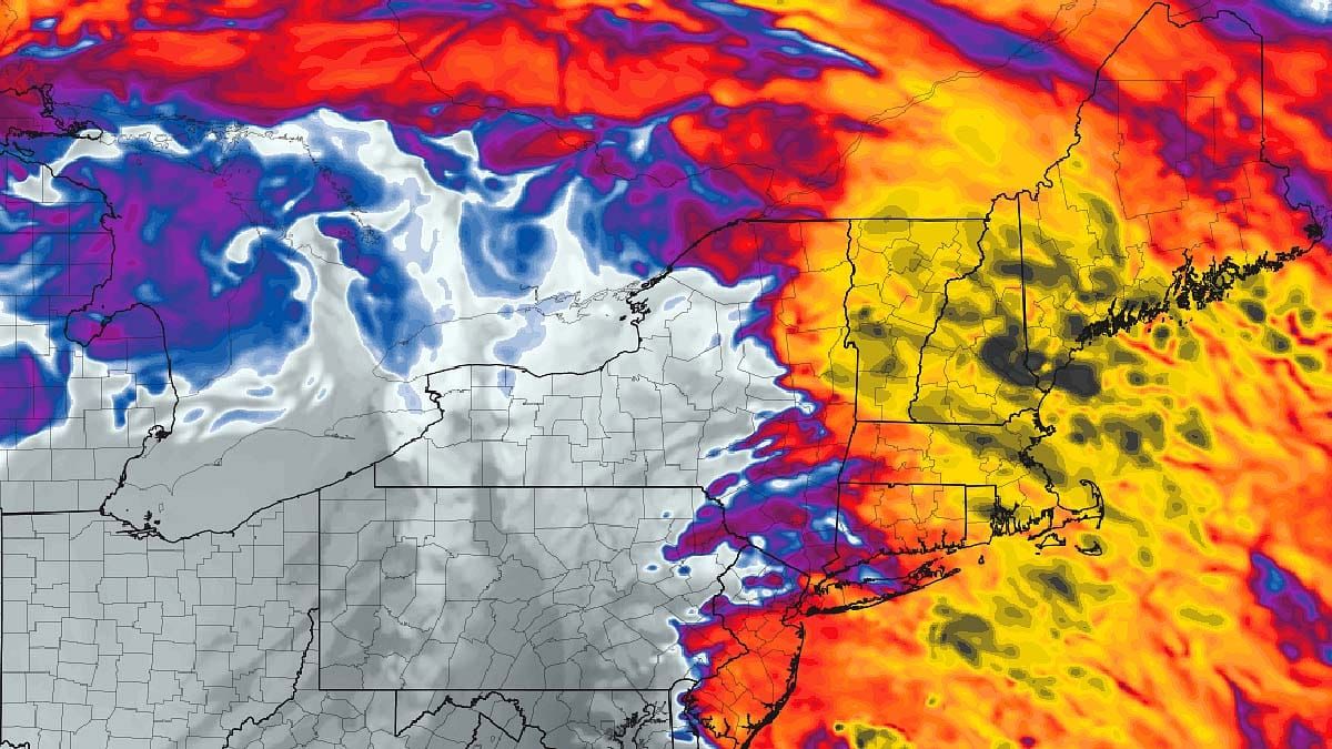
Folks, we have a pretty good sized lake effect event behind this storm that will have streamers off of both lakes at least through Tuesday and they will travel far, in fact some streamers may persist for over 300 miles. There will be a lot of snow from this in some focused areas, but also wind and some lift holds plus increasingly colder temps by day so be prepared to withstand some single digits with wind come Monday.
The forecast here will only cover 4PM Saturday through 4PM on Monday in order to help everyone understand what to expect. If you are looking for information on Saturday's storm, coverage through 4PM on Saturday was updated earlier today (and will be updated Friday also) and can be found here:

With both the Storm Updates and Back-End Updates you should be able to better plan and prepare for the holiday weekend. This update will primarily cover the snow, wind, and temperatures that will affect your ski days, however the detail below is only available to Premium Subscribers.


