It's full-blown winter in the Northeast. That shouldn't be a surprise, but it is an El Nino year and we definitely got off to a late start and barely made it through Christmas even at some larger more northern resorts, and MLK weekend was transitional and the beginning of our real recovery with low acreage still. Snowmaking came back full blast all over this last week and every ski area we forecast for is open now.
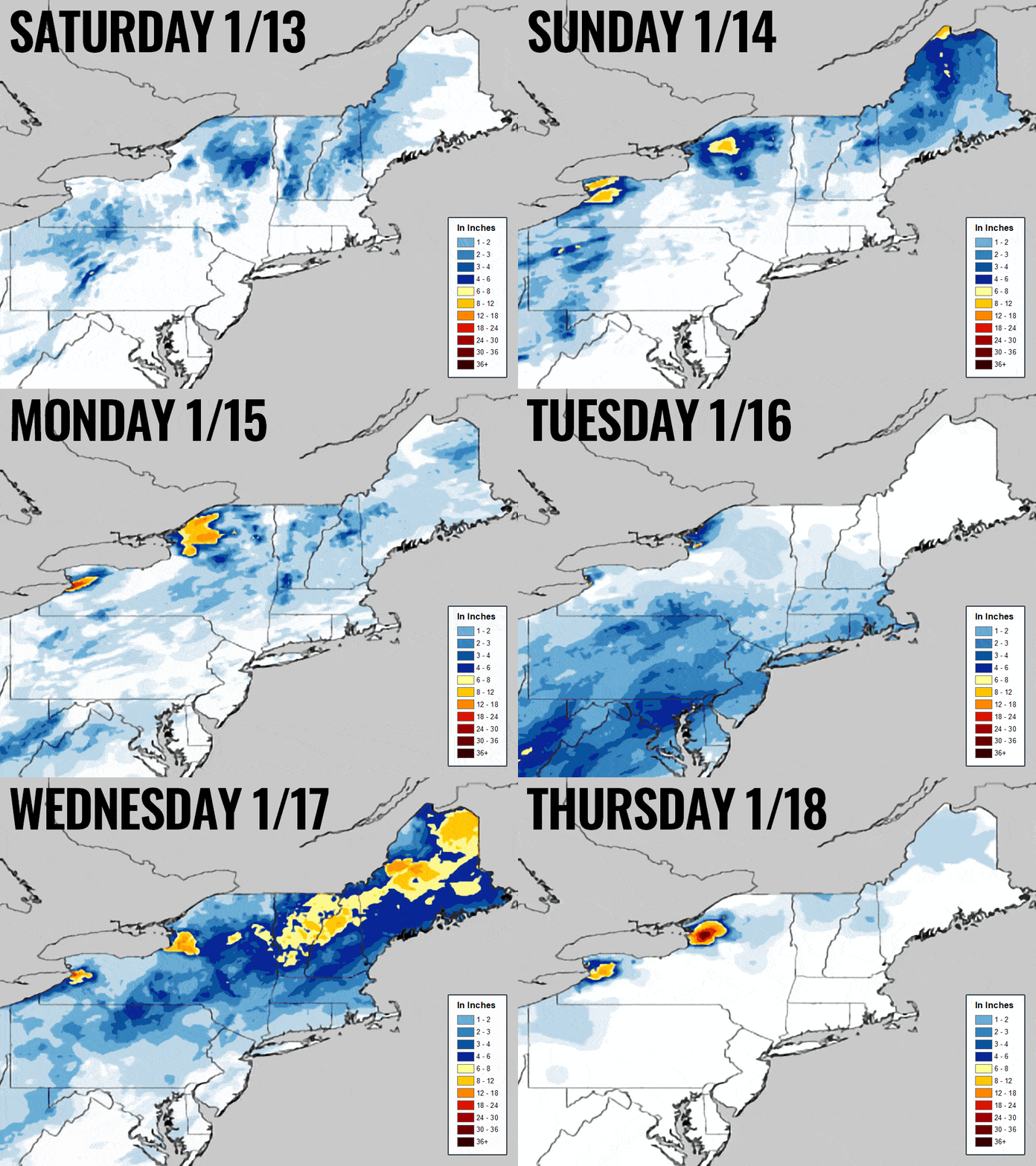
Snow has been falling non-stop in some areas since last Saturday with almost everyone receiving between 4" and 36" since then. The snow can sneak up on you when it happens in bits and pieces outside of larger systems, though the surprise overperformance in Tuesday's storm after last week's basebuilders was literally icing on the cake. Here's a look at the NWS snowfall analysis daily from last Saturday through Thursday showing the previous 24 hours of snow through 7AM on the day timestamped.

We have a system impacting mostly Pennsylvania and the southern half of New York on Friday with some continuing lake effect that is also benefiting Vermont and the Eastern Townships. That was covered with snow forecasting through Saturday at 8AM in the Minor Storm Update #1 earlier today:

We do have more snow this weekend through Sunday AM, but the real story is going to be the cold weather. It's not brutally cold, but you need to prepare for it. I'll cover the snow, the temperatures, the wind, and I'll have some cold weather tips and some picks for this weekend below, but the weather parts are a quick read.


